This walk got off to quite a dramatic start as we got stuck in the mud whilst parking in the car park! Luckily, it wasn’t just me and Alex on this walk as I think I would have struggled to push the car out on my own. Instead, I was a passenger princess and that everyone else do the work! Somewhat ironically, this was during a heatwave and this patch of grass just happened to be beneath a tree that never got any sun…But, we got out in the end and carefully parked elsewhere. The car park itself was this one, near Crummock Water.
Now, onto the walk itself. There’s is no easing into this walk; it’s a short one but really enjoyable with a bit of hands-on rock scrambling. Nothing too technically challenging but, adds an extra element of fun! The path begins right across from the car park and once you’ve crossed the footbridge, you take the path to the left and begin your ascent. There’s no easing yourself in to the climbing on this one, it’s straight off the bat and sweaty work in the summertime. It may be steep from the offset but there are also incredible views too, looking backwards Crummock Water and the hills behind.
Difficulty: Medium
Distance: 10km
Elevation: +736m
Notable Features: Whiteside, Hopegill Head, Crummock Water
Look out for: mud in the car park!
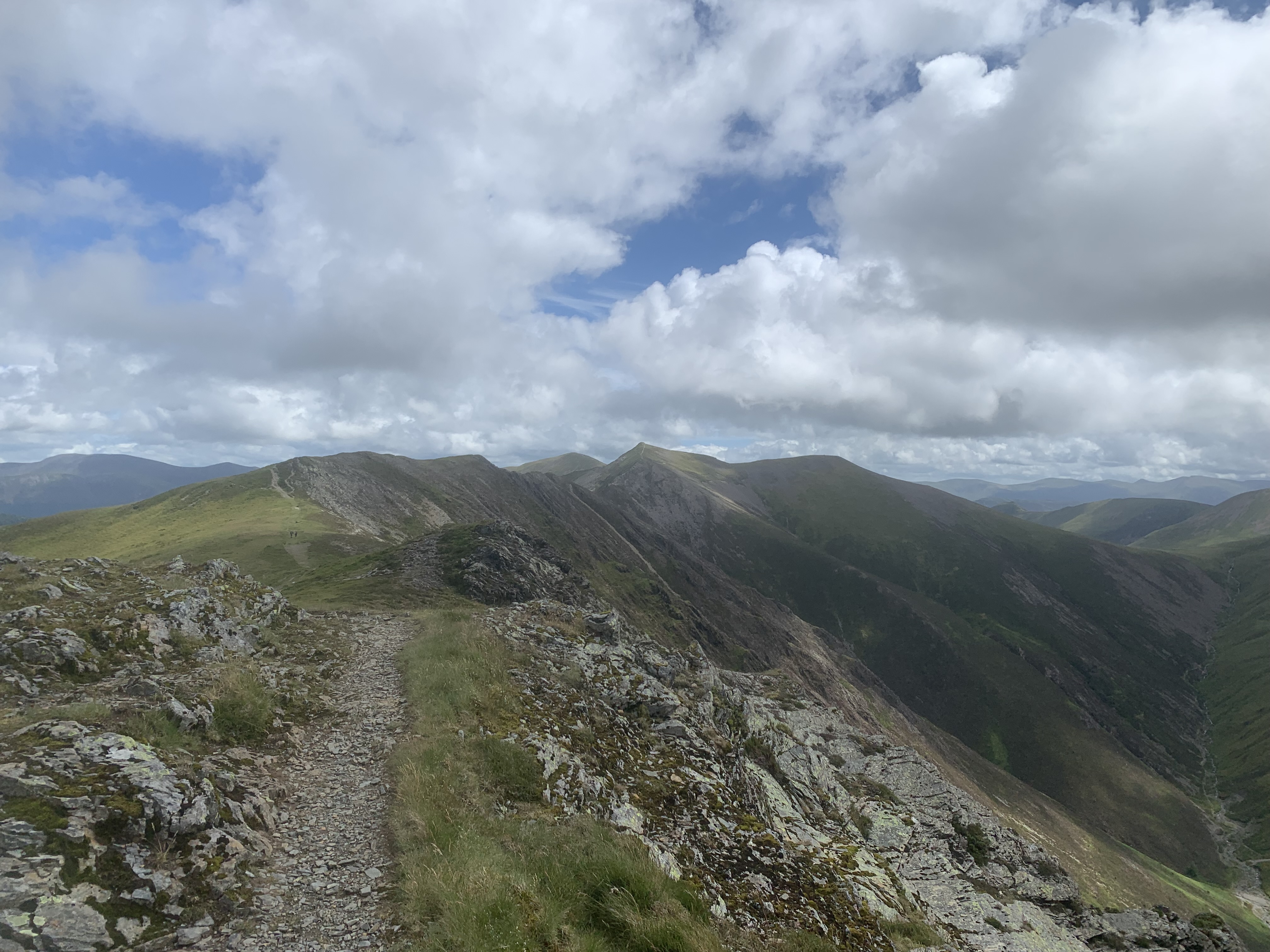
2km later and you’ve made it to the Whiteside ridge but it’s a slower 2 km than it sounds as it is hard-going with, I would say, two instances where you need hands to rock to make it up. It makes the steepness easier in some ways though, as you have something else on your mind. Whiteside actually has three summits along the top of the ridge. The first 707m and then you make your way along to the East Top which is 719m and technically the tallest. Apparently, the official Wainwright is the shorter one but it doesn’t really matter anyway as you’re walking across the entire ridge in this route.


Whiteside is actually one of those that looks more impressive from a distance, than when you’re on it. When you’re on it, you can’t really understand how it’s got it’s name but alongside it, or from the nearby vantage point of Grasmoor, you really see the white quartz stones on it’s western slope. Nevertheless, the exposed ridgeline is a fantastic walk that concludes at the second wainwright of the day, Hopegill Head. This is the largest of the two with the summit at 770m.


We stopped on Hopegill Head for some lunch, hiding out from the blustery wind the best that we could. It was actually fairly busy out on the route and we saw a couple of others hiking in the area. It did get cool, sat in the wind, so we moved on fairly quickly. Not before everyone had a taste of some interesting seaweed flavoured crisps we’d bought from Tesco the day before. The general consensus was that they were nice but not groundbreaking. Food experiments out of the way we headed onwards.
Now, you have three options here: 1) add an extra 4km out-and-back to Grisedale Pike (790m) and tick off another Wainwright. 2) descend to Sand Hill and Coldale Hause and turn right alongside the beck for the return to the car park. Or 3) make this a longer day walk and head up Eel Crag and Grasmoor, too. We opted to go for option 2 here as we’d actually already summited Grisedale Pike as part of a horseshoe route from Braithwaite. I would recommend tackling the wainwright as part of that route as it’s a nice circular that makes more sense than the out-and-back here. We’d already already bagged Eel Crag and Grasmoor on another occasion.

The path on the descent to the beck is a bit of a scree slope and then the route alongside the beck also wasn’t without it’s little quirks! I some places the path had fallen away in the river so it wasn’t straightforward walking. There was one section which involved bear hugging a rock to go around it as it was pretty much blocking the way entirely. It wasn’t too challenging though and was all perfectly passable with care. There way have been a more in-tact path slightly higher up the banks but that was where we found ourselves.
At the end, the path regions the footbridge that you passed at the very beginning of the walk and you retrace your steps to the car park. Or, if you’re one of the boys, you’ll ford the river (almost fall in) and then take the path on the opposite side. It really isn’t necessary to do this unless you particularly want to and I didn’t!
This was a super enjoyable walk and it really made me realise that you don’t have to do huge distances to have a great day out. This walk had a bit of everything, a little bit of scrambling, excellent views, river crossings (if you particularly want to) and a less popular access point than along the edges of Crummock Water and Rannderdale Knott. I’d highly highly recommend it to bag Whiteside.
Have you done this walk? See the route on Mappedometer and AllTrails.
Amie x


Leave a Reply