With the constant rain lately, it has been difficult to get outdoors and walk. I wouldn’t say that we’re fair weather hikers but, when the cloud base is 200m, there doesn’t seem all that much point. Finally though, there was as somewhat better weather day so we headed across to the Yorkshire Dales for the day. According to Mountain Forecast, the weather was slightly better over there than in the Lake District.
We headed to Keld which is village in the Swaledale area of the Yorkshire Dales. The drive here was fantastic as there was some snow on the tops. We actually pulled over B6270 to take in the views! I’d definitely want to go back and do some more walking around here, including Nine Standards Rigg. Keld itself though, is a lovely little village.
Difficulty: Easy
Distance: 6km
OS Map: OL30
Notable Features: Keld, East Gill Force, Crackpot Hall, Swinners Gill and Lead Mine
The car park here is run by a farm that also operate a campsite so you have the added bonus of access to toilets at the beginning and end of the walk. I can’t quite recall how much it was to park but it was only a few pounds, that much I’m certain. The village also has a little community run tea room with an honesty box. Here you can pick up fizzy drinks, help yourself to tea and coffee and homemade cakes for a small donation. We used this after the walk but you could pick up a treat for along the way too!

The start of the walk includes a short stroll down a gravel path and before you know it, you’re at the first waterfall. East Gill Force is an impressive beginning and you’re utilising paths that are part of the Pennine Way and the Coast to Coast long-distance trail which is pretty cool! Maybe one day I’ll be walking through Keld again on one of those trails. Fingers crossed my plans for walking the Pennine Way come to fruition this summer…we shall see. There’s also quite a few benches here next to the waterfall so it could make a good lunch spot in the summer for a family walk!


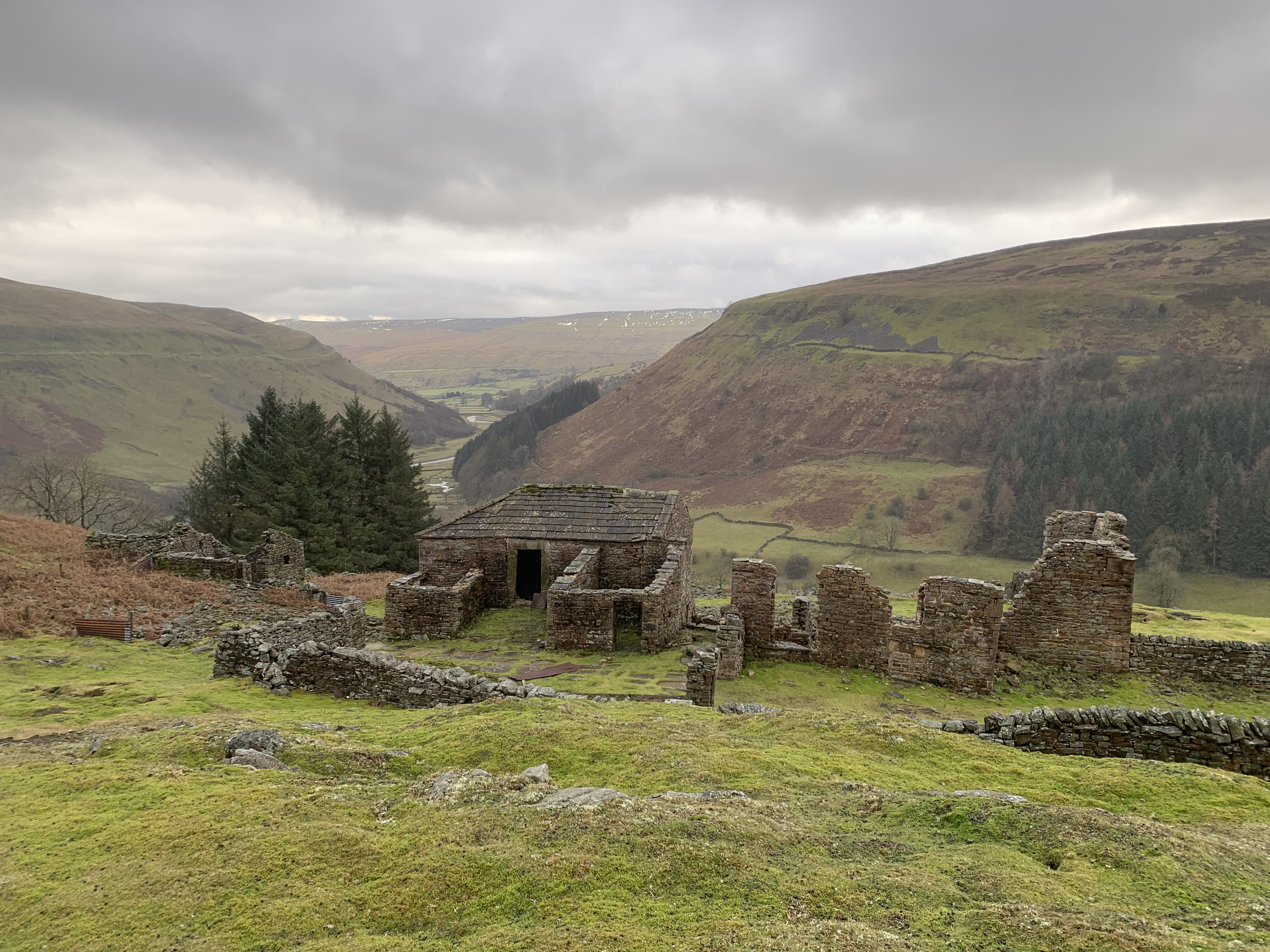
From here, we continued along the gravel track which has beautiful views across the valley and down to the river below. After approximately, a kilometre or so, a path forks off to the left, signposted as the Coast to Coast high-level route. We took this path and soon came across Crackpot Hall. This building, now in ruins, was a at one time a hunting lodge, built some time in the 16th century. Then, a farmhouse was built in the same spot in 1700s. Interestingly, the house also acted as an office for the lead mine in this area until the late 1800s. However, the property became vacant after it was declared structurally unsafe due to subsistence caused by the lead mining activities.


Sadly, the heavens opened and the rain began to fall as we explored the old Hall. So much for the good weather we had been promised! Still, it was nice to be out in the countryside again and we didn’t let it dampen our spirits. Onwards we went towards Swinner Gill, following the path as it skirted the valley sides towards our next waterfall. Just as you reach the waterfall, the path splits in two: you can take either of these. Keep right to avoid a slightly steep, gravelly descent. It’s less than a few metres though so nothing too crazy! Then, across the bridge we went.
Here, you’ll pass more remnants of the areas lead mining past which is always interesting to see. This lead mine was built in the 1740s and was operational well into the 1830s. It is around the lead mine buildings that our first problem came. The path crosses the stream here and because of all the rain we’ve been having, it wasn’t the easiest. We spent a bit of time trying to find the safest place to cross before making it to the other side. According to our OS map, there were two paths on the opposite side, one slightly higher and another that followed more closely to the gill. We soon realised that we were on the higher path instead of our intended lower path. I’m not entirely sure what happened here: we could have just missed the path by crossing the water in a different place. However, the second path doesn’t appear on Map Pedometer at all so I can’t be 100% sure that it exists properly. Not the most helpful advice…

We decided that, instead of retracing our steps and finding the correct path, we’d try and cut diagonally down to it. This was a bit of a mistake. The descent would have been too steep so we continued on, hoping that they’d eventually be a safe spot to make it to the new path. Our opportunity came when a field appeared on the right, surrounded by a stone wall. We could see from the map that the ‘correct’ path ran along the bottom of the field so, we hopped over the crumbling stone wall and cut diagonally across the field and we were soon back on track.
I would, of course, always recommend sticking to the paths but, sometimes mistakes happen and, you’ve got to be sensible and not take any unnecessary risks. This was a section of the walk that was filled with that very uncomfortable walking where you feet are constantly tilted to the side which isn’t fun! But, we made it back to the path in the end.


The path then meets a lane at the bottom which bends to the right and then crosses a bridge across another lovely little waterfall. Then, take the track to the right which climbs back to that gravelly path from the start of the walk. You’re back to skirting alongside the valley with beautiful views across the horizon. Before you know it, you’re passing the East Gill Force waterfall and dropping back down into Keld. Don’t forget to call in at the community tea shop for some goodies!
This is the second walk in a row where I’m not going to include my usual step by step instructions. You can see the rough route that we took on Map Pedometer here but, as I can’t clearly give advice on which path to take following the crossing at Swinners Gill, it wouldn’t feel right to give you a full step-by-step. Despite that though, this is a lovely walk and I highly recommend heading out to this area. You could easily extend by adding a nearby peak or keep it that bit easier by following along the valley, or tuning back from Crackpot Hall too. There are lots of opportunities here!
Have you done this walk? Let me know if you’re going to give it a go!
Amie x


Leave a Reply