Somehow, I missed the memo at the end of last year that AONB (Area of Outstanding Natural Beauty) sites have been renamed as ‘National Landscapes’. The National Landscapes team said that this was to highlight the importance of the sites and I suppose they were attempting to bring the name in competition with those areas that have national park status. I’m not sure it’s exactly the right name but, it is what they are now being called so I’ll have to remember to pop that in the titles of my posts from now on. What do you think?
Anyway, we decided to head to the North Pennines at the end of the summer holidays to avoid the busyness of the Lakes as people were trying to make the most of the last weekend before the kids were back to school. It was actually my first time in the North Pennines and it was a great first introduction to the landscape. It seemed, on first glance, to be a hybrid between the Yorkshire Dales (probably due to its close proximity) and Dartmoor, as it doesn’t quite have the mountainous landscape of the nearby parks. That being said, I’m now very much looking forward to exploring more of the area.
Difficulty: 1/5
Distance: 15.7km
Elevation: +525m
OS Map: OL19
Notable Features: High Cup Nick, Dufton Village, Dufton Ghyll
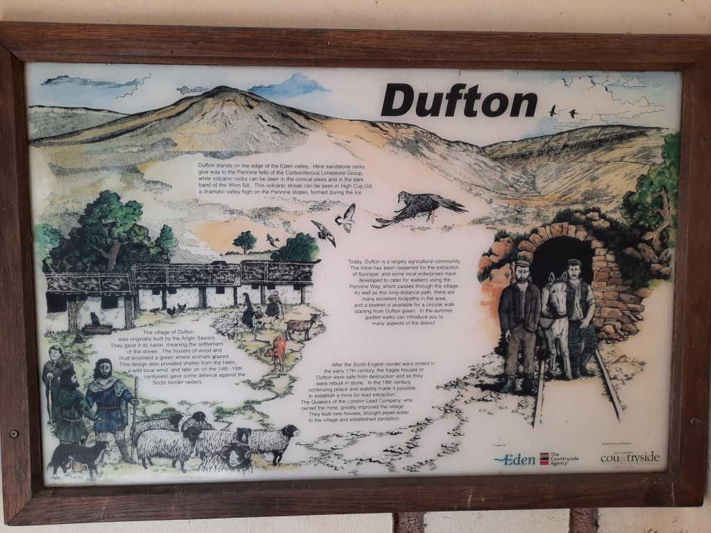
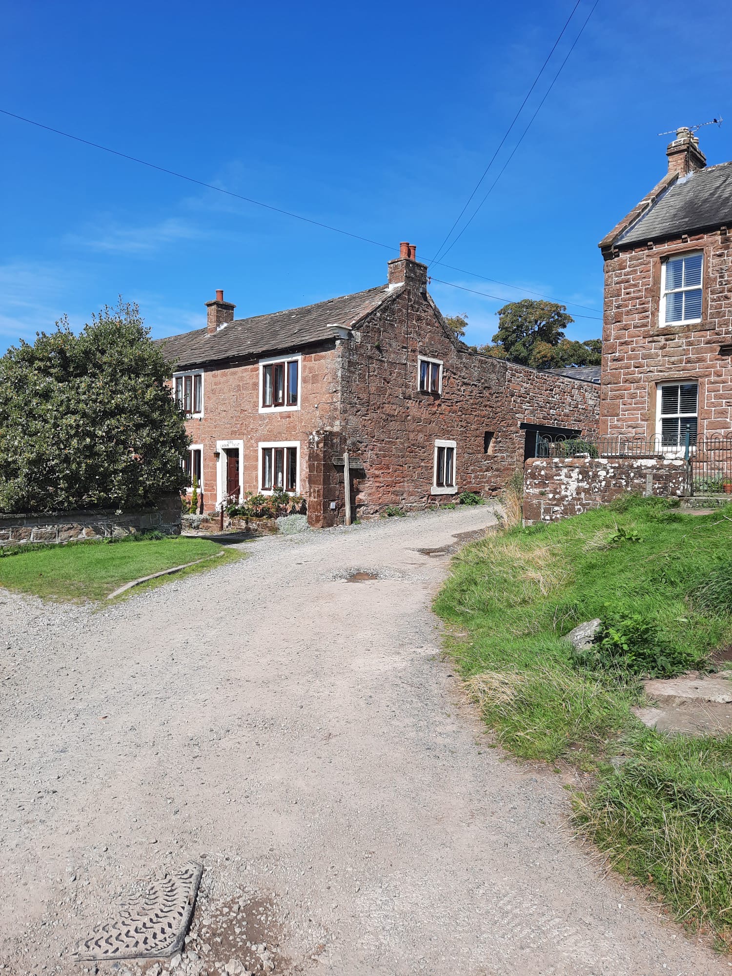
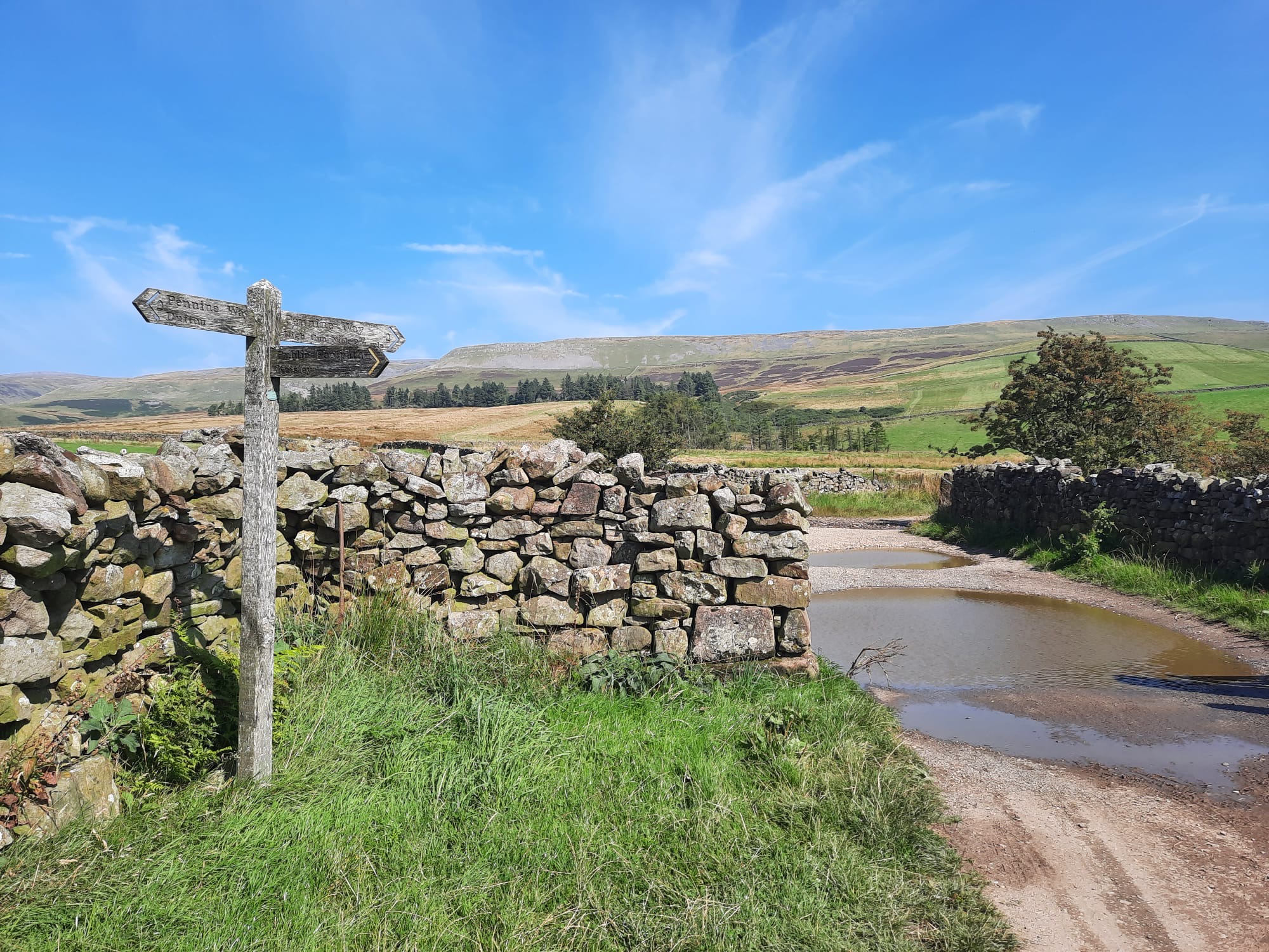
So, our day started in the gorgeous little village of Dufton. It was so quaint and wholesome! The Dufton Show, a large agricultural and country show was on the same weekend so the area was a little busy but, they were all concentrated in the fields outside the village, rather than within it. The village is brimming with history as it was originally built by the Anglo-Saxons and was faced with many raids from the Scots through the long history of border conflicts. Following the border wars, a lead mine was established in the area which brought new people to the village and prompted new houses and a school to be built. Nowadays, visitors to Dufton are usually walkers heading out into the hills or long-distance hikers taking on the Pennine Way. It was such a lovely little village and I honestly wouldn’t mind living there. An additional bonus: the car parking was free!
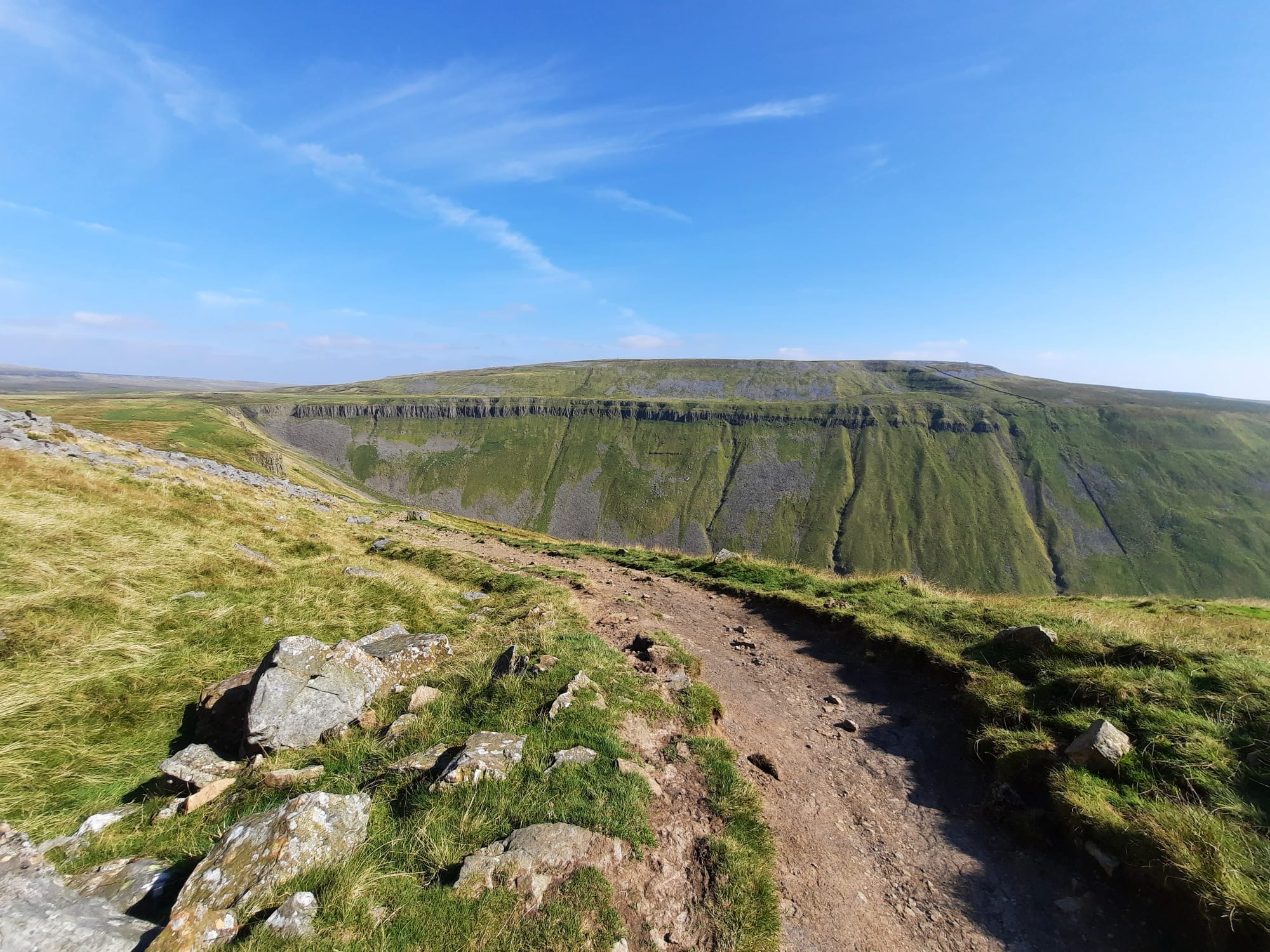
The walk to High Cup Nick is a really accessible one for beginners, whilst seasoned hikers will also enjoy the magnificent sight of this U-shaped valley. Even Arthur Wainwright called High Cup Nick an “unforgettable sight” and a “natural wonder” which is high praise indeed for a man who has paved the way for Lake District hikers. It doesn’t require any technical skills and the distance is a manageable 15km in a circular route that begins and ends in Dufton. The elevation gain is also fairly limited at 525m which is a long and gradual climb which can make it more difficult because of tediousness but means there are no hugely steep inclines. Like I said, very beginner friendly! Make sure to bring a map and compass as, though the route is easy to navigate, you never know when the conditions may change.
The walk begins with a bit of road walking out of the village. However, there is a house which has very kindly started a little stall outside of their home selling drinks in a bucket of cold water and some snacks. They just ask you to put the change into a box. I imagine that they only do this through the summer season but, we bought a can of Tango Apple which we very much enjoyed later in the walk. It is incredibly cute when people do this, especially, as I think was the case here, they get their children involved. It’s a nice gesture and a good way to earn some pocket money.

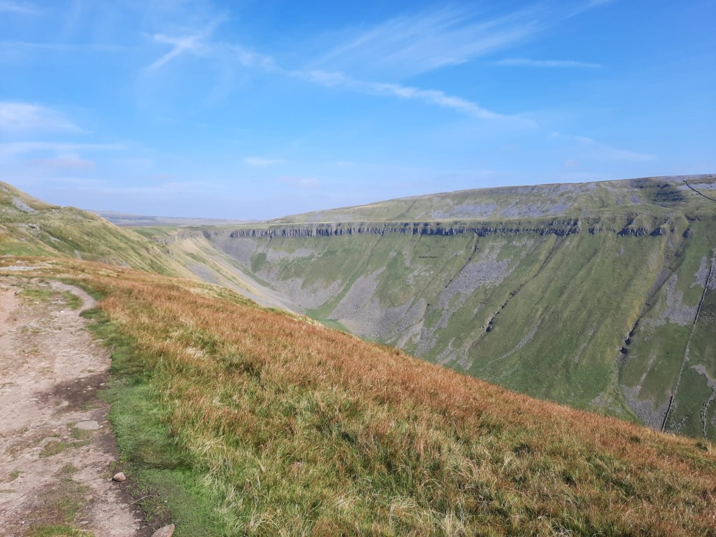
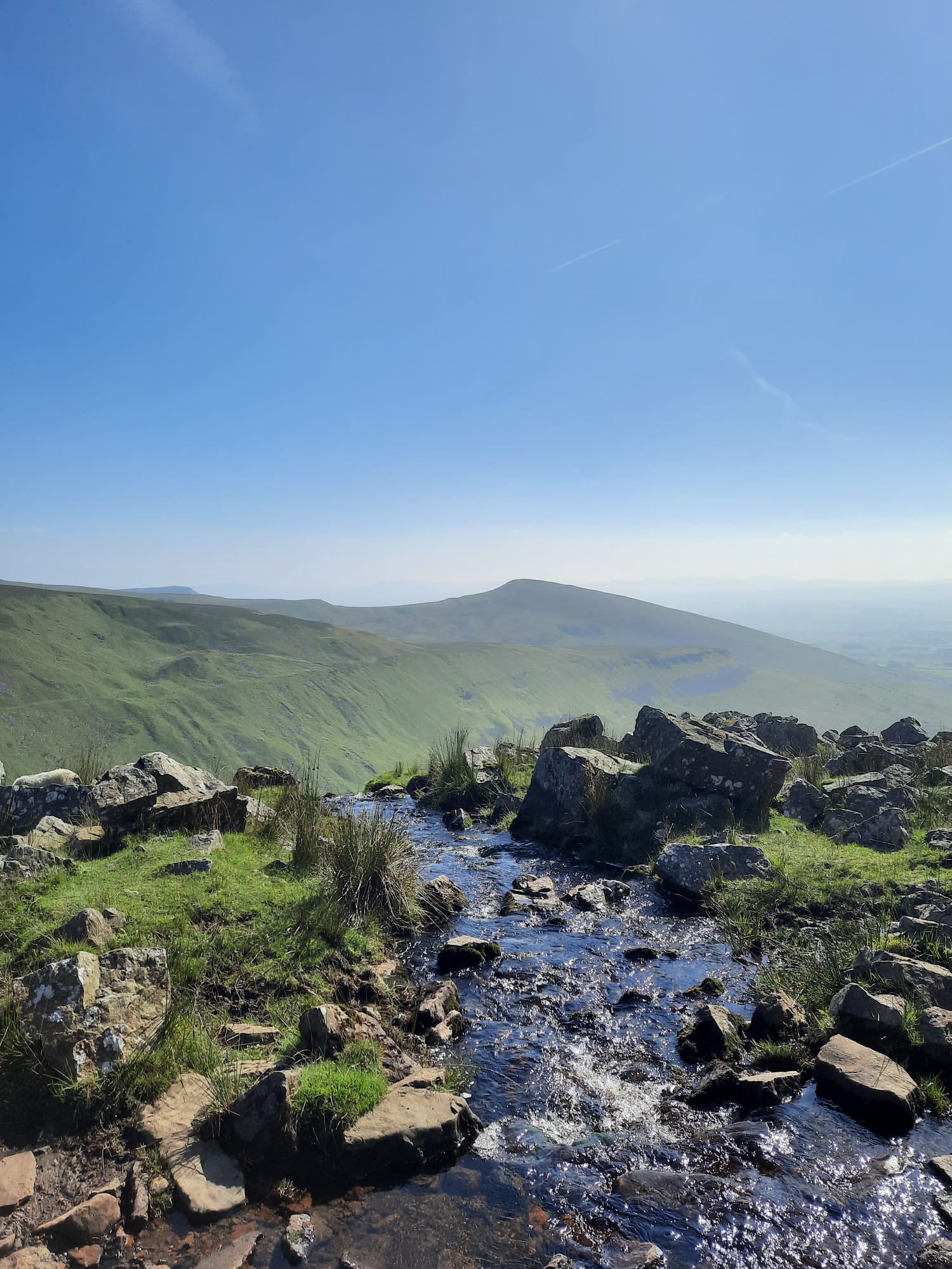
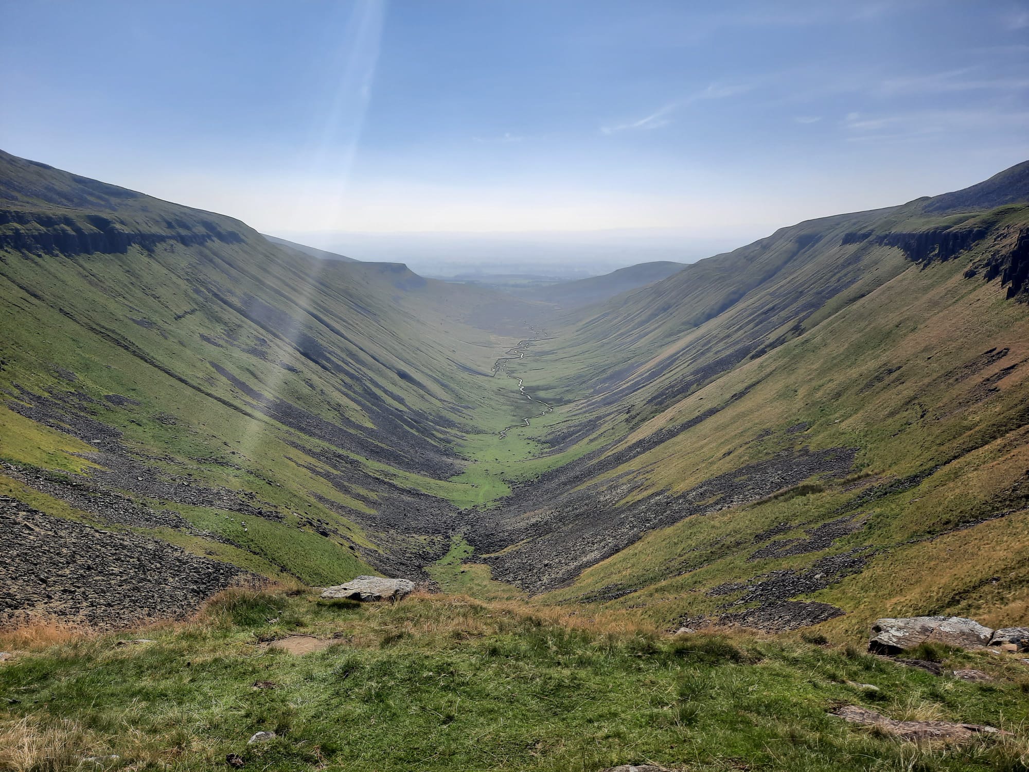
Off we went up the road which then becomes more of a track and it does stay that way for the majority of this walk. It is basically just a case of following the path straight until you get to High Cup Nick and, you’ll know when you do as the sight is quite magnificent. It is similar in a way to the Giants Causeway in Northern Ireland. Obviously, this isn’t coastal in anyway but the rock formations in cylindrical columns felt quite similar. The rock borders a U-shaped valley which, from GCSE Geography, I know means that it was formed by a glacier many many years ago. This large chasm is actually the biggest glaciated valley in England.


A local man told us a tale of how a cobbler brought his equipment and shoes up to High Cup Nick and sat on top of one of the exposed columns of rock and made new soles for his shoes. I’m not sure how true that is and I haven’t found any other reports of the story online. However, it is pretty cool, and slightly bizarre, if that did happen. The rock column the man was referring to is easy to identify as it looks pretty perilous; narrow and tall, separated from the rest of the structures around it. It would not be for the faint-hearted to get up there!
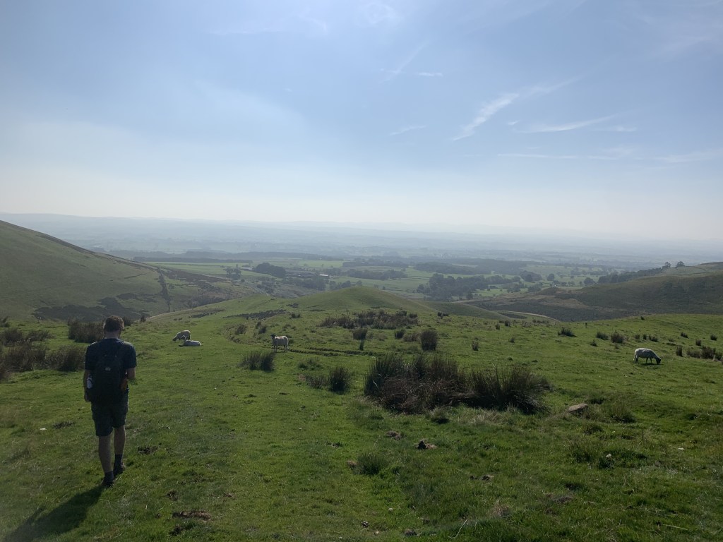
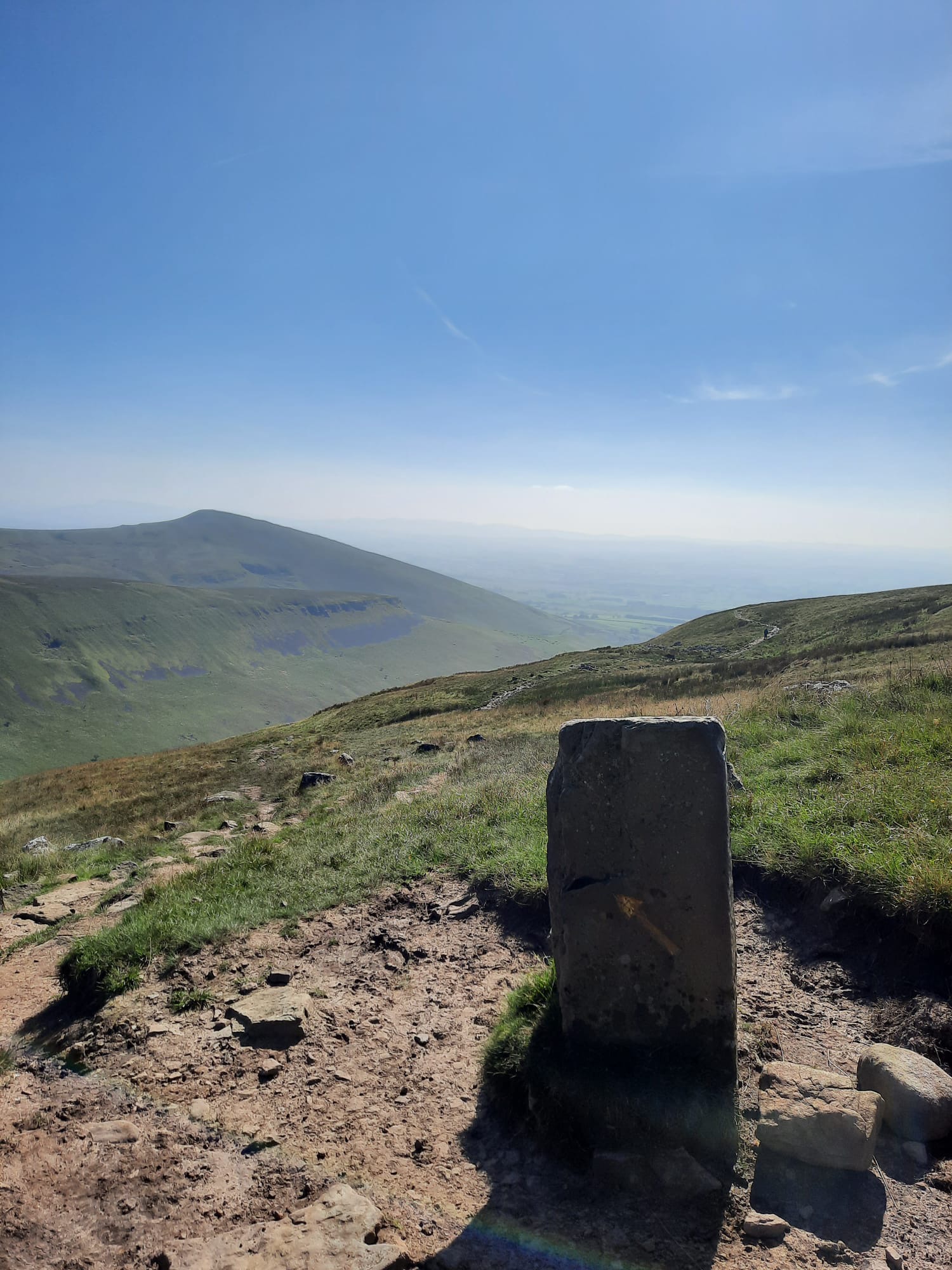
You circle the valley for this walk and return along the opposite side of High Cup Nick. There is the option of dropping into the bottom of the valley down a steep decline to the river. However, we opted to continue with our initial plan and make the walk back a little bit longer. From there, it’s a gradual walk that did get a little boggy at times but, other than that, proved no problem. The path eventually drops into a farmyard which we passed through before heading back along a road for a short while. This isn’t too bad as it is not a busy road at all – more of a country lane.
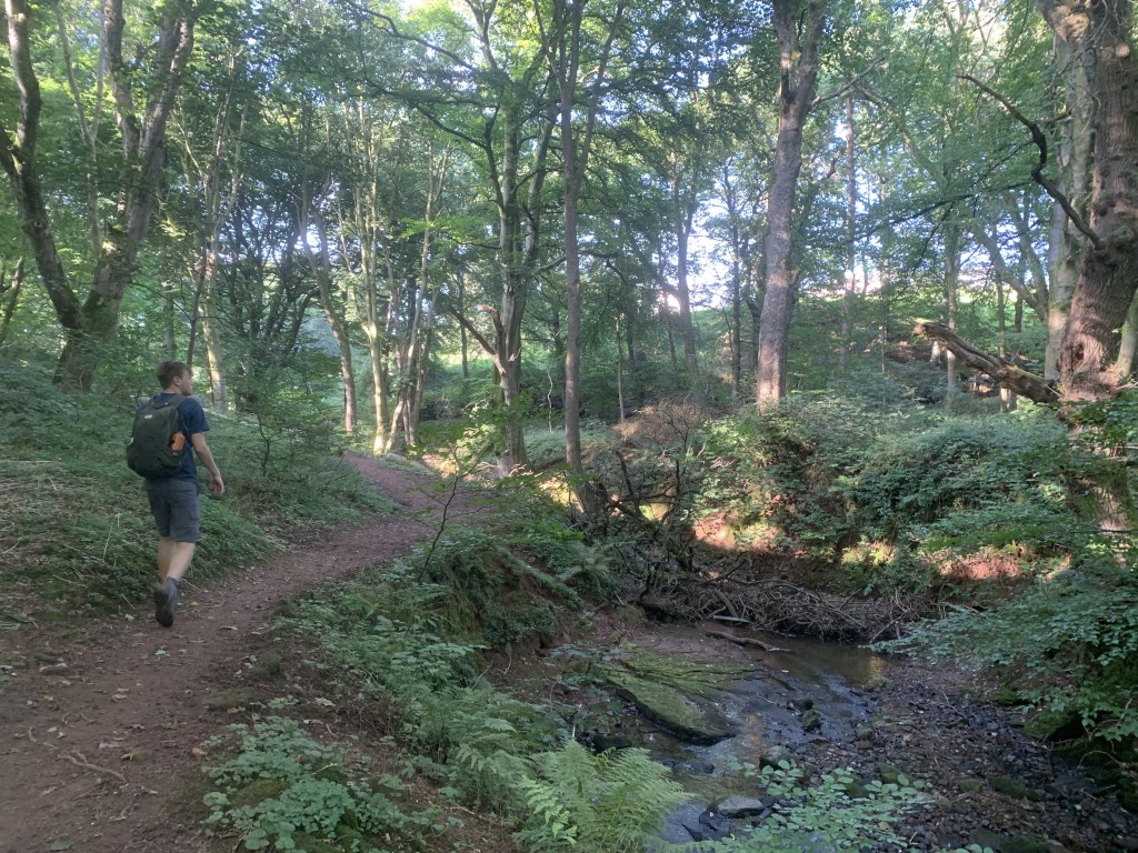
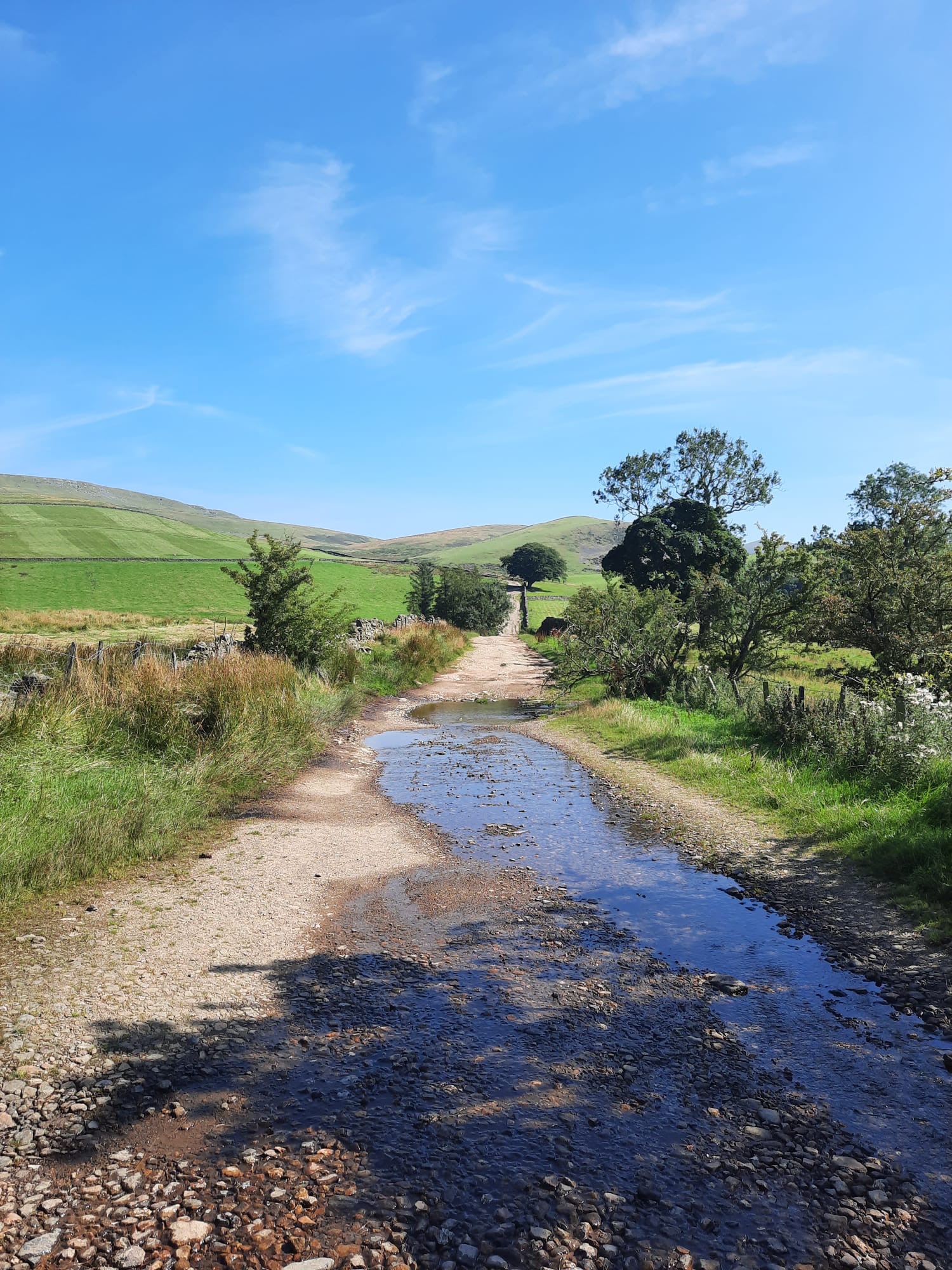
We dipped back onto footpaths, passed through another farm and walked alongside Dufton Ghyll back into the village. The Ghyll was lovely with a river and woodland area. It had the added bonus of running right to the car park. You can exit the woodland alongside the caravan park right next to the car park. And that’s it! You’re back.
This isn’t the most eventful or challenging of walks but, it is a great day out. I highly recommend heading out this way.You can check out the route we took on mappedometer and follow the step by step below.
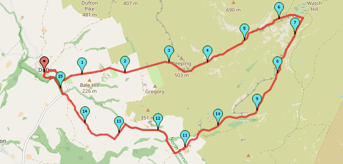
Start Point: Dufton Car Park
- Exit the car park and turn right following the road.
- Follow the road as it bends to the left and then the right. It should then have a slight incline before a downhill section.
- At the bottom of the hill, take the road on the left. There is a flag post and sign here for the military range nearby. This walk doesn’t enter the range so, it doesn’t matter if the flag is flying.
- Follow the road for around a kilometre before it becomes a track. Follow the track as it takes you slightly right.
- Continue to follow the track, passing through a gate and continuing straight as it becomes more grassy.
- Eventually, you will arrive at a sheep holding area used by farmers – you can use any of the gates here – just continue on.
- On the left hand side of the path, there should be a very small cave. (We stopped for lunch here).
- Continue on the path as it continues to climb.
- Soon, there will be more rockier bits to step across like stepping stones to ford a small river. These may be slippy when wet but otherwise aren’t difficult to pass over.
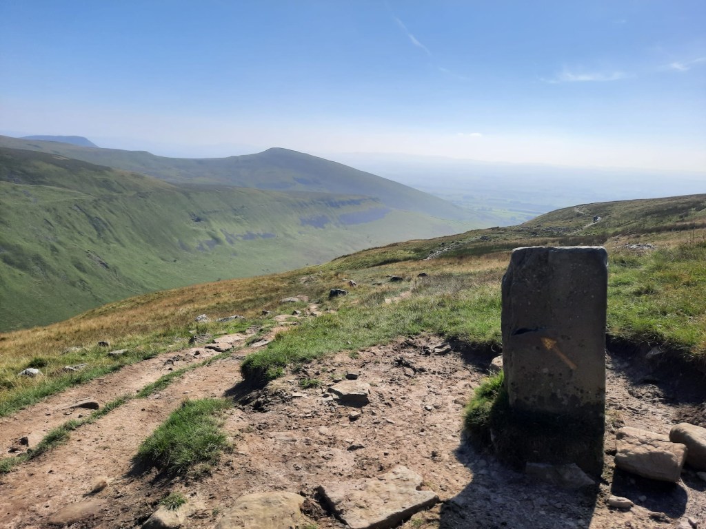
- Continue on, circling the top of High Cup Nick.
- Once on the opposite side, keep right to follow High Cup Nick down the opposite bank.
- Keep following this grassy path back down into the valley, heading into sheep territory.
- The path joins a track and enters a farmyard, once again crossing a small river.
- Follow the track through the farmyard. Once you’ve reached the road, turn right and keep following the road.
- In around 1.5km, you will leave the road onto a footpath. You should have passed another farm on the right. When you see a clump of houses on the right and a road leading up to them, the path should be on the left. It is signposted too.
- Follow the path through the field. When it forks, take the path on the right.
- Continue to follow the path as it crosses through another field. Pass through the gate and follow the track alongside the farmyard.
- When the path meets a road, cross the road and follow the footpath straight ahead, signposted Dufton Ghyll.
- Follow the path through the woods before crossing the bridge to the right.
- Then, follow the path as it bends to the left and around the caravan park.
- Join the lane as it passes to the centre of the village. Turn right and the car park is there.
End Point: Dufton Car Park
A nice and easy circular route with a absolutely fabulous sight in the middle!
Amie x


Leave a reply to The Highest Mountain in the North Pennines: Cross Fell + Greg’s Hut | Walking Route – Explore with Amie Cancel reply