
Last weekend, I had an absolutely fabulous couple of days as my sister and her friend came to stay with us. On Megan’s last visit, we attempted Hellvelyn but the weather conditions and the late time that we set off meant we didn’t manage to make it all the way across Striding Edge and had to turn back. We talked about making the attempt again this time however, when I mentioned the idea of hiking Scafell Pike, the highest peak in England, Megan was desperate to do this one instead. Whilst Alex and I first bagged the peak back in May 2021, Megan has never been to the top so it felt like a great idea! It was a good test for me too as I’d barely done any walking at that time so I wanted to see how much my confidence has grown.
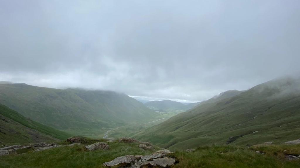
Last time we hiked up Scafell Pike via the corridor route, starting at Seathwaite Farm. This time, we opted to begin the walk at Old Dungeon Ghyll in the Langdales area. I believe that we actually took a similar route on the descent in 2021 but it was so long along, that it didn’t really matter that we were doing the same paths. Also, the weather was incredibly different this time around. You would have thought that the weather would be better in June but alas not, we were not treated to sun and blue skies that is for sure. I will publish the route that we took previously to Scafell soon so you can compare the two and decide which works best for you.
Difficulty: Medium
Distance: 19km
Elevation: 978m
OS Map: Explorer OL6
Notable Features: Angle Tarn, Scafell Pike, Bow Fell, Esk Pike, Cumbria Way
Look Out For: Robins, Sheep, Buzzards, Golden Eagle
It is worth noting first of all that the Old Dungeon Ghyll car park is owned by the National Trust and you have to pay. Naturally, because they know that you will probably be out longer than 4 hours, a day ticket is required for the walk and is quite expensive. There is no signal here too so you really need to have change for the machine if possible. There is the option to donate later and send an email confirming your payment. All of this information is located on the signs beside the pay machine so make sure to have a look, taking a picture of the RingGo code before you set out. The service is actually better on the fells than in the car park. The pub doesn’t like to give change so best to avoid that if you can. They do however, have some toilets that you can use if needs be which was particularly useful.
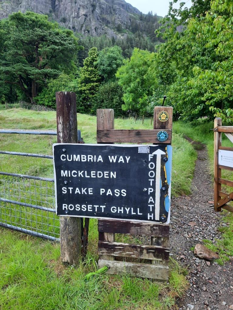
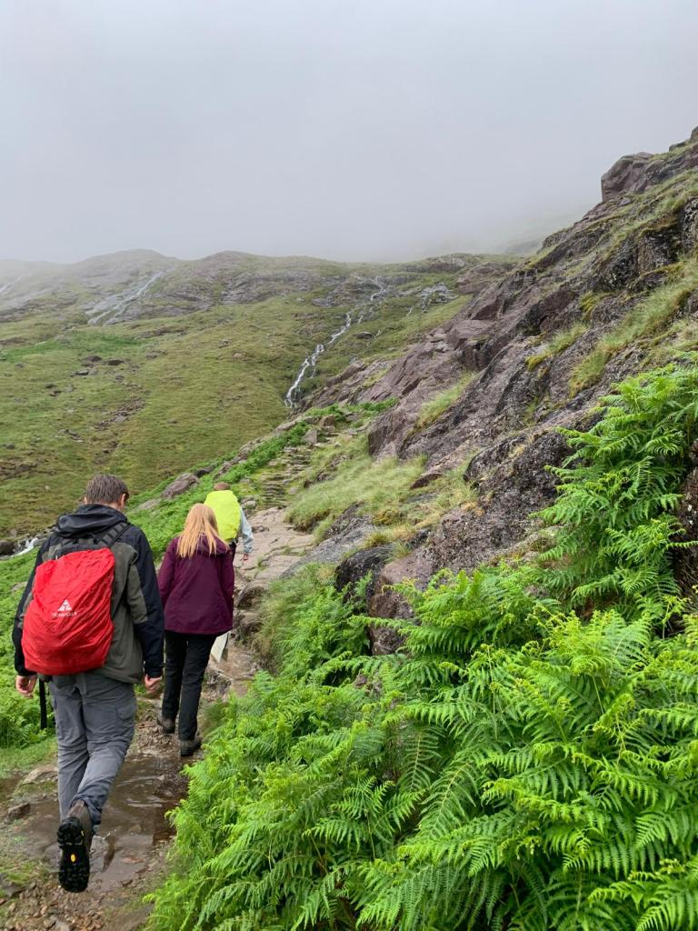
The route begins by following the Cumbria Way for around 3km which is a well signposted gravel path. You don’t gain too much height initially in this portion of the walk however, after crossing the river, the climb begins to Angle Tarn. As we climbed, we were already going into the clouds and the views were diminishing. In fact, we had to keep a close eye on the map to ensure we were going the right way as you couldn’t actually see the tarn in the mist when we had reached the top of that initial climb.
Soon we reached a stone shelter, which is more of a drystone wall cross. This was the point when we were sure we had passed through the same route last time as it is a rather notable feature. From the shelter, we headed onto Esk Hause and began the ascent to Scafell Pike.
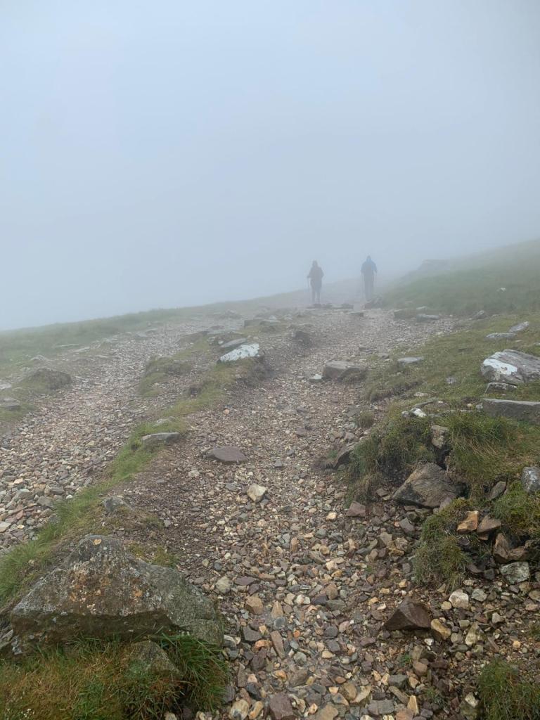
I was actually very surprised by how little I had remembered about the route. I did not recall the the descent and how difficult I would have found it back then. Apparently, my memory had failed when it came to the boulder fields that you have to walk over for a large portion of the final kilometre. We stopped for lunch and I happily told everyone that we were 1.6km from the summit but, it was probably the most difficult kilometre of the walk so far. In all honesty though, this doesn’t require any technical skills and is a case of just stepping from rock to rock with care. Some would call it minor scrambling but, I’m not sure I’d even go that far. If you think about how many people climb Scafell Pike a year, of varying levels of experience, most able-bodied walkers will be able to handle this.
The weather conditions were less than ideal for walking on the boulders though. We relied on the cairns to help keep us on the right track, working our way from one to the other. The boulders were also a little slippy because of the rain. It wasn’t anything too crazy though and we made it across the two long stretches of boulders with relative ease.
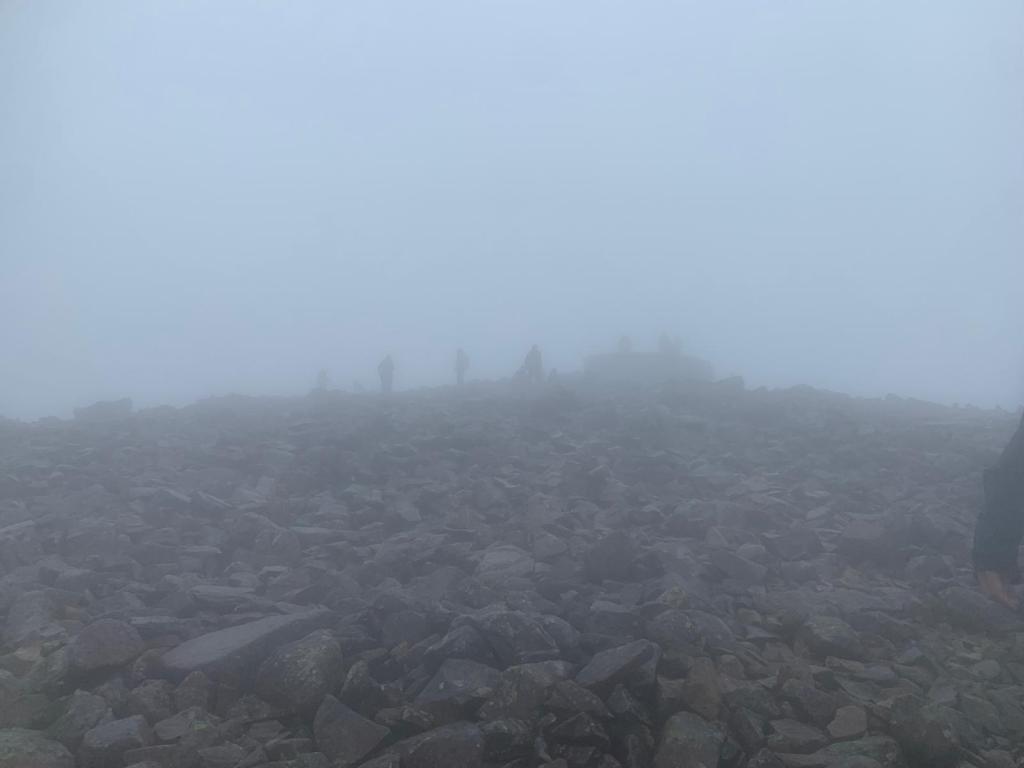
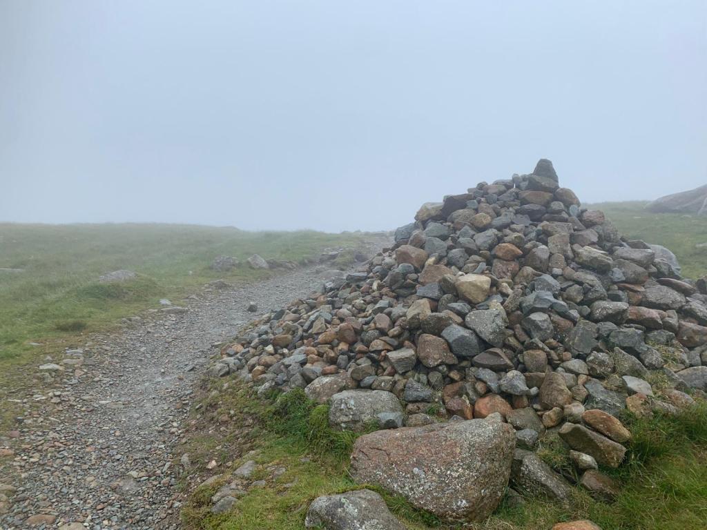
From there, it was a final steep surge to the top. The stone peak of Scafell Pike soon came into view through the cloud (just about) and we reached the top. It was a case of taking a few pictures to commemorate the occasion and then heading straight back down. The weather really was miserable and it didn’t quite reach the triumphant achievement that I was hoping for but alas, we still made it to the highest point in England. On the return route, we decided to head back down to Esk Hause the same way we approached which was a lot easier than we anticipated. The steep descent was much less slippy than we thought and we made quick work of the boulders the second time around.
Once we reached Esk Hause, we made the decision to go a different route back to the car and this meant that we were able to bag an extra two wainwrights as well. From Esk Hause, we headed to the right to begin the ascent up Esk Pike which required some minor scrambling, or clambering, but wasn’t too bad at all. From there, we continued onto Bow Fell. At this point, our map was completely soaked so we had to use MapsMe a free map app that works without wifi. We are usually strictly paper map kind of people but, the map was just getting too wet at this point.
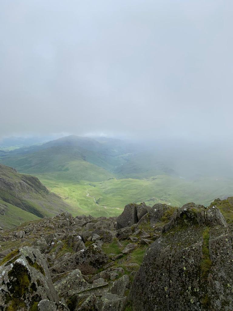
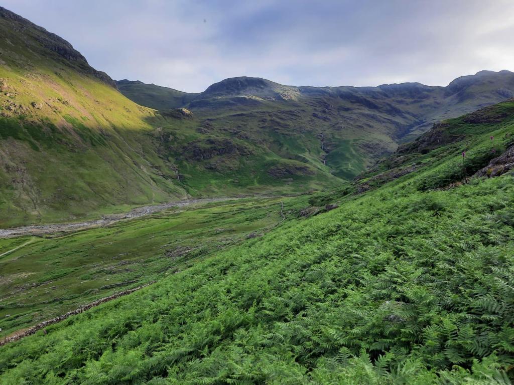
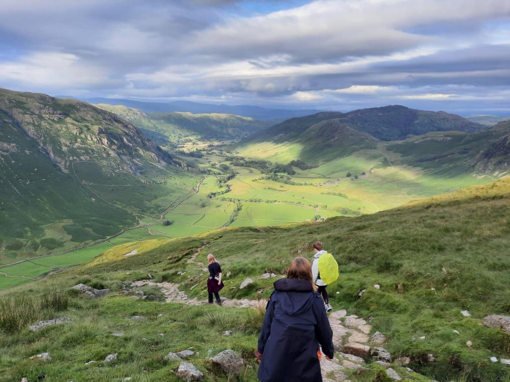
Bow Fell was another minor scramble to the top and down the other side. However, the main highlight here was the cloud cover was finally shifting! We were finally getting a little bit of a view and that certainly helped the morale of the group! We had just bagged the highest, sixth tallest (Bow Fell) and eleventh (Esk Pike) peak in the Lake District and we were finally being rewarded.
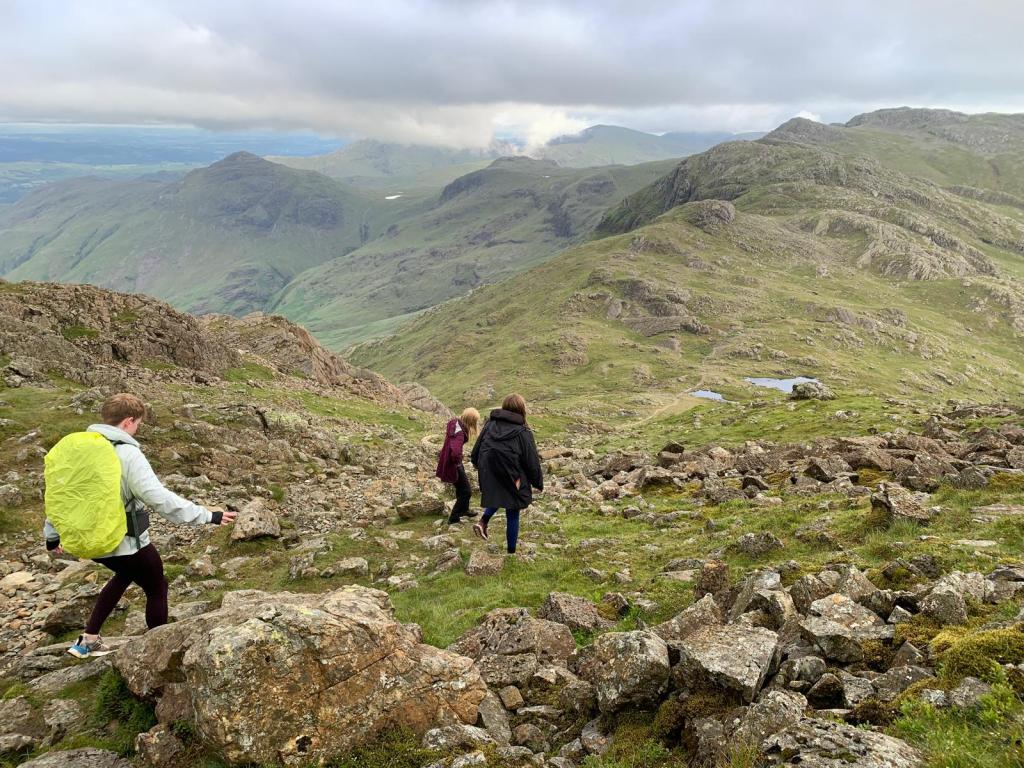
It is a long and gradual descent back into the valley from Bow Fell but I can confidently say that this was a fantastic way to bag Scafell Pike and I had a fabulous day. Megan’s friend had never walked quite that far or high before so was very much ready for the walk to end but, it shows that this walk is doable for a beginner as well. I was so happy that we managed to get the views at the end to top off what had been a great walk.
It’s a long one but a good one. Click here to view the route in more detail and follow the step by step below.

Start Point: Old Dungeon Ghyll Car Park
- Head behind the pub and through a gap in the wall to join the Cumbria Way.
- Continue to follow the gravel path of the Cumbria way for 3km until you reach a footbridge.
- Cross the footbridge on the left and continue straight, leaving the Cumbria Way which heads to the right.
- Ascend the steps and continue following the path as it wiggles up the valley.
- Once you reach Angle Tarn, follow the path straight and turn left at the shelter (a large stone cross shape).
- Soon, you will reach Esk Hause as named on the map. At this crossroad, take the fork on the right that continues ahead.
- Follow the cairns across the boulder fields. Eventually, the path will descend before heading steeply upwards – called Broad Crag Col on the map.
- Head upwards and continue straight to Scafell Pike.
- Retrace your steps back to Broad Crag Col, along the boulder fields to Esk Hause.
- At Esk Hause, take the path second from the right. You may be able to see the peak of Esk Pike ahead.
- Follow the path up Esk Pike, with a small amount of scrambling to reach the top. Continue straight over the peak.
- At the junction, take the path straight ahead to continue onto Bow Fell.
- Clamber to the peak and down the other side, using the cairns as a guide to go back to the path. There is no specified path down the other side of Bow Fell so pick a sensible route and rejoin the path at the cairns.
- Head down to the Three Tarns. Once here, take the path to the left named The Band.
- Follow The Band along the hillside and down into the valley.
- Approximately, 3km later, you should arrive at a farmyard. Follow the footpath signs through the farm and down the road.
- Cross the cattle grids and continue down the road back to the car park.
End Point: Old Dungeon Ghyll Car Park
This is a fairly easy to navigate route, just keep an eye on the map at key moments such as Esk Hause and you should be okay!
Have you reached the top of Scafell Pike?
Amie x


Leave a reply to Crinkle Craggs | Lake District National Park – Explore with Amie Cancel reply