
Alex and I have often discussed whilst out on walks which Wainwright can be tackled from car park to peak in the shortest amount of time and we do have some strong contenders. Great Mell Fell and Little Mell Fell have to be close but, Binsey might have just won. However, the award in the Peak District, from my experience so far, would undoubtedly go to Mam Tor. Having lived near the Peak District for quite a lot of my life, it’s surprising that it took me until now to tackle this one. But on a very rainy visit to the national park, we decided to do just that.
Despite the miserable weather and the late hour, the car park and walk to Mam Tor was fairly busy. It’s surprising but then again, this is a very accessible mountain. It’s the kind where you can go up in jeans and trainers and probably be alright.
Difficulty: Easy Distance: 4km
Notable Features: Mam Tor, Blue John Cavern, Old Mam Tor Road (A625
Okay, I’m not saying you should do that in wintery conditions but, if you kept to the cobbled path and visibility was okay, you would be fine. Parking can found at the Mam Tor Hillfort Car Park which is owned by the National Trust. I think you could also park at Blue John Carvern, though you would need to check the rules.
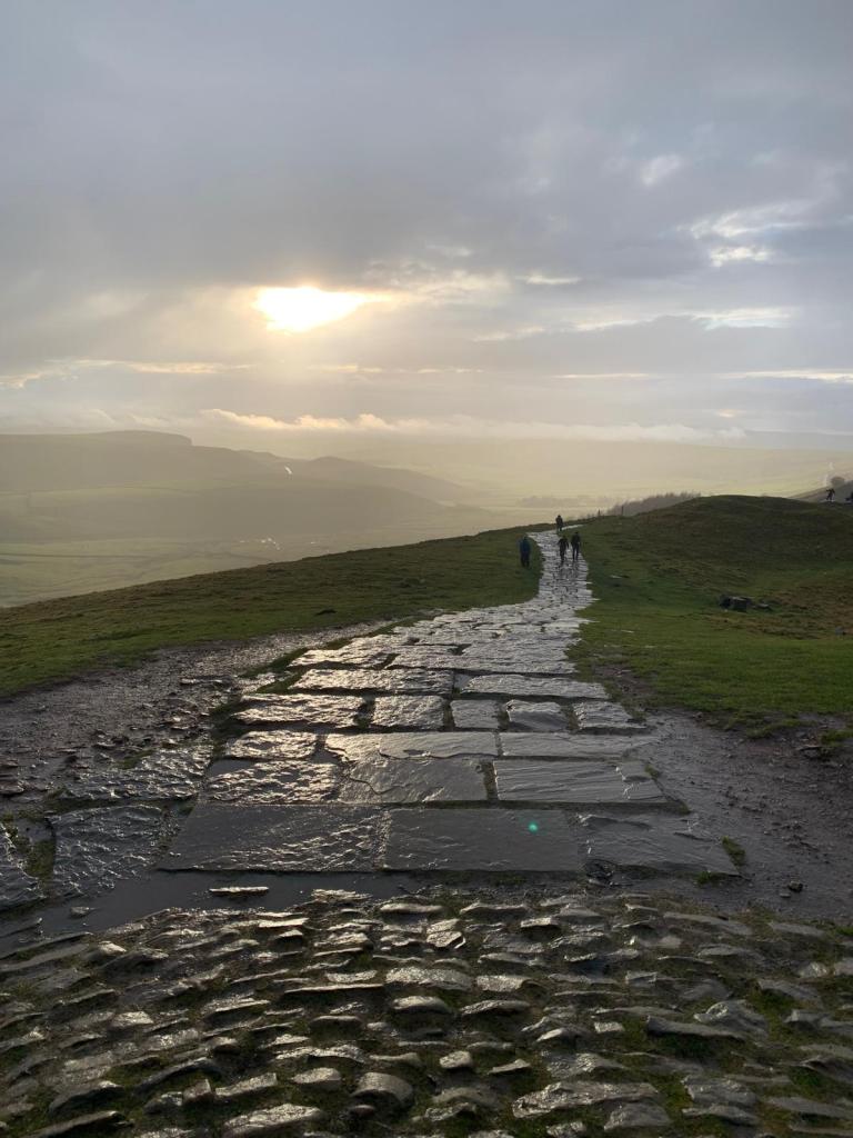
You head out of the back of the car park up a cobbled path that soon emerges out of the trees, alongside the road. There is actually a bus stop just down the road from here so you could actually access this by public transport too, which is great! You should take the path that continues diagonally ahead, signposted for Mam Tor. Then, its an easy stroll to the top, following the slabstone path. You can literally be at the trig point in fifteen minutes and you’re bagged yourself another peak.
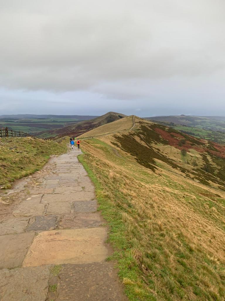
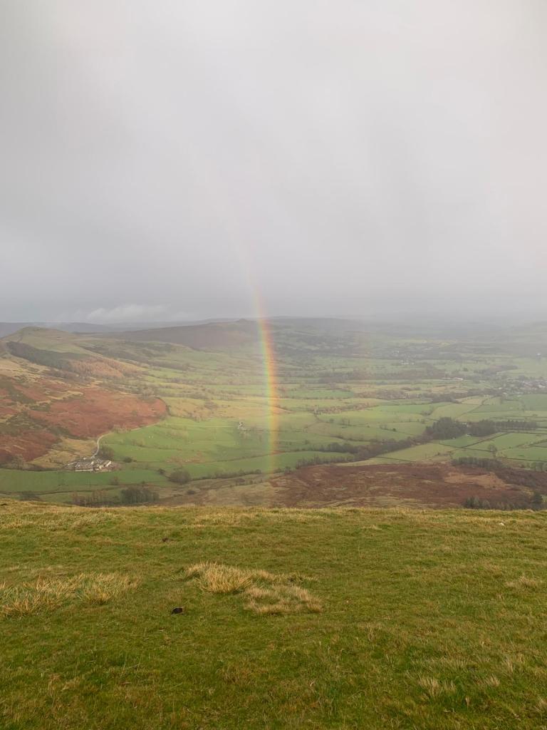
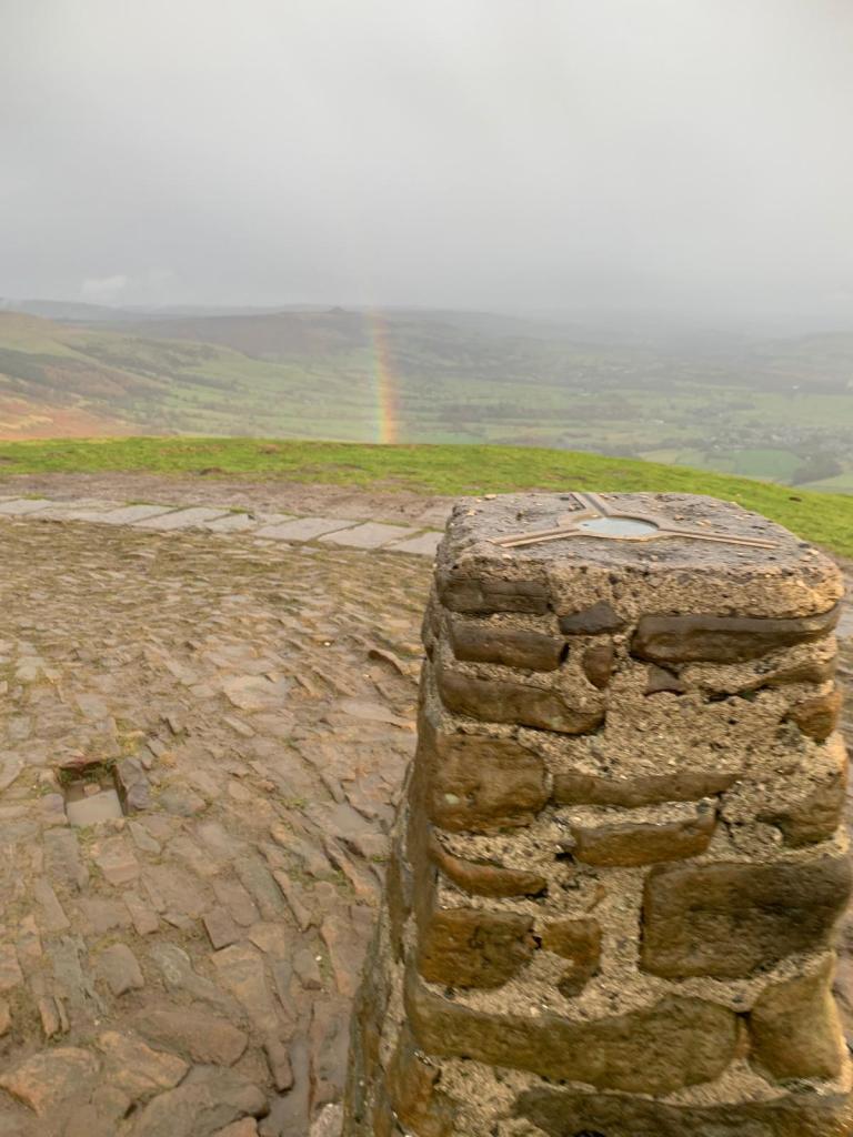
One option here would be to turn straight back around and walk back to the car park the way you came. However, the National Trust know what they’re doing here as you can’t just put an hour on the car so, to make the most of the parking and to extend the walk longer than 30 minutes, we opted for a circular route. From the peak, continue straight following towards the ridgeline. Again, the path is very clear here and the flagstones continue. The weather was clearing up a little bit at the time point and we managed to see a beautiful rainbow! That was great to see and made the walk that little bit more special.
After you’ve passed through a gate, you want to take the first path on the right which skirts back along the hillside. Here is where the walk got interesting… Because of all the rain we’ve been having and the constant foot traffic at Mam Tor, the path was a mud bath and became incredibly slippy very quickly. Not too long after we’d begun making our way down this path, I slipped over and was incredibly muddy for the rest of the walk… I’m talking mud all the way up my trousers! Safe to say, our pace dramatically slowed as we made our way around and through the mud, careful not to have a repeat incident.

A short while later (though it felt much longer!) we cut down to Old Mam Tor Road which was really interesting to see and a welcome break from the mud. Last time we were in this area, we had witnessed them filming the first season of the Game of Thrones spin-off, House of Dragon! On this occasion though, there was no film crew in sight. Old Mam Tor Road used to be part of the A625 across the Peak District, connecting Sheffield and Castleford. However, because the road was originally built upon shale and loose ground, as opposed to the limestone beneath Winnats Pass, the road was continually damaged and closed for repairs. After a landslide in 1979, it was decided that the road would be closed for good. Now, the only through route that remains is along Winnats Pass.
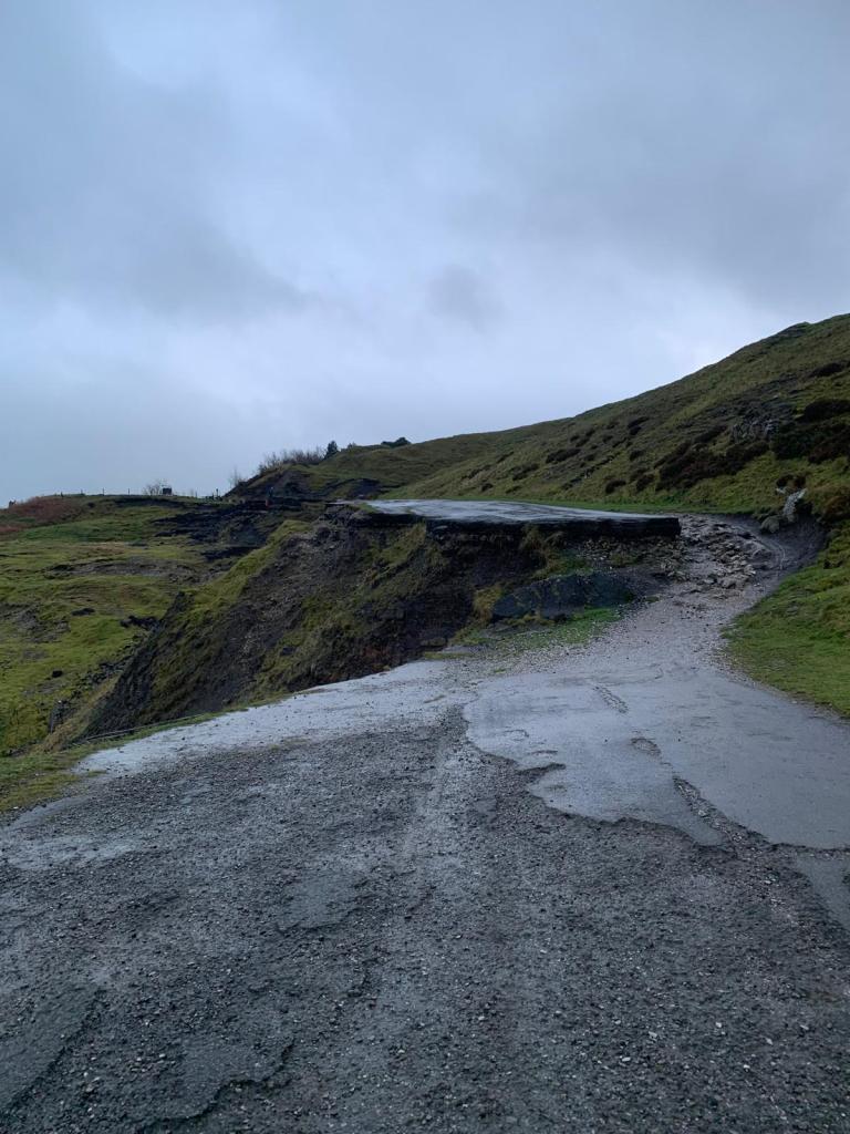
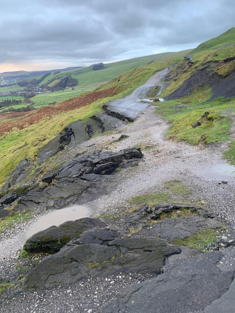
You can see why! As you walk along, it looks as if the road has just dropped away from the hillside forming huge dips and broken tarmac. Many seem to now using as a mountain biking trail.
From the road, we opted to turn right and follow back through a field of cows in order to avoid walking on the open and busy road up the car park. A lot of people were walking on the road but, if we can avoid it, we usually do. This was a short walk back to up junction that we had crossed earlier on the ascent to Mam Tor. We retraced our steps back down the cobbled path back to the car park.
Take a look at the full route for yourself here on Map Pedometer.
Start Point: Mam Tor Hillfort Car Park
- Exit the car park via the cobbled path at the back.
- As the path reaches the road, continue diagonally through the gate, following signposts for Mam Tor.
- Follow the paved path to the peak.
- At the trig, continue straight following the path towards the ridge line.
- Pass through the gate.
- Take the next path on the left to skirt back alongside the mountainside.
- Soon, the path meets the old abandoned road.
- Follow this collapsed road and pass through the gate into the car park of Blue John Cavern.
- Walk through the car park, towards the main road.
- Take the path on the left, following the path uphill through a field of cows.
- Once you’ve reached the gate, head through it and then turn left.
- Follow the cobblestone path back down to the car park.
End Point: Mam Tor Hillfort Car Park
This is a fab little walk that is best done outside of the usual tourist months as it can get incredibly busy!
Amie x

Leave a comment