Recently, I shared the itinerary for a trip to Northumberland which included exploring the coast as well as the National Park. We covered a lot of ground in one weekend and, as we timed the trip around a bank holiday, we also had the Monday to play with. That meant that we could walk to the highest peak in Northumberland, the Cheviot, before driving back home. At 815m this is a sizeable peak by Lake District standards but it would still only be ranked 29th if it was a Wainwright. Think High Street or High Crag kind of height. The walk really was a lovely one and I’d highly recommend it, if you have the time. Here is the route we took and everything you need to know.
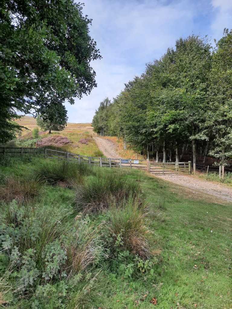
Parking was very easy. There is ample free parking space alongside Harthope Burn. The road itself is a dead end and there are signs preventing you from parking past a certain point so you can’t really miss it. To say this was a bank holiday, and nice weather, we managed to find a space easily. Then, we headed down the track to begin the walk.
Difficulty: Easy
Distance: 15km
Elevation: 626m
OS Map: OL16
Notable Features: Scald Hill, The Cheviot, the Scottish Border
I feel like I need to add a bit of a disclaimer here. I have used mappedometer as usual to plot the route and it is linked further down this post however, according to map pedometer this is a 19km walk. My GPS on the day says 14km and to be honest, I’d say the 14km is more accurate given how quickly we did this route. Mappedometer may have the parking spot in the wrong place or may simply be quite inaccurate in this case. There is usually a slight variation of a couple of km but nothing this substantial. Expect around 15km, I would say.
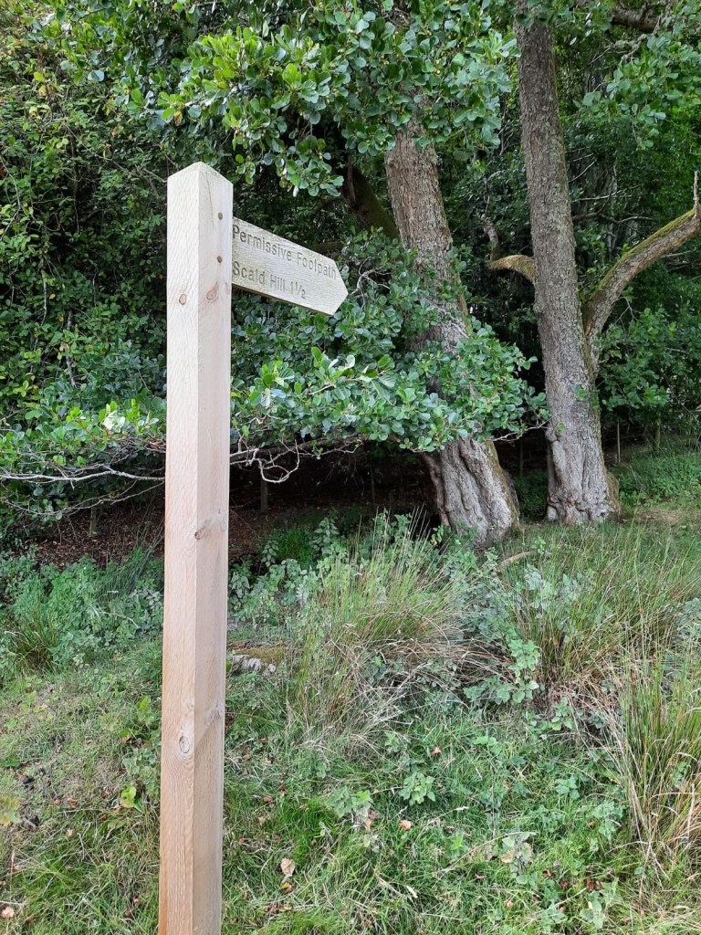
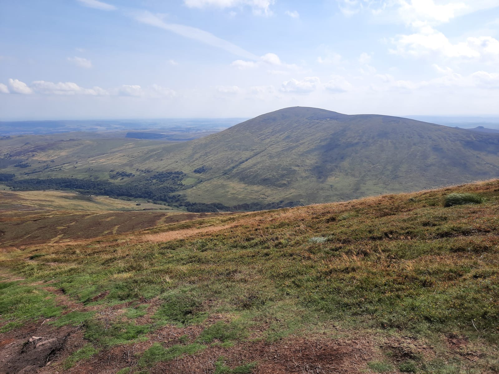
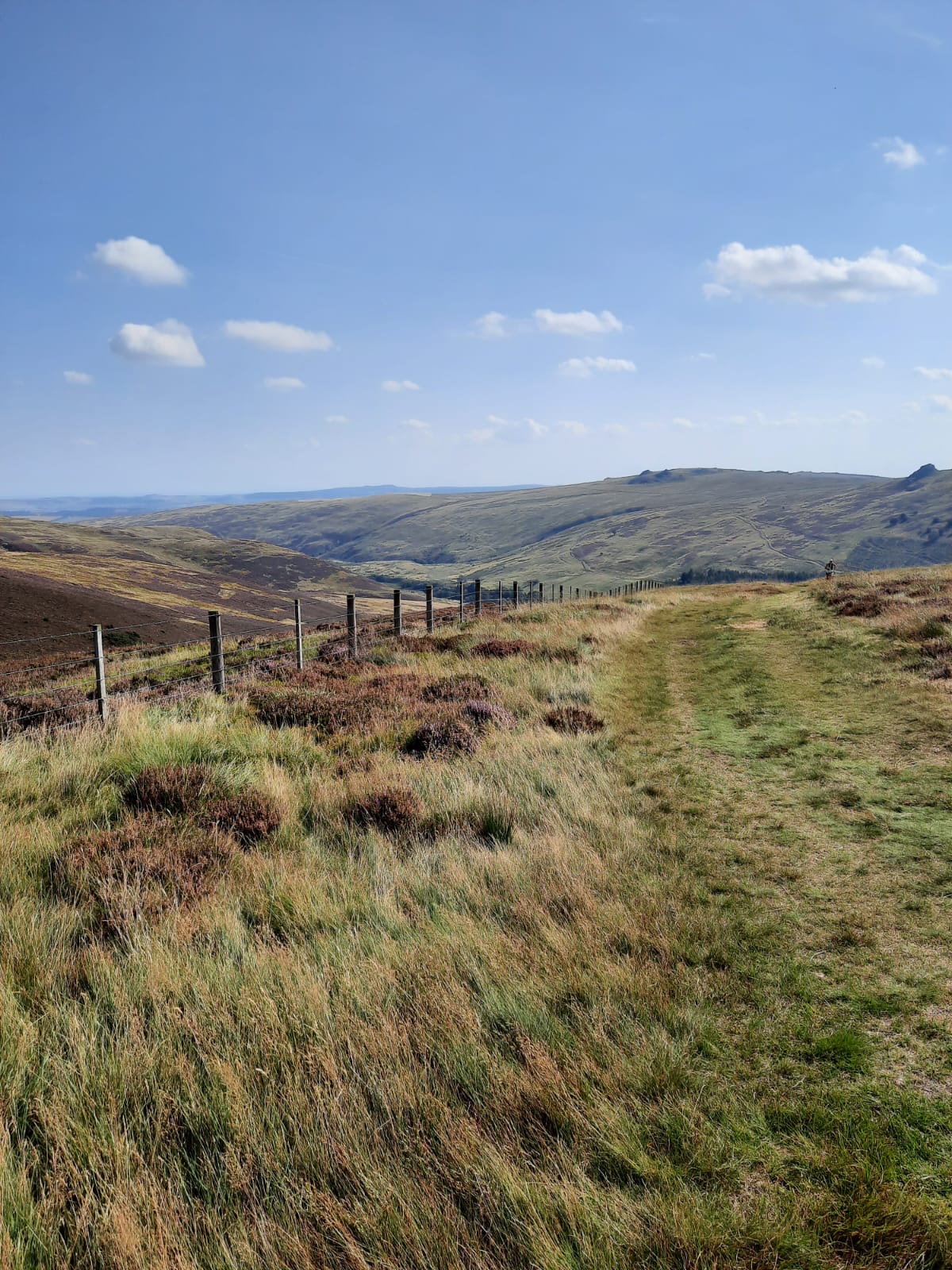
As well as The Cheviot, this also takes in Scald Hill which is 549m tall and a fairly easy climb to the top. Despite a steep start, it soon becomes more gradual, making your way through moors. In some ways, this reminded me of the Peak District and the Pennines. I mean, the part of this walk uses the trail of the Pennine Way. It is bleak but beautiful with quite a lot of wildlife too, which makes a nice change from the Lakes.
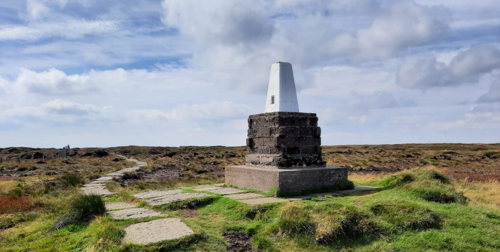
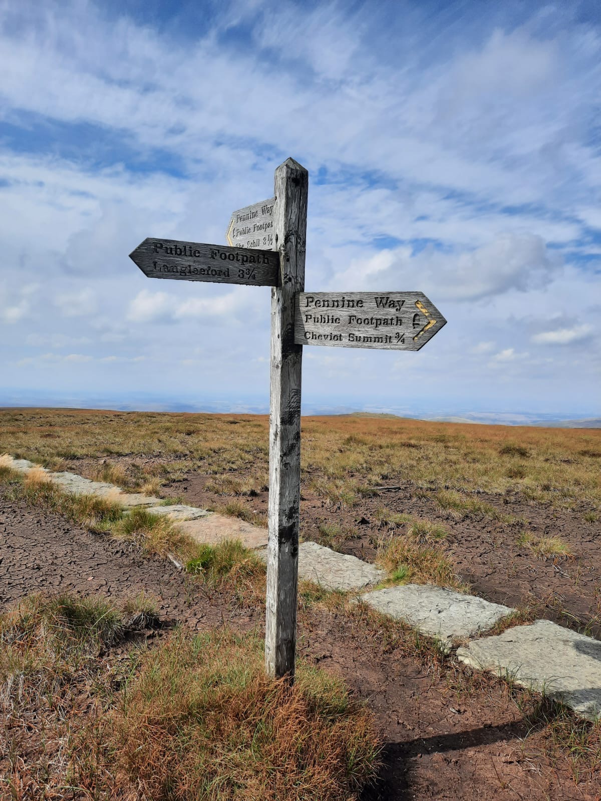
However, the real hard work starts after you’ve reached Scald Hill as there is a very steep ascent towards The Cheviot. My advice would be to take this a section at a time, especially in warm weather and tackle it in manageable chunks before taking a few minutes and then continuing. It isn’t technical in anyway; just steep! It’s incredibly rewarding to get to the top! But, don’t think you’ve reach The Cheviot yet… The large cairn at the top is a welcome site but it isn’t the peak. It’s a pretty level walk over a stile and along some stone slabs to the trig point. It was here that I said to Alex “This looks like the Pennine Way” and alas, it was.

Surprisingly, because its a plateau, you don’t get the best views from the top of The Cheviot but, you do get some pretty incredible ones on the way up to make up for it. The white trig point crowns the landscape and its a fabulous sight on the approach. You’re also only a stones throw from the Scottish border if you fancy adding on an extra km or two to stick your arm into another country! We didn’t which I kind of regret now…
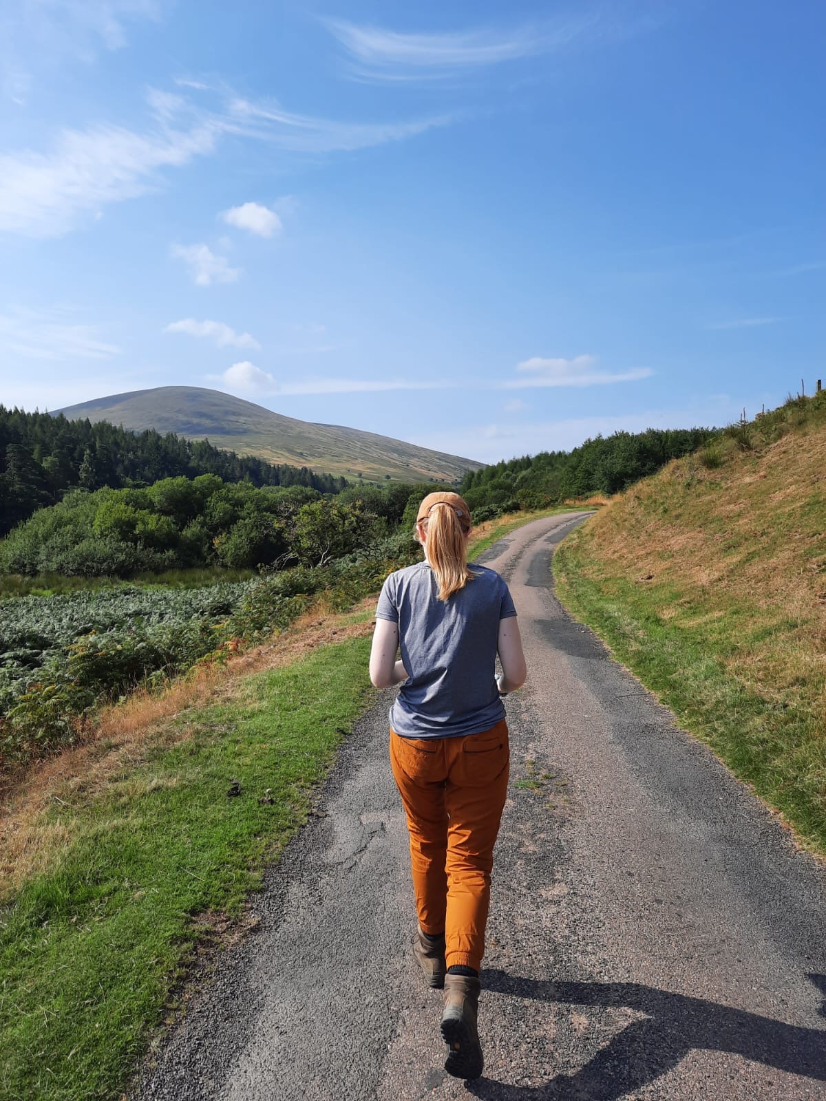
From the Cheviot, we headed back down into the valley but, we love a circular route so didn’t go back the same way. It’s quite a long descent but, it’s a fun one as you walk alongside the Burn you parked alongside at the start. You walk alongside it for quite a while hopping from one side to the other and passing through heather and ferns. It was a little muddy in places and that was after a long spell of dry weather so I imagine that this path gets quite boggy during the winter months which is something to watch out for. As I said, we had no such problems though as the sun was shining and we made quick progress along the valley.


We got back to the car at around 3pm and sat and had lunch next to the river. We had planned to eat at some point along the descent but, didn’t find anywhere alongside the burn that we wanted to sit or that was slightly away from the path. Regardless though, we weren’t too hungry and lasted well until we got back to the car. It was a classic meal deal job before hopping back into the car.
I feel like there isn’t much to say here but it is because this was a really lovely walk which was plain-sailing and, on a clear day, shouldn’t cause too many problems. Navigation would, of course, be much more difficult during the winter months in poor visibility. That being said though, I highly recommend heading up and ticking off another of the highest peaks in a no-nonsense, rewarding walk in Northumberland.
If you want to follow this route for yourself, here is a handy mappedometer link.
Start Point: Car park alongside Harthope Burn (Google Maps pin)
- Continue along the lane past the car park.
- Take the second path on the right signposted for Scald Hill.
- Keep left to begin the climb towards Scald Hill
- Follow the path. Once you’ve reached Scald Hill, continue straight. The steep ascent towards the Cheviot is visible ahead and to the right.
- Bear right to climb towards the Cheviot.
- Once you reach the Cairn, continue straight, crossing the stile.
- Across the stile, follow the stone slabs to the trig point.
- You’ve reached The Cheviot.
- Continue straight past the peak until you get to a junction. Here, there is another way marking signpost.
- Take the path on the left back down into valley.
- Once you reach the bottom of the valley, take the path on the left alongside the burn.
- Follow this path for 6km.
- For the final 3km, follow the lane back to the car park.
End point: Car park alongside Harthope Burn (Google Maps pin)
This is a simple route navigation wise but is so rewarding and you’re ticking off another of the highest peaks!
Have you tried this one?
Amie x


Leave a comment