
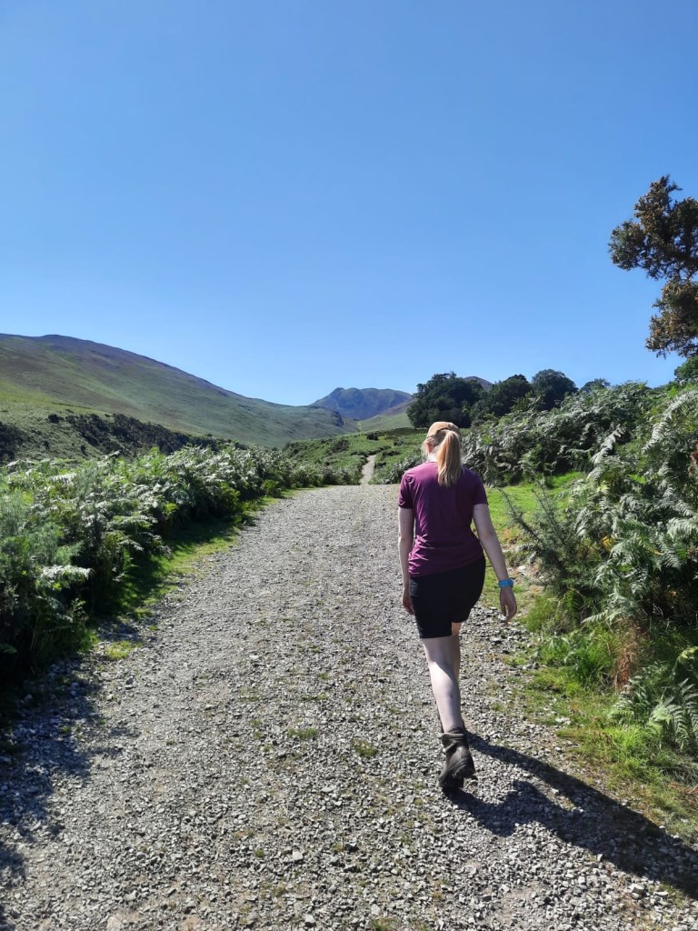
For the first time since the Cumbria Way, it was time to get out and into the hills of the Lake District. After weeks of travelling, we were excited to finally be walking in the hills again. Whilst we had a lovely summer travelling to different parts of the country and trying out new routes like the Cross Bay Walks, you can’t really beat the Lake District!
I picked the Coledale Horseshoe for us to tackle which is one that I’ve had on my list for a long time. The route begins in Braithwaite, a small village just north of Keswick. Parking is limited near the church. Luck was on our side when we visited on a weekend in the peak summer season and, we managed to find a space easily even though it was getting towards midday. I thought that the Coledale Horseshoe was a popular walk and it is, but less so than the classic Fairfield Horseshoe. The parking here is also free which is always a bonus.
Difficulty: Medium
Distance: 13.3km
Elevation: 835m
OS Map: OL4
Notable Features: Braithwaite, Force Crag Mine, Grisedale Pike, Sail, Crag Hill/Eel Crag
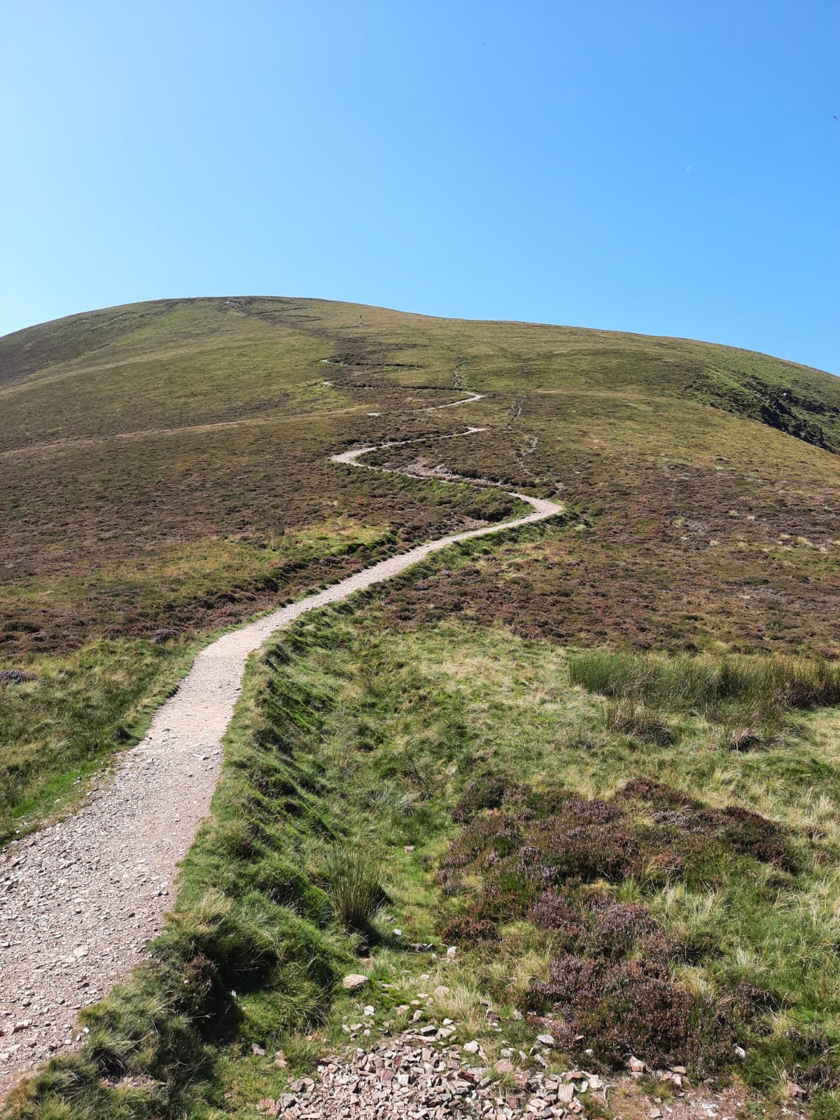
From initial research online, it seems as if most tackle this route anti-clockwise but, we opted for clockwise instead. This means that you head out of the village via a small road, passed the pub. The road soon becomes more of a gravel track as the climb begins towards the first wainwright of the day. Whilst steep from the offset, this was a the right way to do the walk in my opinion and gives you the best approach to Sail – more on that later. First, the path is a relatively straightforward albeit steep ascent to Stile End. This peak is 447m but is not classified as a Wainwright. You are graced (on a good weather day) with phenomenal views of Barrow to the left and the descent of Grisedale Pike on the right. Horseshoes are great for seeing everything that’s to come on the walk – daunting but beautiful!

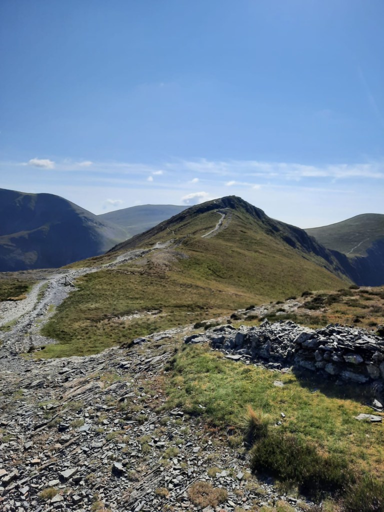
From Stile End, the path continues to Outerside which is slightly taller at 568m and is the first Wainwright of the walk. It became obvious from the offset that this horseshoe wasn’t quite like any other and rather than maintaining height throughout, there are lots of ascents and descents before climbing again. Moving onto the second Wainwright, Sail was a prime example of this. However, this was a fabulous path to ascend.


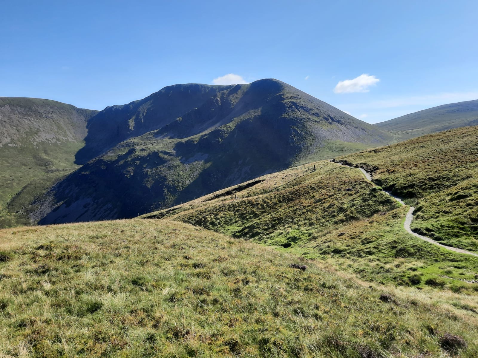
The route skirts alongside Scar Crags on quite a narrow, gravelly path with a small amount of clambering – nothing too series! It was fairly slippy in places and I would suggest taking care when descending here but, going up was absolutely fine. This path soon meets a junction with Scar Crags on the left and the iconic path to Sail on the right. I’d seen this picture online and thought it looked like a very cool path. If you aren’t aware, the path to Sail zig zags upwards and, whilst not difficult, it is steep. Sail reaches 773m and is ranked 50th of the Wainwrights.
Whilst en route from Outerside, be sure to look down into the valley on the right to see Force Crag Mine. In fact, if you have time at the end of the day, or are in the Keswick area on another occasion, I would highly recommend taking the short walk to visit the mine. This is one of the best abandoned industrial features of the Lake District in my opinion. Force Crag was one of the last working metal mines in the Lakes until it was abandoned in 1991. It is now owned by the National Trust and has a water treatment system designed to remove the metal from the water before it enters Coledale Beck. This walk follows the mountains that encircle the valley home to the mine.
From Sail, the walk passes around the ‘back’ of the horseshoe, including Crag Hill/Eel Crag which are classified as the same Wainwright. One thing that I haven’t mentioned yet is that it was incredibly warm on this day with very little breeze and no shade at all on this route. That made the going quite tough, especially on the ascents. As well as that, the weather brought out the insects. We had initially planned to have lunch at the top of Crag Hill but we were being swarmed by what we thought were horseflies. The didn’t’ quite look the same though so, I’m not sure what they were. They were huge though and not exactly what you want to eating lunch so, after a quick suncream reapply, we ploughed on.
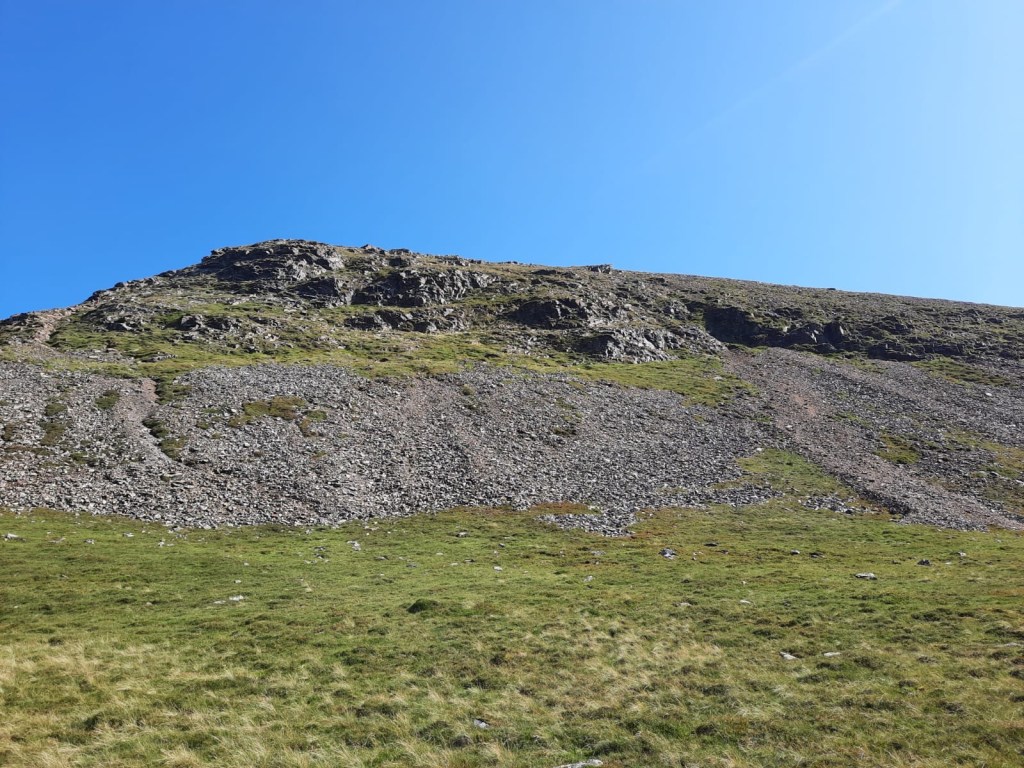
Originally, we had planned to head to Sand Hill 756m and then turn right down to Hobcarton Cragg before going onto summit Grisedale Pike. You also have the option of adding in another Wainwright, Hopesgill Head here too but, we saved that for another day. Instead of following our original plan though, we opted to cut the corner and take a short cut. I would say this was moderately successful… We checked that this was actually a path, which it was, which was great. However, some half way down this path becomes more of a scree slope and, if you’ve been here since we walked the Great Gable, you will know that a scree slope is not for me. I have improved my crouched slide down the mountainside since the Great Gable though which helps although, with the dust from the stones, I was still covered in orange dust by the time we reached the bottom. It was also all over my trousers and my arms! The route was fine and I would say very possible on a clear day if you’re happy going down loose scree. However, if visibility is poor, I’d probably say stick to the slightly longer option.
After a quick lunch beside some running water which helped to keep the flies away at the bottom. We continued on for our two final climbs of the day. The first wasn’t a wainwright but had rewarding views onto Grisedale Pike and towards Scotland. Here, there is also lots of old mining features leftover from when Force Crag was a working mine. One large area is cordoned off where there is a huge hole – I imagine because of the mine work that went on underneath.
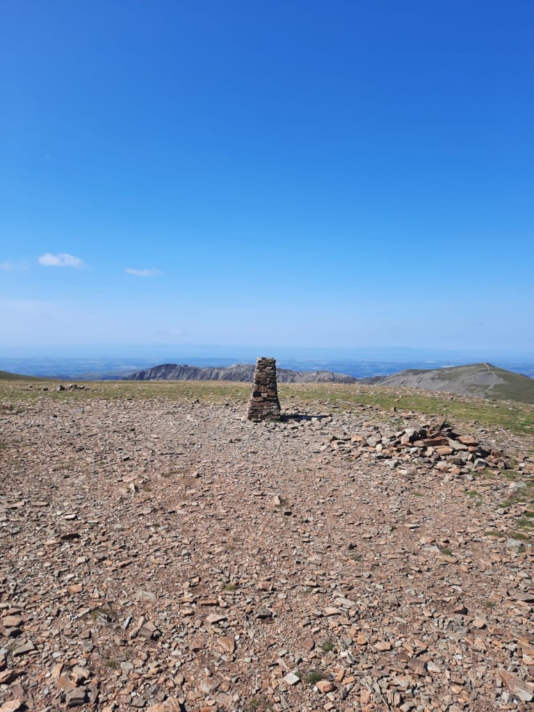
Grisedale Pike is the final Wainwright and second highest of the walk at 790 metres and then the descent begins. It is a very long descent back to Braithwaite with another 4km of the walk remaining but, it is fairly gradual after a steep start. A short amount of road walking takes you back to the village and the church car park. However, for us, the day didn’t end there.

After walking all day in the sunshine and a rather lacklustre lunch, we were both desperate for some sugar and a fizzy drink. This often happens when we walk on a summers day – all you want is a lemonade or Fanta right after. Remember the pub I mentioned at the start of the walk? We opted to stop here for a drink before heading home. The Coledale Inn looked to be a lovely village pub. We sat outside in the beer garden under some shade. Covered in dust, I wouldn’t have wanted to go inside! I did use the toilets to wash my arms off though which definitely helped! Then, it was time for the journey back home.
The Coledale horseshoe had been on my list for quite some time and it did not disappoint! We’ll be back in the area soon enough to tick off the Wainwright’s surrounding it that we missed on this occasion…
Start point: Old Methodist Chapel (Orthodox Parish of St Bega, St Mungo, and St Herbert)
- Head out of the car park and up the hill around the village keep.
- Follow the road to the left as it passes in front of the Coledale Inn pub.
- Then, take the road on the right, continuing on as this becomes a gravel track.
- Soon, the gravel track becomes a grassy footpath towards Stile End with Barrow visible to the right.
- Follow the path straight to this first peak before a short descent then ascent to Outerside.
- Descend Outerside, keeping left to the path that skirts the mountainside up towards Sail.
- Once you’ve reached the top of this narrow path, you reach a bit of a Ridgeline. Turn right, following the zig-zagging path towards the peak of Sail.
- From Sail, follow the path straight as it continues on to Crag Hill and Eel Crag.
- Here, to descend via the scree, keep towards the right and continue straight down the scree slope towards the stream at the bottom. Alternatively, from the peak of Eel Crag, bear left towards Sand Hill to bag Hopesgill Head.
- The path bends to the right and climbs again towards Hobcarton Crag. Here, you will see features remaining from Force Crag Mine.
- Continue along the path, ascending towards Grisedale Pike.
- From the peak, deep right to follow the path back towards Braithwaite village. Be sure to look left to see the rest of the horseshoe you have completed!
- After around 1km, keep right at the fork to continue the descent. Ignore any other diversions from the path.
- On the final section to the road, the path wiggles through some trees before reaching the main road via a small car park.
- Follow the road downhill and then turn right to cross the bridge into Braithwaite village.
- Turn right again to meet the car park.
End Point: Old Methodist Chapel (Orthodox Parish of St Bega, St Mungo, and St Herbert)
This was a fab route! Have you walked the Coledale Horsehoe?
Amie x


Leave a comment