As the weather has turned and the rain has arrived, a short walk is perfect to get an outdoor fix whilst hopefully managing to miss the intermittent showers. That is exactly what we did recently by heading to Eskdale, one of the lesser visited areas of the Lake District to see a fabulous waterfall.
There are a couple of options for parking for this walk. The first is the Dalegarth train station car park. This is a small, steam train that runs from Ravenglass to Dalegarth. You would have to do some further research but, in theory, you could get the steam train to Dalegarth and then do this walk before getting the train back – go make a day of it! You would, of course, have to look into the train times. This car park has the added bonus of the cafe facilities of the station as well as the toilets and a gift shop. However, if you want to evade the parking costs there is a small car park in the woodland in the lane on the right just before the train station if you’re arriving from the Beckfoot/Eskdale direction.
Difficulty: Easy
Distance: 4.64km
Elevation: +118m
OS Map: OL6
Notable features: Stanley Ghyll Waterfall, Dalegarth Railway, Catherine’s Church
Look out for: Grey wagtails
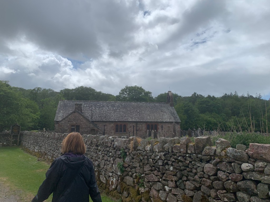
After stopping at the cafe for a drink, we headed down the lane before turning right down the footpath towards Catherine’s Church. The church is thought to date back to the 12th century and is a lovely building. You can take the time to look around the church should you wish to. Just beyond the church, there is supposed to be some stepping stones across the River Esk. Because of the rainy weather we have had recently, these were completely submerged however, helpfully there was an alternative route.
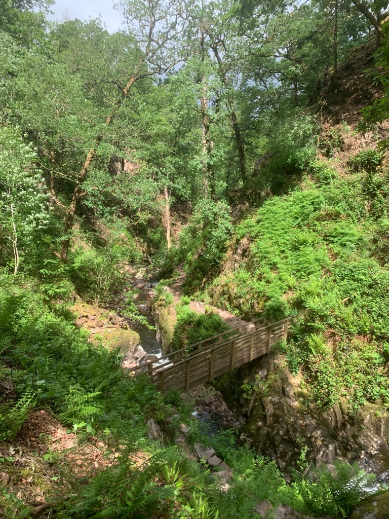
Head to the left to follow the bank of the river until you come to a bridge crossing a small gorge. Cross and then turn right to follow back along other side of the river. Soon, you should arrive at the stepping stones on the opposite side. This isn’t too large of a detour so don’t be disheartened if the crossing is impassable.
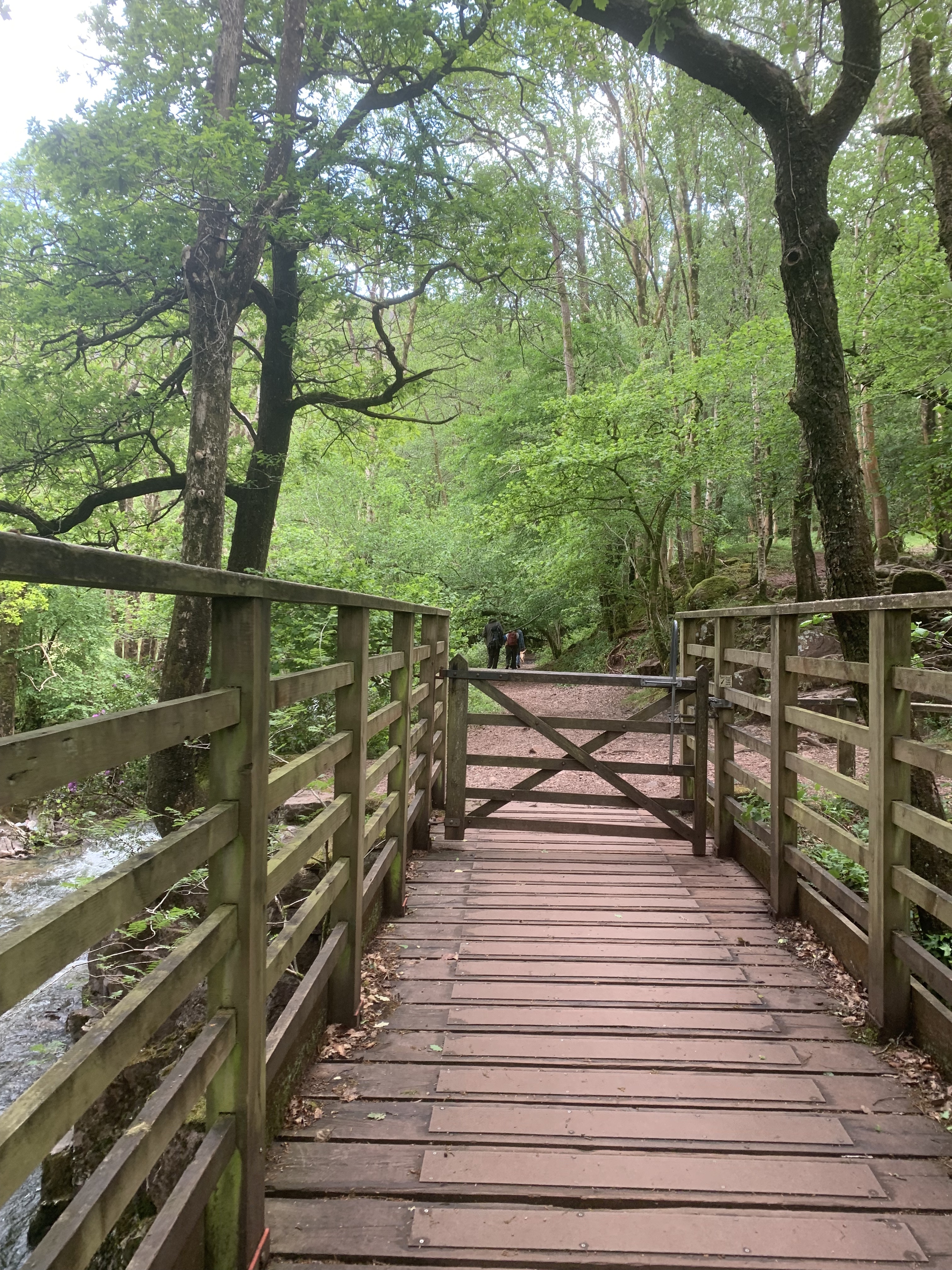
After continuing along the path through the woodland, cross a footbridge and then pass through the gate. Head through and continue across to the next gate. Once you’ve passed through here, you should reach a crossroads the path. It is signposted to turn left to Stanley Ghyll. I quite liked the metal footpath signs here, a modern take on the old wooden classic, but they were difficult to read. I’m sure they last longer but newer doesn’t always mean better.

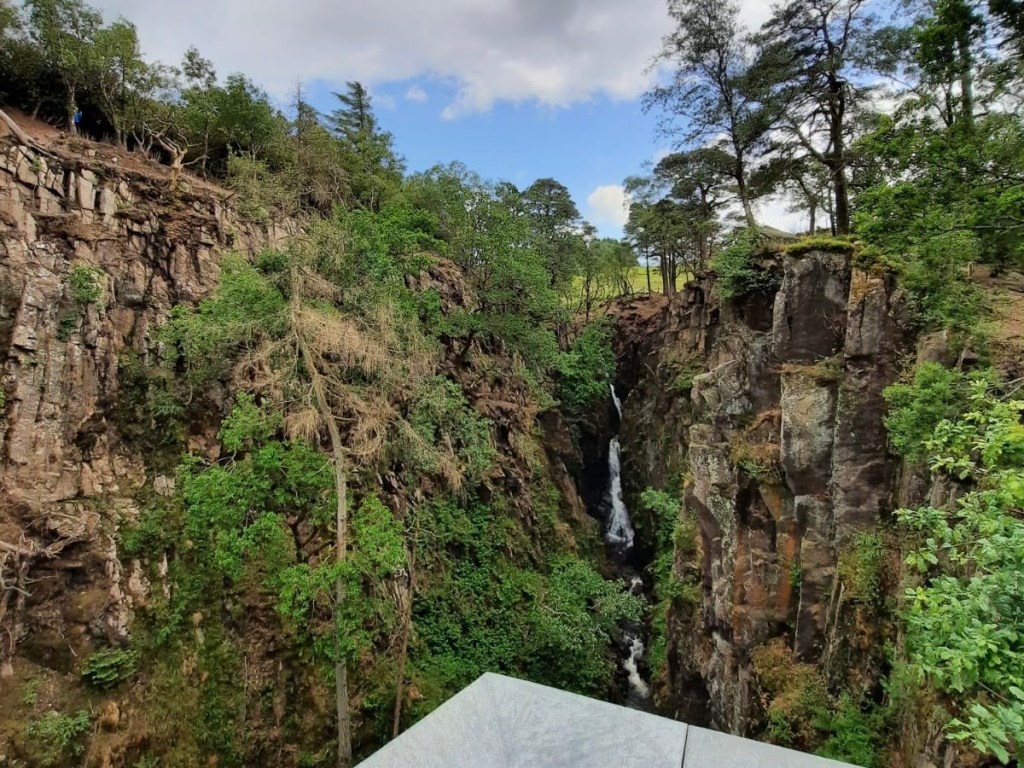
From here, you follow the path alongside the river, crossing back and forth every now and again until you reach the path up the side of the valley to head to the waterfall viewpoint. On this occasion, and I can’t comment on how long this will be for, the lower path to the bottom of the waterfall is actually closed for safety reasons. You have no choice but to head up the side towards the viewpoint. This is a steep climb but there are steps in place to help you out. It’s also over fairly quickly too!
The viewpoint for the waterfall is very cool! A platform jutting over the 150m drop to the waterfalls below, gives you an amazing perspective..They have built a platform to allow you to go slightly beyond where the ground ends so that you can get a good look at the falls. It’s one for those with a head for heights! The metal flooring using for the viewpoint has holes in which is a little disconcerting but, you do get a sense of just how steep the drop is which is pretty cool.

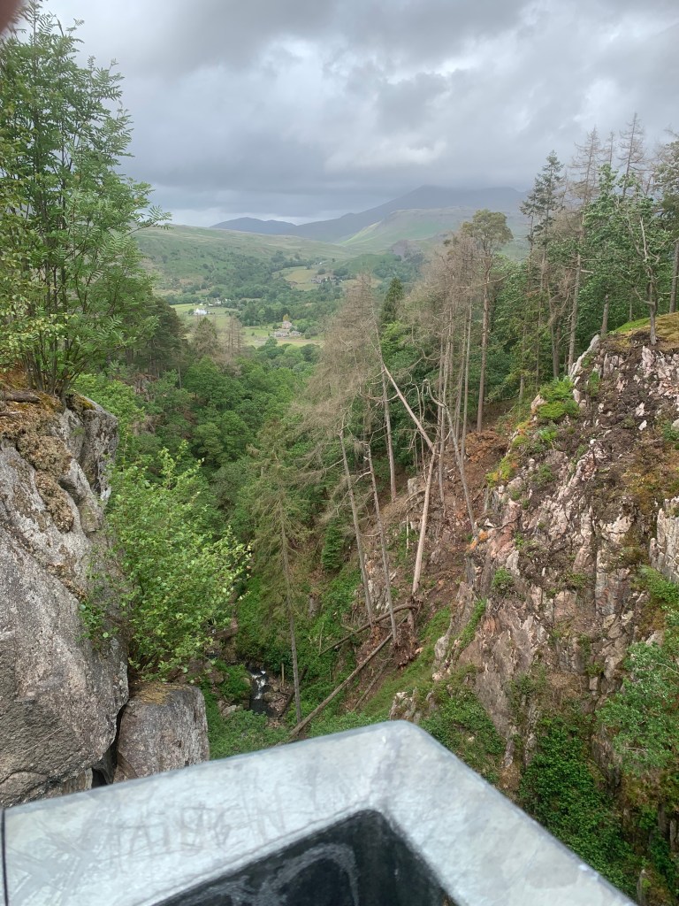
After spending some time at the top, its an easy walk through open land from the waterfall so you don’t need to go back down the same way you came up. That was a concern for one of our party who was more unsteady on their feet but there is nothing to worry about with this path down. This is a major path that is gravel underfoot. It heads across the open moorland, through a gate and back into the woods.

Soon, you’ll recognise that you’re back at the crossroads from the start. Instead of turning right to go back along the river, you want to head straight across and down the lane. The lane crosses over the bridge and then continues back down to the main road. Then, all that’s left to do is a short walk down the road back to the train station.
It’s as simple as that for a lovely waterfall walk. Here is a link to the map take on the walk yourself or follow the step by step below.
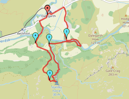
Start point: Dalegarth train station
- Exit the train station and head down the road to the left.
- Take the next lane on the right, signposted Catherine’s Church
- Follow the lane alongside the fields and towards the houses. Continue to follow the lane as it bends around to the right and then to the left towards the church.
- At the end of the lane, when the path meets the river, either cross the stepping stones or head to the left alongside the river.
- If following the path alongside the river, continue on, through gate. Follow the river and cross the bridge. Once across the bridge, turn right to follow back along the river. Soon, you’ll reach the opposite side of the river to the church and the stepping stones.
- Continue straight moving slightly away from the river bank. Cross the footbridge and pass through the gate.
- Cross this field to the next gate.
- Once you’ve passed through the gate, turn left and continue until you see a gate on the right. Head through this gate and then follow the path to the right alongside the beck.
- Follow this woodland path alongside the beck for just under 1km, crossing the river when necessary.
- The lower waterfall path is currently closed so follow the stairs up the side of the valley to the viewpoint.
- At the viewpoint, take the path straight ahead as you leave the platform. Follow this path as it opens out onto moorland.
- Continue as the path bends to the right, heading downhill.
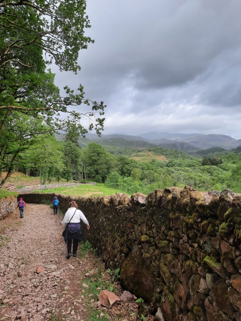
- Pass through the gate. At this point there should be drystone walls either side of the path.
- Soon you will recognise the crossroads from earlier in the walk. Instead of turning right to head back along the river, continue straight.
- Follow the lane as it wiggles its way back to the main road. You should cross over the river using a stone bridge.
- Once you’ve reached the main road. Turn right to head back to the railway station.
End point: Dalegarth Railway Station
This was a lovely little short walk and I highly recommend visiting this waterfall. It seems slightly less busy than other popular waterfall walks in the Lakes as we visited on a Bank Holiday, albeit a wet one and, whilst there were people on the same walk, there was plenty of space in the car park.
Have you visited this waterfall?
Amie x


Leave a comment