Missed out on day one and day two? Don’t forget to read those posts before this one to get the full picture of this three day hike from Glenfinnan to Inverie on the Knoydart Peninsula.
Day three started slightly differently to day two as we woke up in Sourlies bothy. I say woke up but this was probably one of the worst nights sleep of my life, purely because Alex and I were sharing one blank of wood to sleep on that was smaller than a single bed. The bothy was certainly at full occupancy. That also meant that people were talking late into the night and some people woke up extra early to get a head-start on their walk. One couple were aiming to make it to Inverie by 1pm as they had lunch reservations at the pub which I thought would have been quite the feat. Naturally, we were the second to last people to leave the bothy that morning after we packed away all of our belongings and had a breakfast of porridge.
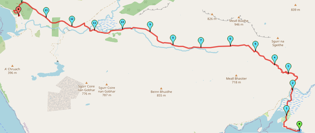
Difficulty: Medium (3/5)
Distance: 14.7km (of 45km)
Elevation: +632m
OS Map: Explorer 398
Notable Features: Loch Nevis, Sourlies, Inverie, Druim Bothy, Old Forge Pub, Knoydart Foundation Bunkhouse
Look Out For: Red Deer, Highland Cattle, Golden Eagle, Porpoises/Dolphins (on the ferry home!!)
One thing I haven’t really touched on so far in these posts is the fact that I my face was eaten alive by midges during the night on both night one and night two. The lack of sleep on this second night already made my eyes quite puffy which, coupled with the red bites dotted underneath my eye made for quite a sight. I felt and looked like I’d been punched in the face. My thinking was that I couldn’t exactly spray insect repellent on my face so I didn’t do it. To be honest, the spray we had was doing absolutely nothing to deter them anyway. It was just amusing that, even though there were about 8 other people to choose from in the bothy, including Alex’s face which was mere inches away and they still went for me. I just must have that smell that they like haha! They had a real feast around the back of my shoulders, travelled up my neck and then along my top lip before heading up to both eyes and along my forehead. I was quite the sight. I’m not sure I’m brave enough to include a photograph but, just know it was not ideal.
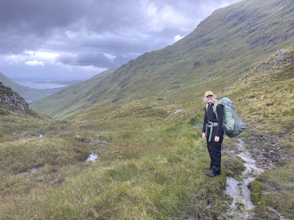
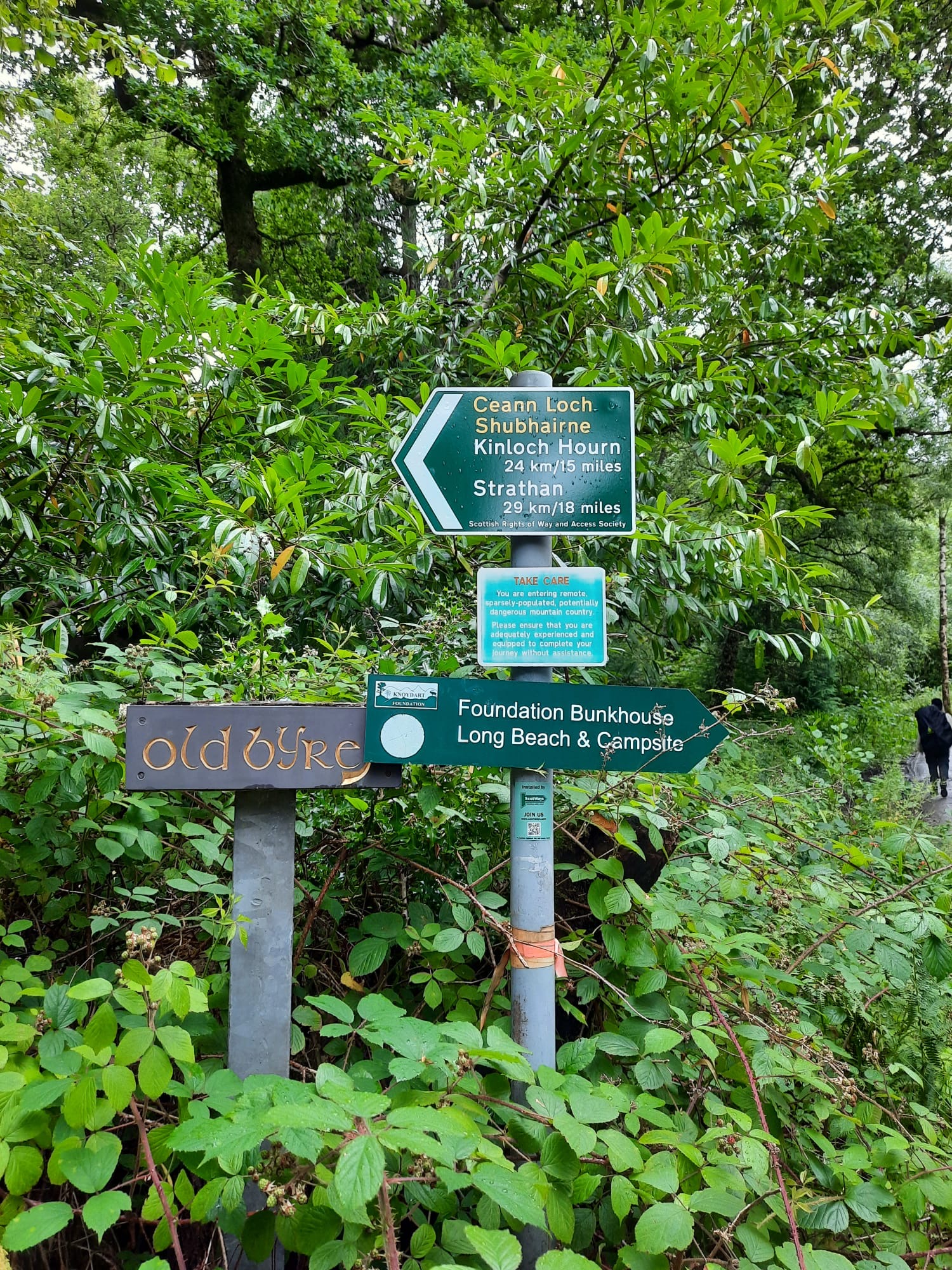
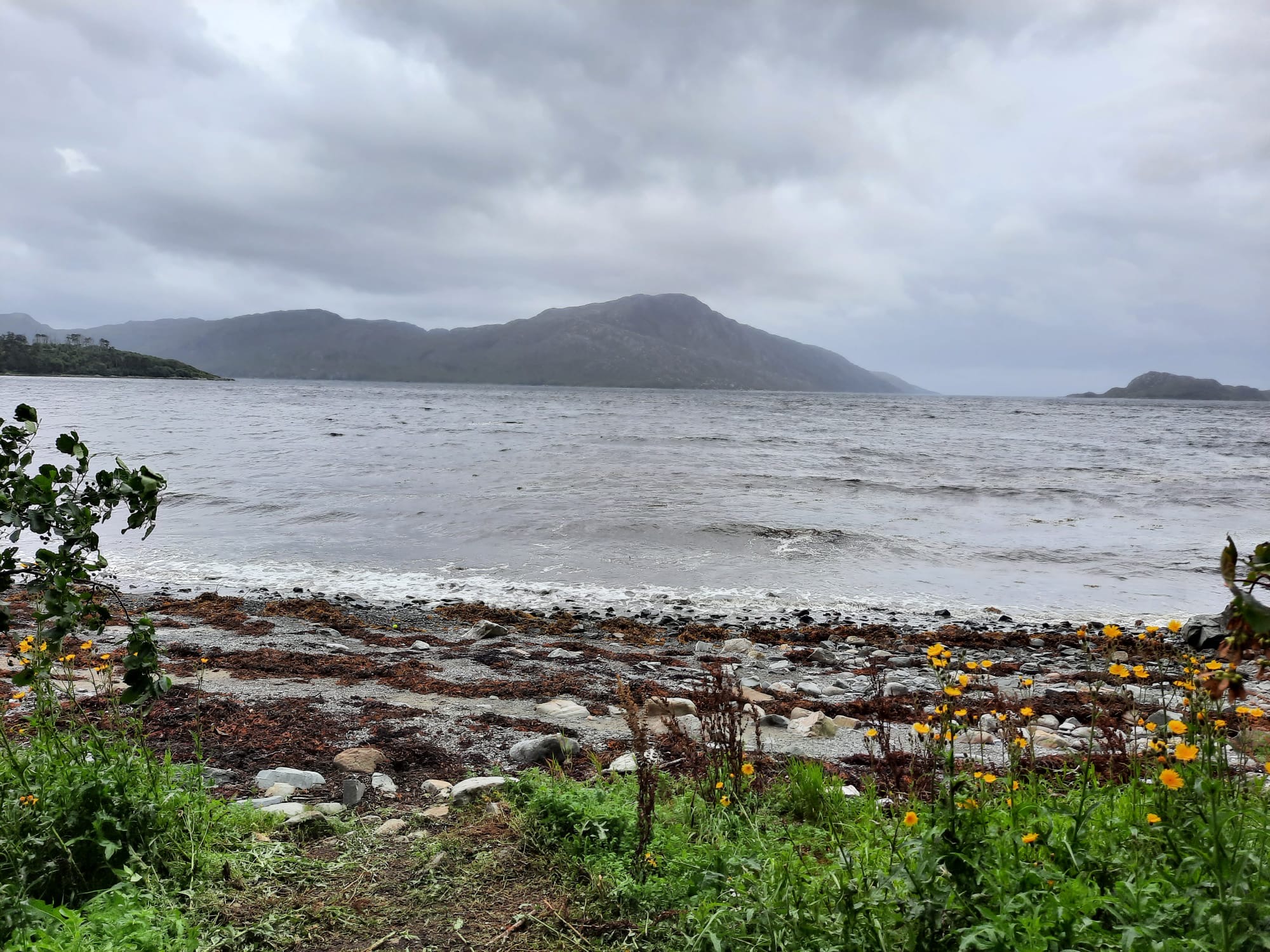
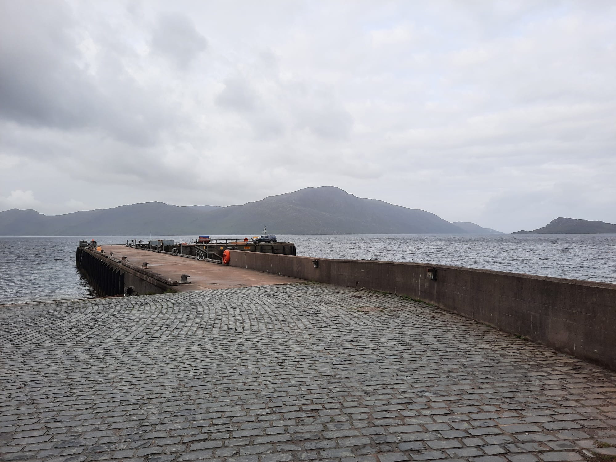
So, we started day three with the knowledge that it had been another night of quite heavy rain and, given the boggy conditions of some areas of the first and second days of the walk, it was same to assume that we were in for the same thing. Adorned with waterproofs, we set off from Sourlies bothy, bidding goodbye to the two men who were heading back towards Glendessary that day. Boy, was that assumption more than correct. The path takes you along the loch and then back inland along what is basically a bit of an estuary. This is where a river meets the sea, or in this case a loch, and the flat surrounding land was incredibly boggy. I’ve plotted the route on mappedometer as it is supposed to be however, in reality, we had to stray from the path in order to make it across to the bridge without getting too wet. We kept to the right hand side of the estuary and then cut across when we could see the bridge and we were almost across from it. In the end, it was a little bit pointless as our feet were wet by the end of it anyway (even with leather boots!).
However, even when we got to the bridge, we were in for another challenge. The girl that we had met on day one was sat on the bridge waiting for us to arrive as the next river crossing, which you are supposed to ford, was absolutely gushing with torrents of water and would have been too dangerous to cross. She had waited for us so that we could figure out a way of crossing together. In the end we had to go further down river in order to find a place that was suitable to jump. Getting to this crossing point was difficult as the ground was either tufts of grass or just extensions of the river. I fell over at one point and my boot was completely submerged in water which wasn’t ideal. In the end, I had to throw myself across the river for the boys to catch me on the other side to make sure that I could jump the distance. We threw our bags across first to make it a little easier too. The girl we were with decided to walk through in her shoes and trousers not rolled up which was a choice and one that I would not necessarily recommend.
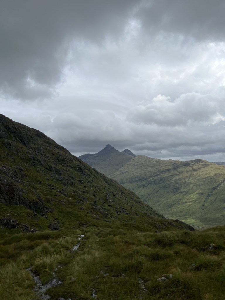
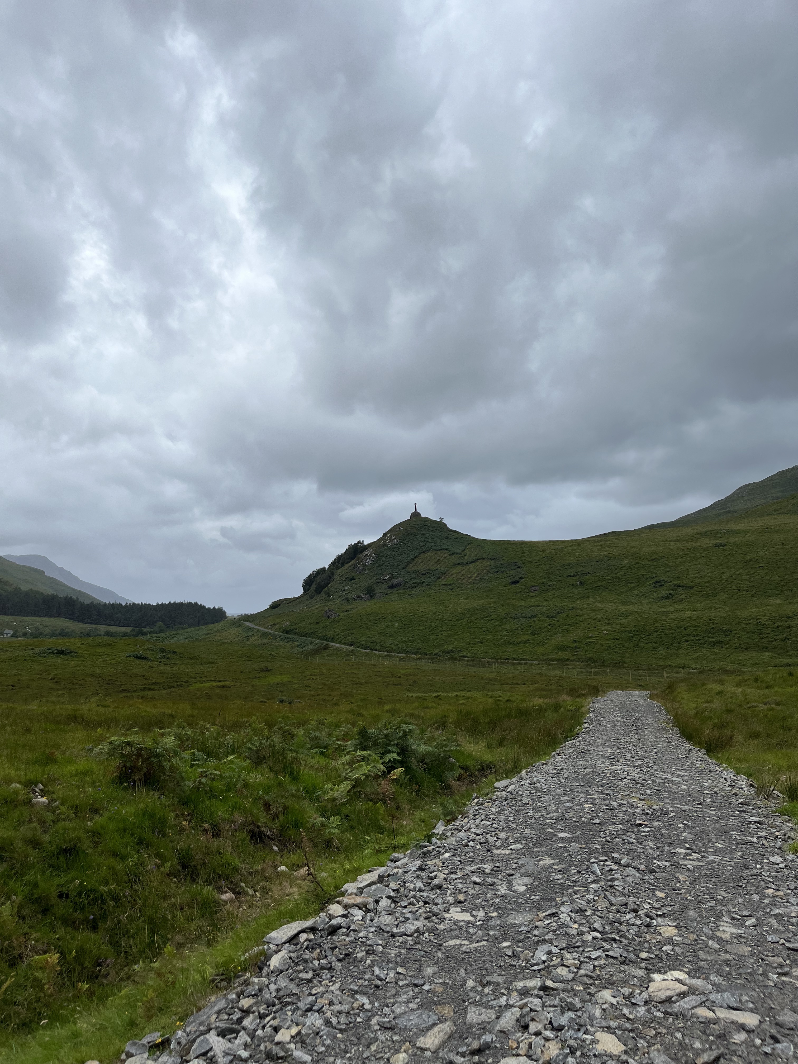
After the somewhat perilous river crossing, we then rejoined the path and began the climb. Each day of this walk has one climb and, although the height is not great, it is made tougher carrying the weight. I didn’t find it as difficult as I was expecting in the end actually but that was because we split it into manageable chunks. We walked a few hundred metres and then paused for some water and a quick stop to get our breathe back before pushing on. I think that is a much more manageable way for me to tackle situations like this and whilst it may not seem like rocket science, usually I push myself to keep up with the boys because I know that they don’t need to stop as much as me. It’s nothing to be ashamed of and I think we actually get up there quicker if we take it easier and have breaks as it saves me from as big of a mental struggle.
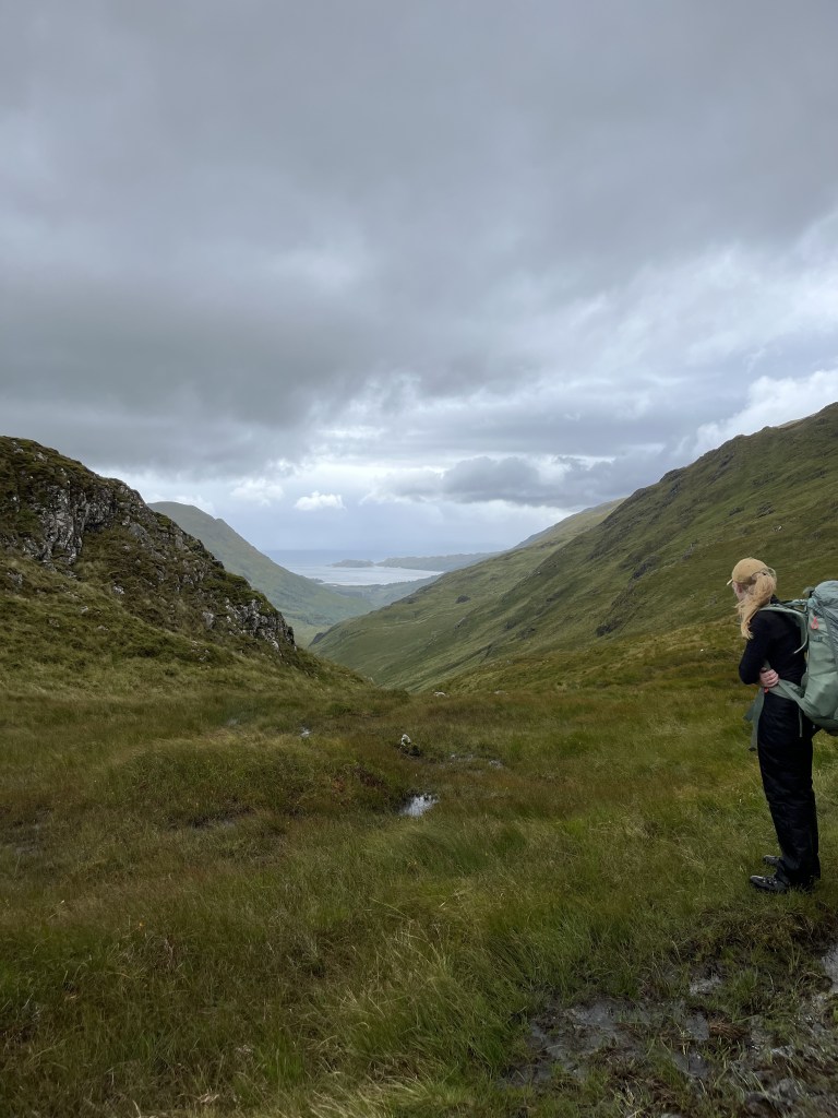
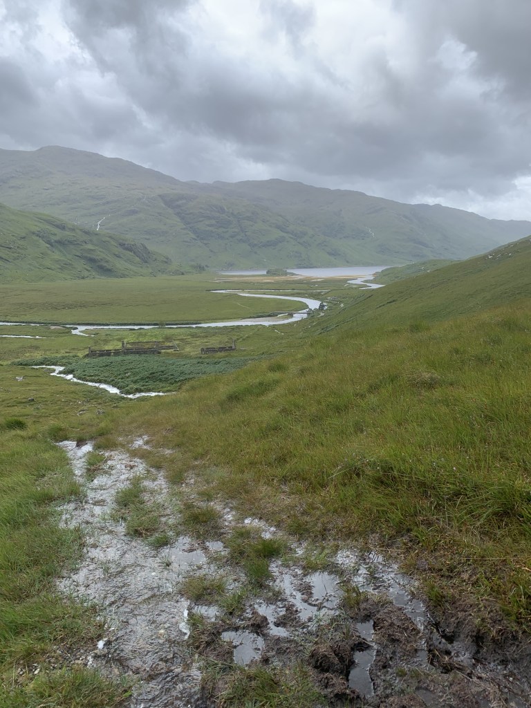
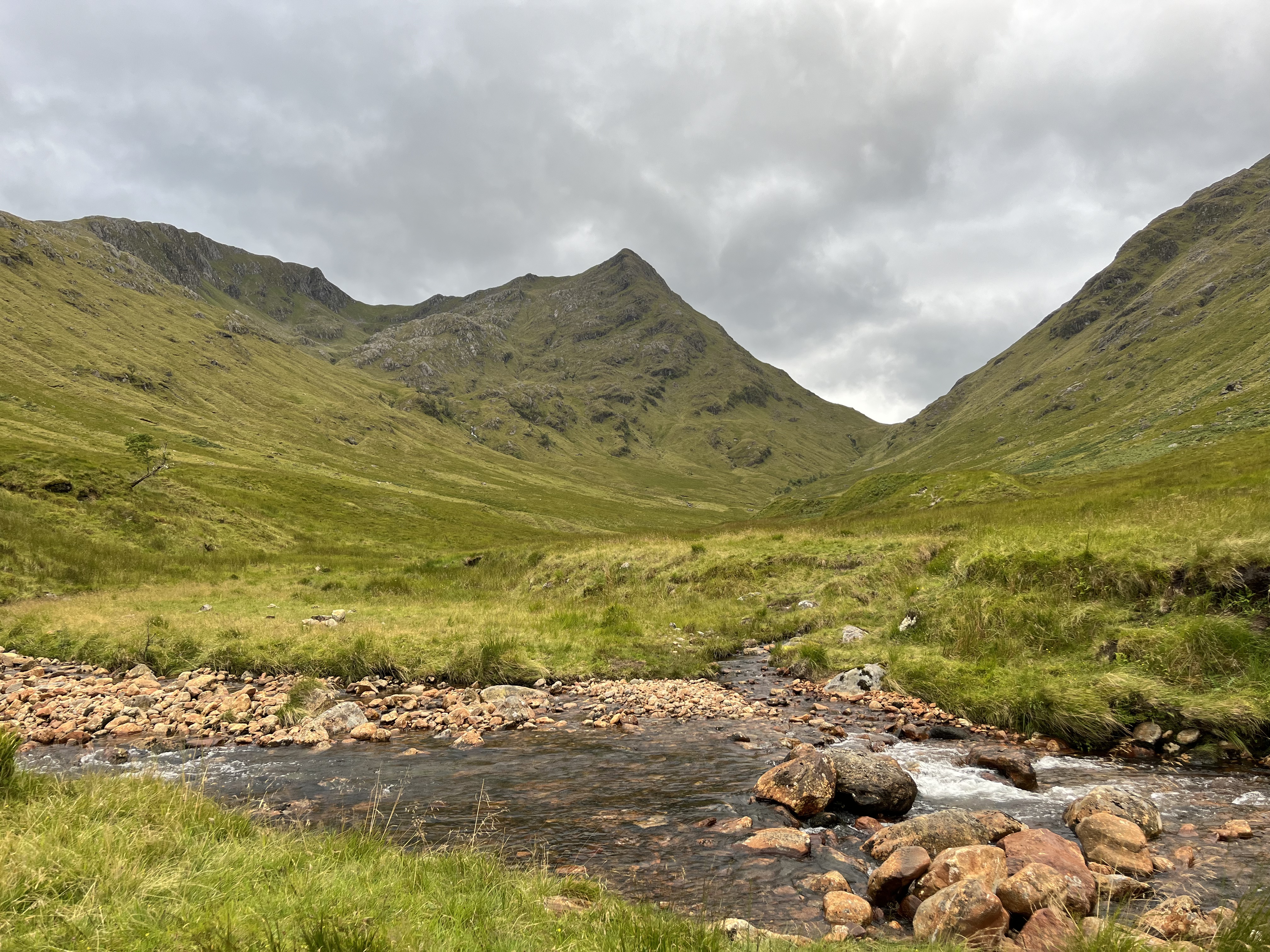
Then, it was a case of walking back down the valley on the other side which was relatively straight-forward. There were a couple of waterfall crossings that were a little more difficult than usual because of the heavy rainfall but we managed to navigate them all with relative ease. We also made the decision at this point to have a snack rather than stop for lunch and just to keep on plowing on to Inverie, our final destination as the weather didn’t look great and we felt like we were on the last stretch. We were only about half way there at this point in reality.
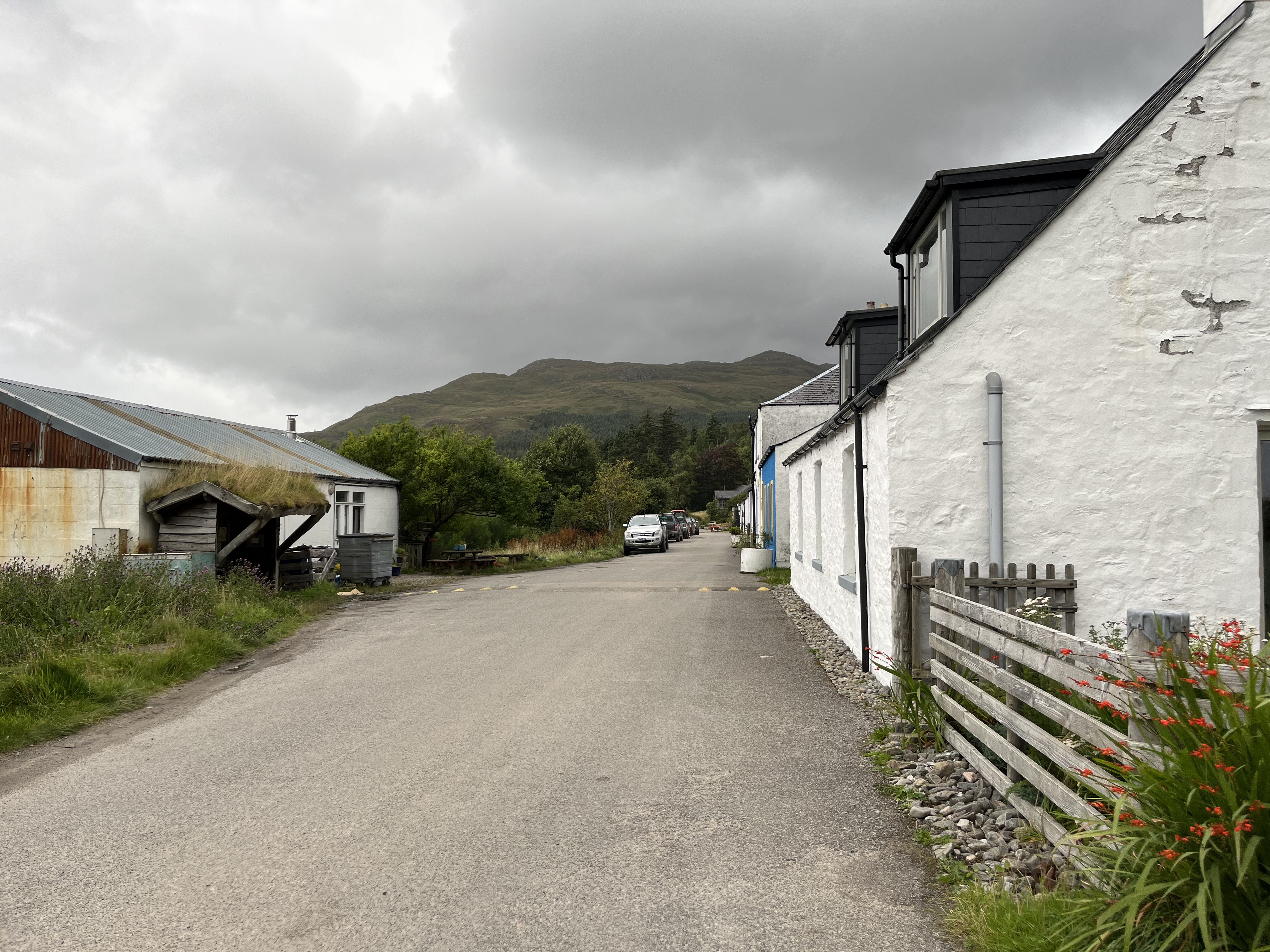
Once we reached the valley floor, we crossed a bridge and then joined a track which headed past a private bothy. Apparently, there are usually highland cows in this area but sadly, we didn’t see any when we were there. I’ve not actually seen highland cattle in Scotland yet which is a shame. It was then, track walking until the end. At this point, my feet were aching and the gravel tracks weren’t making that any easier but, we kept plowing on and soon headed through the fence that marked the Inverie area.
We headed straight to Knoydart Foundation Bunkhouse where we went to see if they had any beds left for us. This is basically a hostel with shared bedrooms, a kitchen and shared bathroom facilities. We were originally planning on camping but, with it being £25 per person and how dead tired we were, it felt like the right decision. Luckily, they had space available and we had a much-needed shower and changed. Now, it was time for the main event of the three days…..dinner at Britain’s remotest pub.
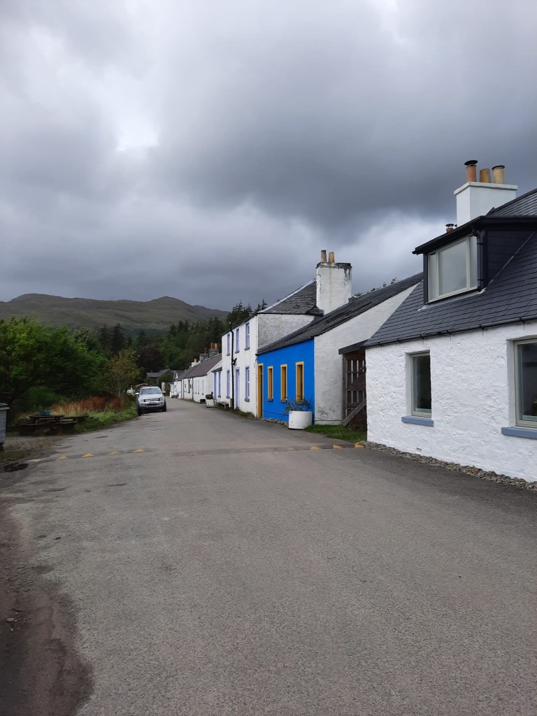
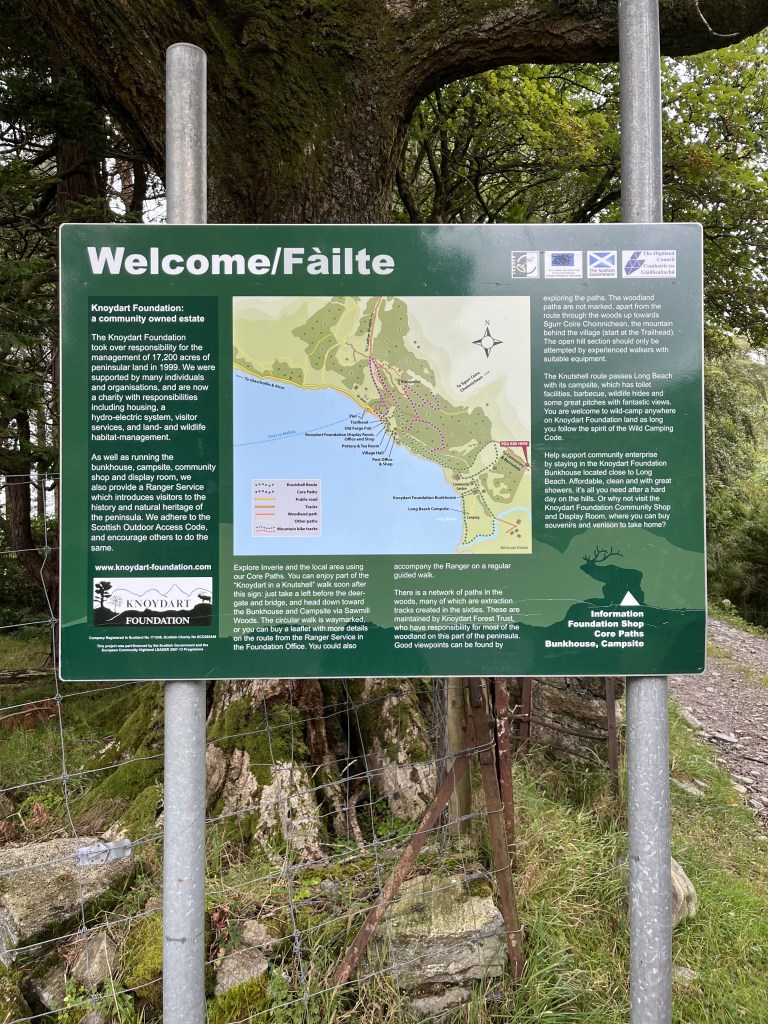
The Old Forge Pub is in Inverie and is considered to the remotest pub in Britain as this area of the mainland is essentially inaccessible by car (unless you have a 4X4) and the main way in and out is by passenger ferry to Mallaig. Interestingly, most of the businesses and land in this area is community owned which makes it incredibly unique. The pub was put up for sale in 2021 and a community buyout was proposed. Essentially, there are 90 shareholders in the pub which equates to around 75% of the Knoydart population. That is pretty incredible and I can confirm that it was an incredibly meal. I had the Cullen Skink for starter which is essentially like a fish soup/broth and a burger for the main and both were delicious. We had a couple of drinks and then headed back to the foundation.
I’m pretty sure I was asleep as soon as my head hit the pillow….
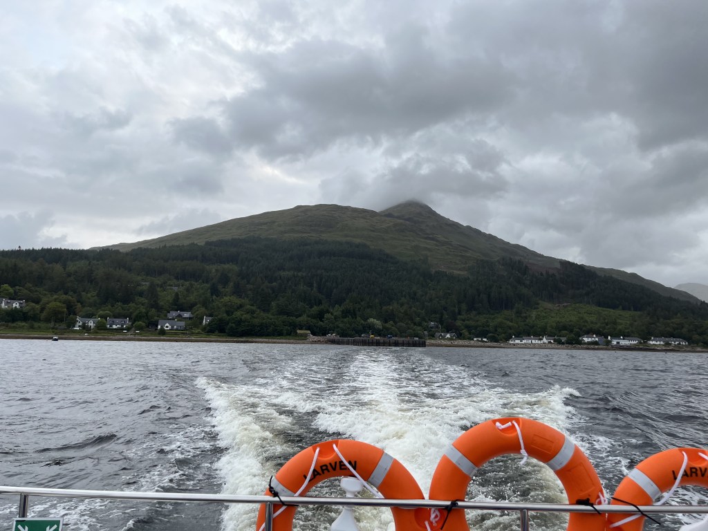
A fantastic weekend that ended in a fantastic location! All that was left to do the next day was board the ferry (prebooked) and get the train from Mallaig back to Glasgow. The journey home took a while but it was so so worth it. I highly recommend this hike. Take a look at the route for yourself here and follow the step by step below!
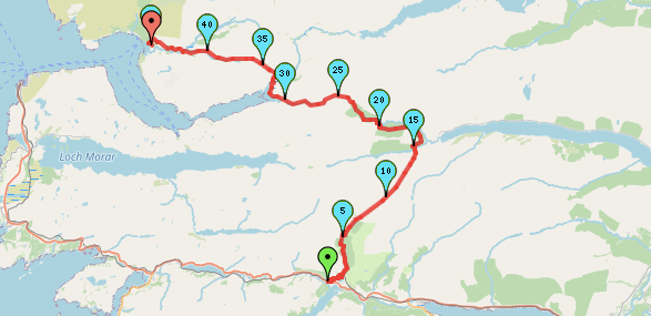
Start Point: Sourlies Bothy
- Exit the bothy and turn right to head along the banks of the loch.
- Keep to the left and make your way back inland across the bog. You goal is a bridge on the left hand side of the ‘estuary’.
- Head across the bridge and then turn right.
- Take a look at the abandoned structures before crossing the river and heading left to begin the climb.
- Wind your way up, following the path to the top of Mam Meadail.
- Head back down the other side of the valley, following the path. You should be heading along the right hand side along the valley wall.
- Keep crossing the waterfalls, following the bath down to the bottom of the valley.
- Follow the path to the bridge on the left hadn’t side over the river. Cross the bridge.
- Follow the path to the right as it heads through a tree covered area.
- Continue on passed the private bothy. Here the path becomes more of a track.
- Follow the track, turning to the right and crossing a bridge around a kilometre after the bothy.
- At the junction, turn right and continue to follow this track as it winds back up and down.
- Continue following the track as it passes through deer gates. Eventually, you will come to a fence which enters a wooded area with signage welcoming you to Inverie.
- Here continue straight down the road, until it meets junction. Here, turn left to head to the campsite/hostel bunkhouse or turn right to head towards the centre and the Old Forge Pub!
End Point: Inverie
That brings us to the end of this three day adventure from Glenfinnan to Britain’s remotest pub in Inverie, on the Knoydart Peninsula. I hope you’ve enjoyed following me on this adventure. Let me know if you have done/are planning on trying this one for yourself!
Amie x


Leave a comment