Welcome to the second part of my hike from Glenfinnan to the Knoydart peninsula. In the first post, I shared our progress on day one which saw us walk from Glenfinnan train station to the banks of the River Pean where we camped just 15km later. If you’re reading this post without reading that one, things aren’t going to make a whole let of sense so I suggest starting there first.
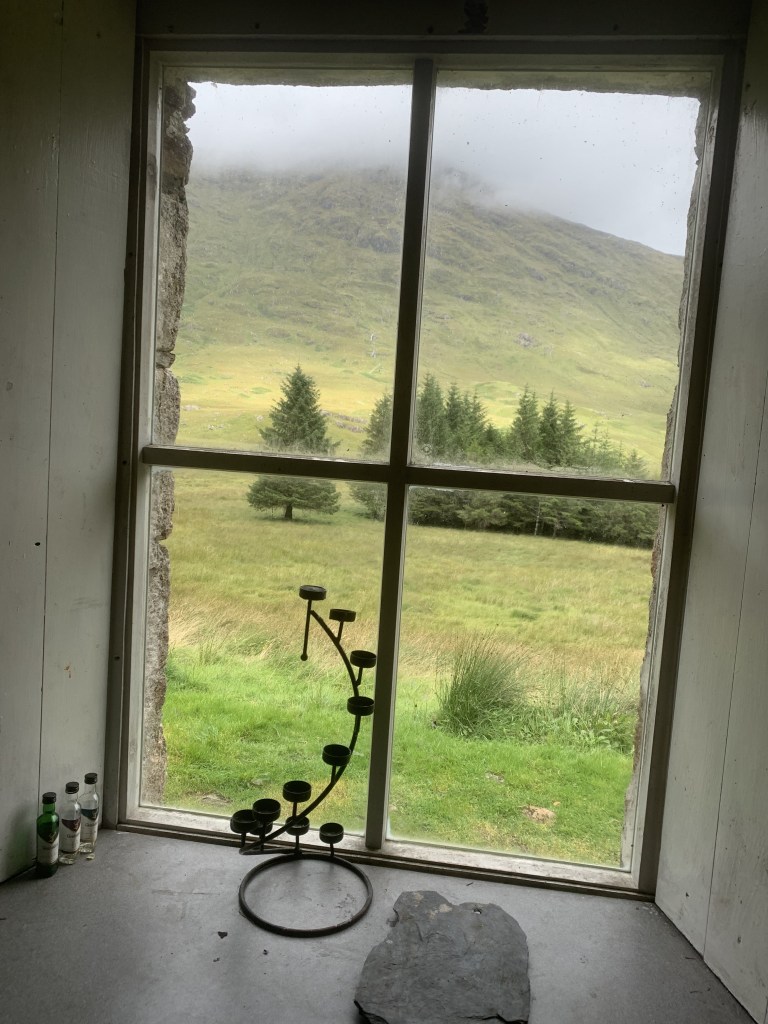
We woke up – well I woke up – bright and early in the tent near the River Pean on the second day of our journey to Knoydart and after much persuading, managed to get the boys up too. We tried to pack the tent away as quickly as possible because the rain hadn’t really let up and we were getting mobbed by midges. Instead of having breakfast in the rain, we decided to walk on to A’Chuil, the bothy that I mentioned as an option to end day one. After around 5km walking through the woodland, we arrived at the bothy to find it completely empty. The path down to the bothy was steep and incredibly muddy – I wouldn’t have wanted to walk that path when it was dark. We had left our camp fairly late so everyone that had stayed in the bothy had moved on. We did a have a look at the visitors log notebook to find that there had been many people in it the night before and, whilst well maintained, this is not the biggest bothy ever in terms of sleeping space. None have been as big as Mosedale Cottage in the Lake District as of yet. It did however have a table and chairs which we took advantage of to have a sit down and heat up our beans for breakfast. Admittedly, it was a rather slow start to the day and we didn’t leave the bothy following “breakfast” until 1pm.
Difficulty: 3/5
Distance: 16km
Elevation: +426m
OS Map: Explorer 398
Notable Features: A’ Chuil, Lochan a’ Mhaim, Loch Nevis, Sourlies bothy
Look out for: Red deer! Wildlife cruises also operate on Loch Nevis from Mallaig.

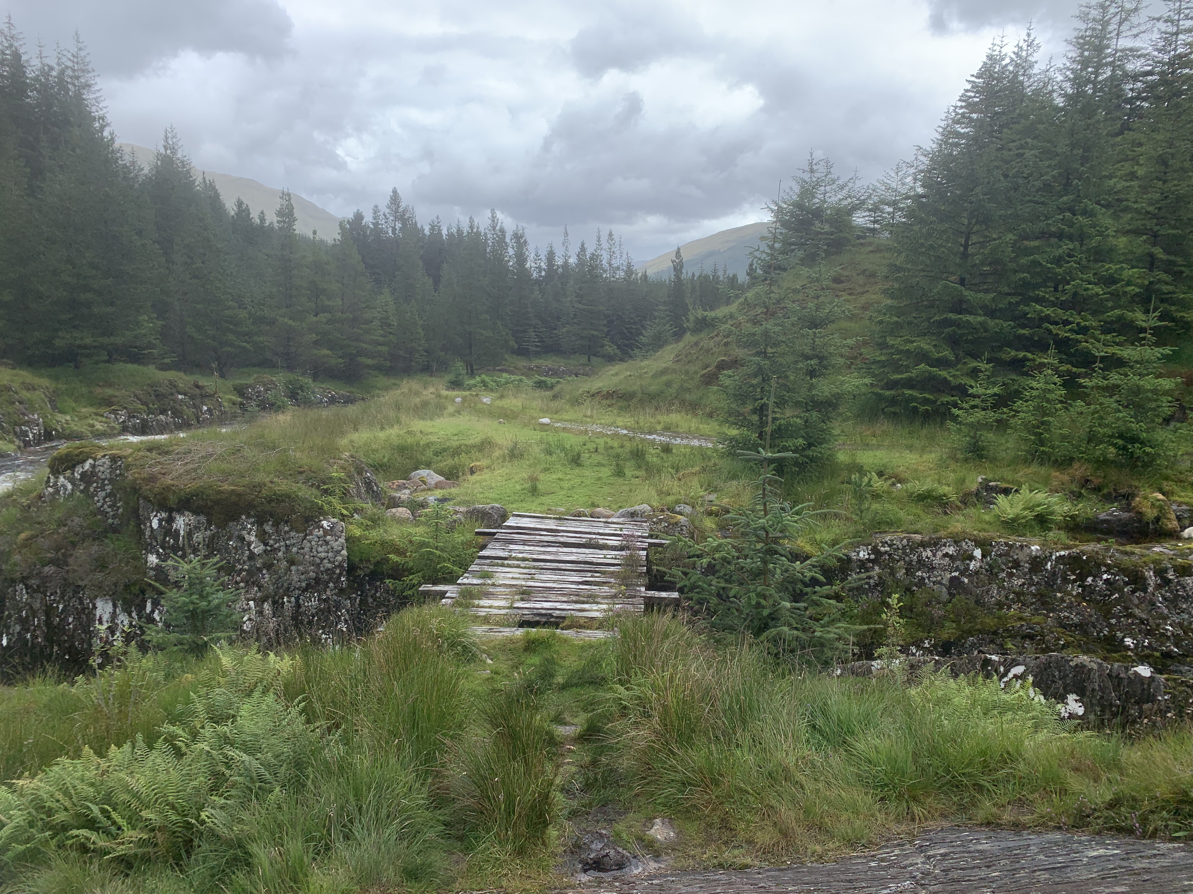
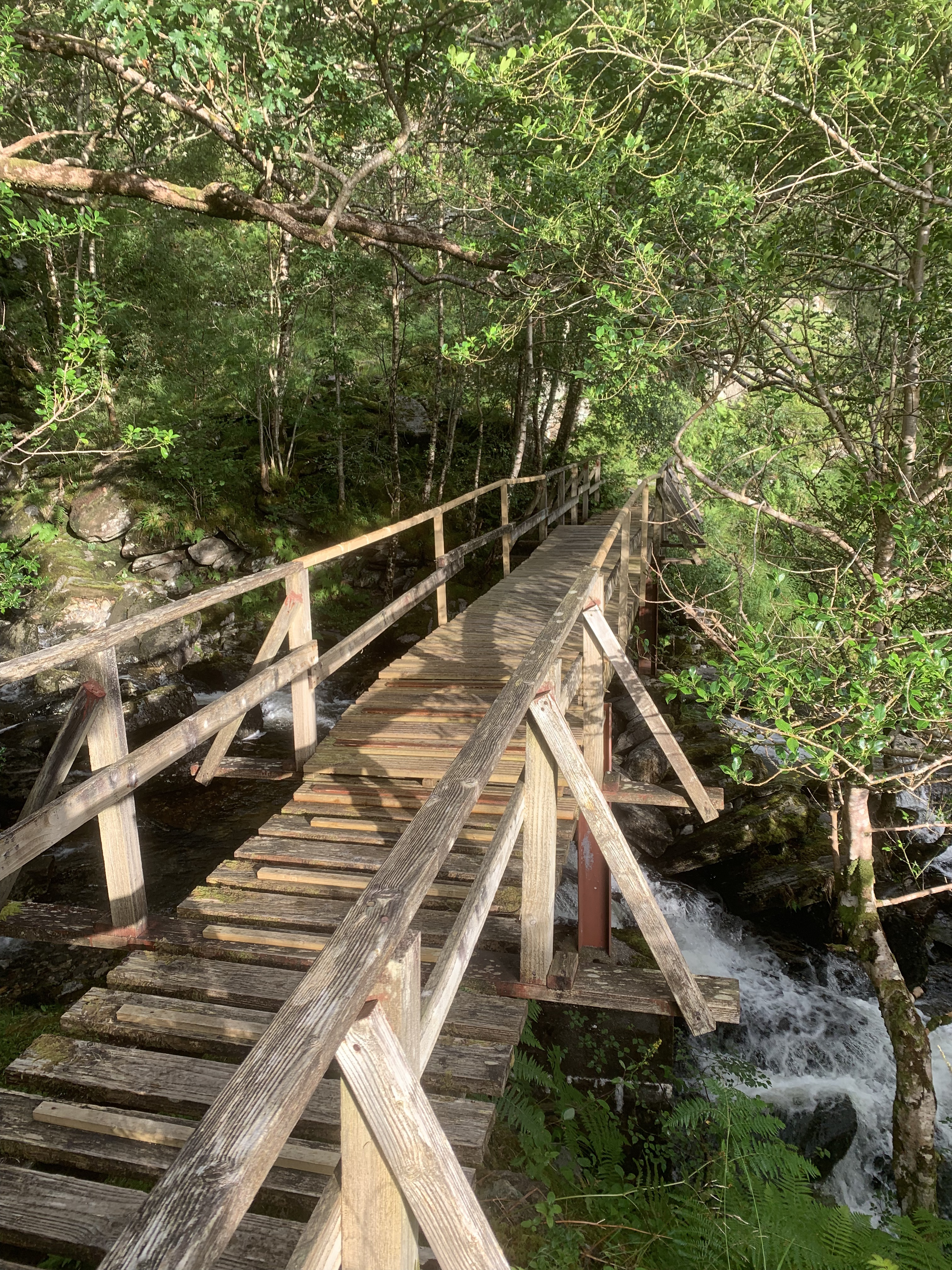
Rather than heading back up to the track via the muddy, steep path down to the bothy, we instead cut across the grassy area to get back on track. Here, we rejoined the track as it made it’s way back into another woodland area. This included crossing one of the sketchiest bridges over a river I have seen. I wasn’t entirely convinced by the structure but we all made it across safely and lived to tell the tale. I discussed in the day 1 post how much of a mental game hiking is and I found this section through the wood to be especially difficult. I was just too stuck in my head and felt as if I would never get to the end of the day. That, coupled with the knowledge that I would have to do it all again the day after, was incredibly difficult for me. This was where things started to get a little out of my comfort zone too as we had to make away across a small river. Usually, you can ford the river easily however, the heavy rainfall meant that that wasn’t an option. Both boys would have easily jumped but, I was feeling less confident so we found a different area that I could use rocks as stepping stones and make a narrower jump across. As I said, I was struggling mentally at this point so, I probably could have jumped it but, my brain just couldn’t tell me feet to do it.
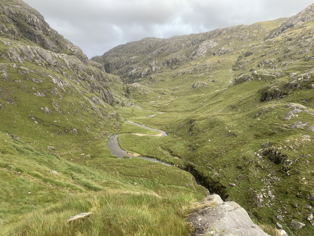
Twenty-three and a half kilometres from Glenfinnan, and ten kilometres into day two, we left the woodland. Here, I managed to push some of those thoughts aside – probably because the terrain was a little flatter – and we made good progress walking along the river banks. We made a small pitstop for some lunch. When we’re on a camping trip like this one, our lunches are usually bagel thins or some other thin bread and tinned tuna mayonnaise with sweetcorn. We find that these are great. The tins are small and lightweight and the bread doubles for breakfast as well (we’d used some with our beans that morning). We also took the opportunity to refill our water bottles here and used water purification tablets, or chlorine tablets, to make sure it was fresh and clean. A lot of people were drinking water straight from the rivers but, the purification tablets gave that extra level of security. Even with the tablets, the water was absolutely gorgeous and tasted better than the bottled water we had bought from Tescos a few days before.
The path also passes a loch which was incredibly beautiful. It was at this point that we were passed by two men who were also heading to the same bothy for the night! This was the second occasion that we met people completing the same route as us and it had a real community feel to it. I imagine that is even stronger on a longer distance route! It was a little demoralising to see them overtake us but, we’ve all got to go at our own pace and, they weren’t carrying as much as we were either.
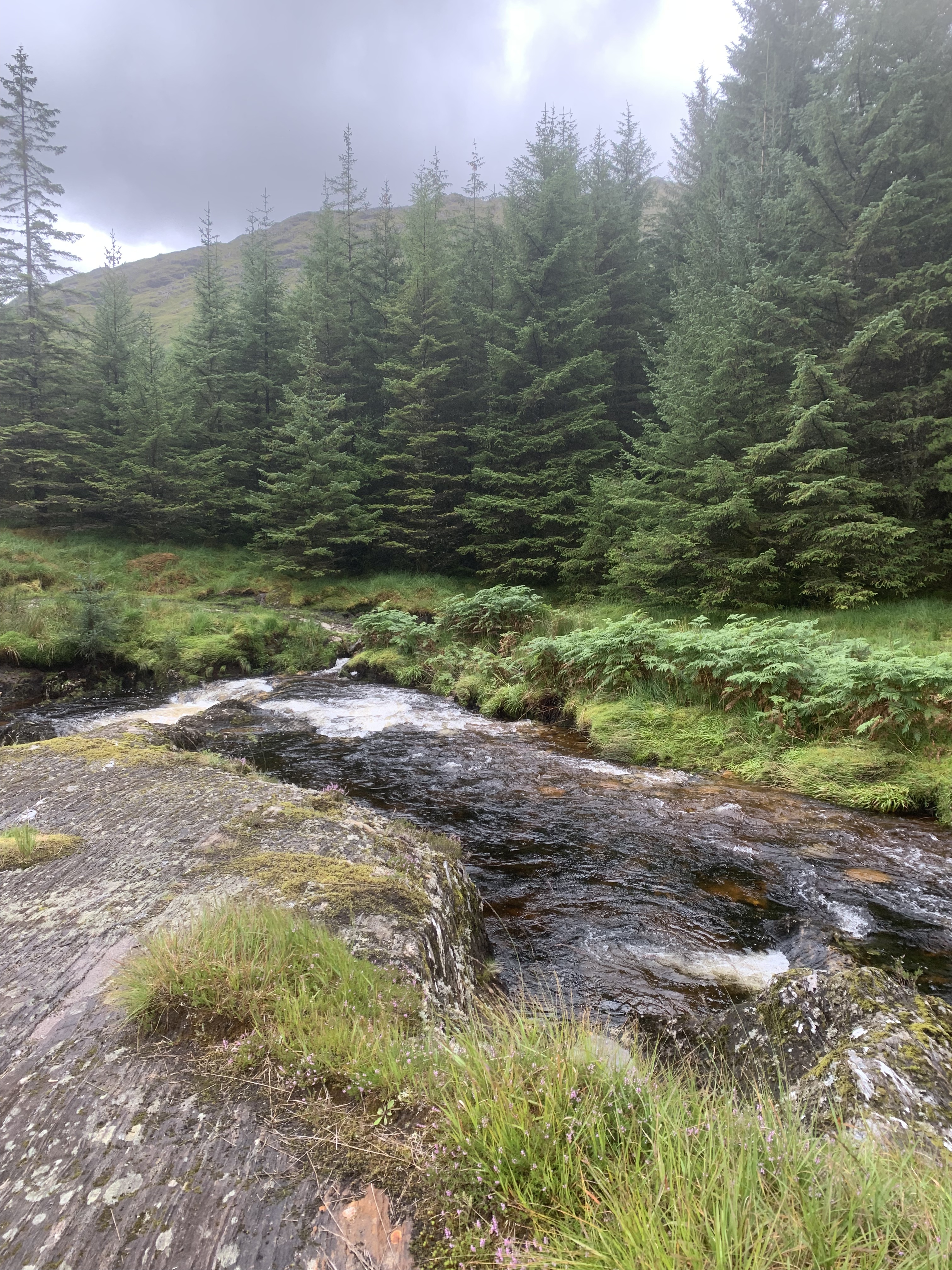
It was after the loch that we encountered our second river. You should also be able to ford this one easily but, not on this occasion. This river was also a hell of a lot wider and much more fast flowing than the previous one. We watched as the two men ahead of us threw their hiking poles across and used a small island in the middle to make the jump across. Ed, one of our group of three, opted to take this route as well however, as with before, I didn’t feel confident that I would make the jump. This time, I think that was more of a realistic conclusion than the fear induced inability to jump earlier on. I just didn’t think I would make it. So, Alex and I went back up the river slightly to try and find a suitable place to cross. In the end, it was a case of taking our boots and socks off and wading through carefully. It is the second time I have had to do something like that and this one was much colder water and felt a little more dangerous. We were sensible though and had picked a point where the river was quite low so, we made it across.
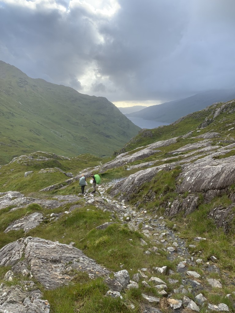
However, as we all crossed the river earlier than the route intends, we had to get around a rocky outcrop that was blocking the path. If I hadn’t been carrying my big rucksack on my back, this would have been a breeze. However, with the additional weight and having just crossed the river in a way that I didn’t entirely feel comfortable with, I panicked. My brain completely saw red and I couldn’t rationally move myself off one of the rocks. It was all incredibly irrational really and I would not have seriously injured myself if I had slipped but, there was no telling myself that in the moment. Both boys were great and got my bag off my back so I could keep moving. It was only once I was down the other side that my brain cleared and I realised just how ridiculous that five minutes was. It is funny how, in the moment, you can see something completely differently to what is actually in front of you. A mental breakdown on a rock wasn’t on my bingo card for this walk but, it happened and we kept on going.
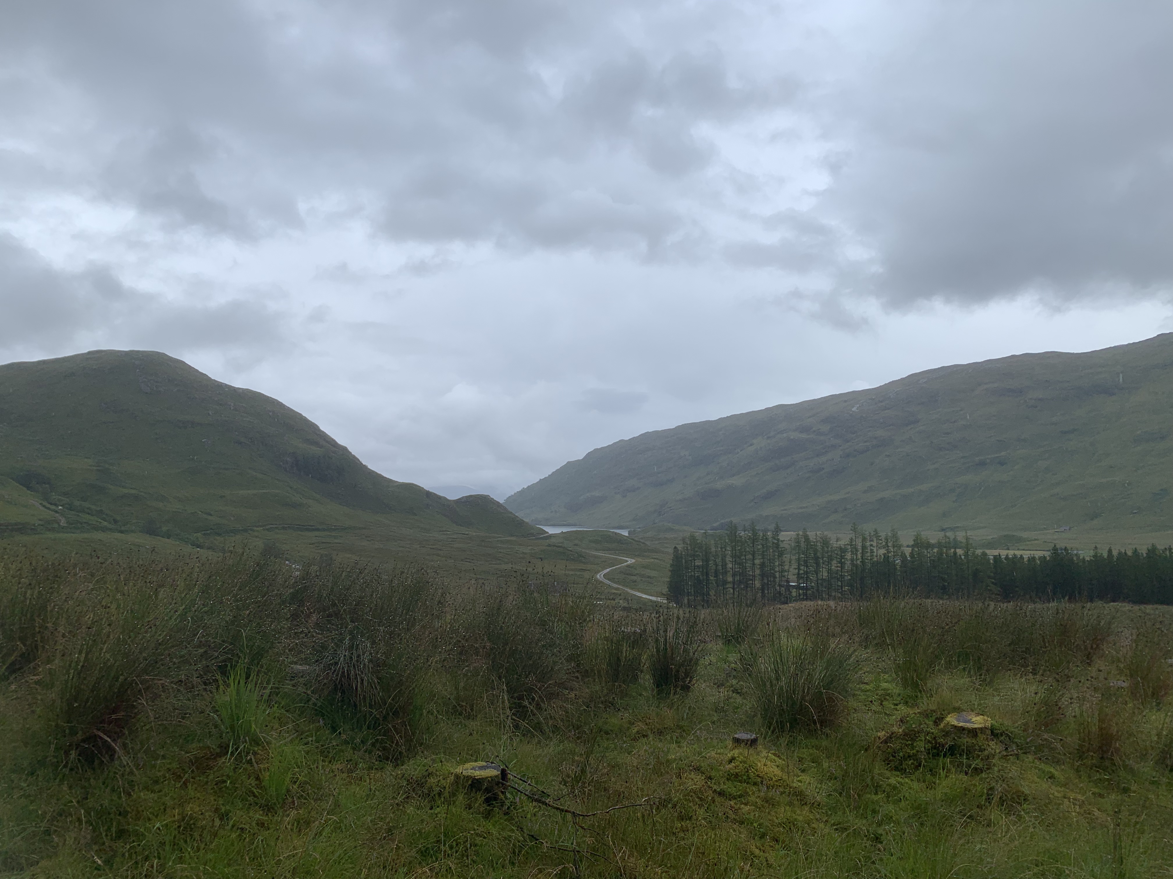
The next section involved another small climb but, this wasn’t too bad and, I think the rock debacle had got some of my fears out of my system. We were rewarded at the top with incredible views down the valley to the loch at the end and the bothy just about in sight. The sun was beginning to set and it really was beautiful! However, the sun was setting and we really needed to get on to get to the bothy after being waylaid by the river crossing. On we went, climbing back downwards. We zig-zagged down the path before crossing over a bridge. In turns out, they do know how to build bridges in Scotland – they just don’t want to make it easy. This bridge was also a lot more stable than the other ones though, it was a bit of an odd one.
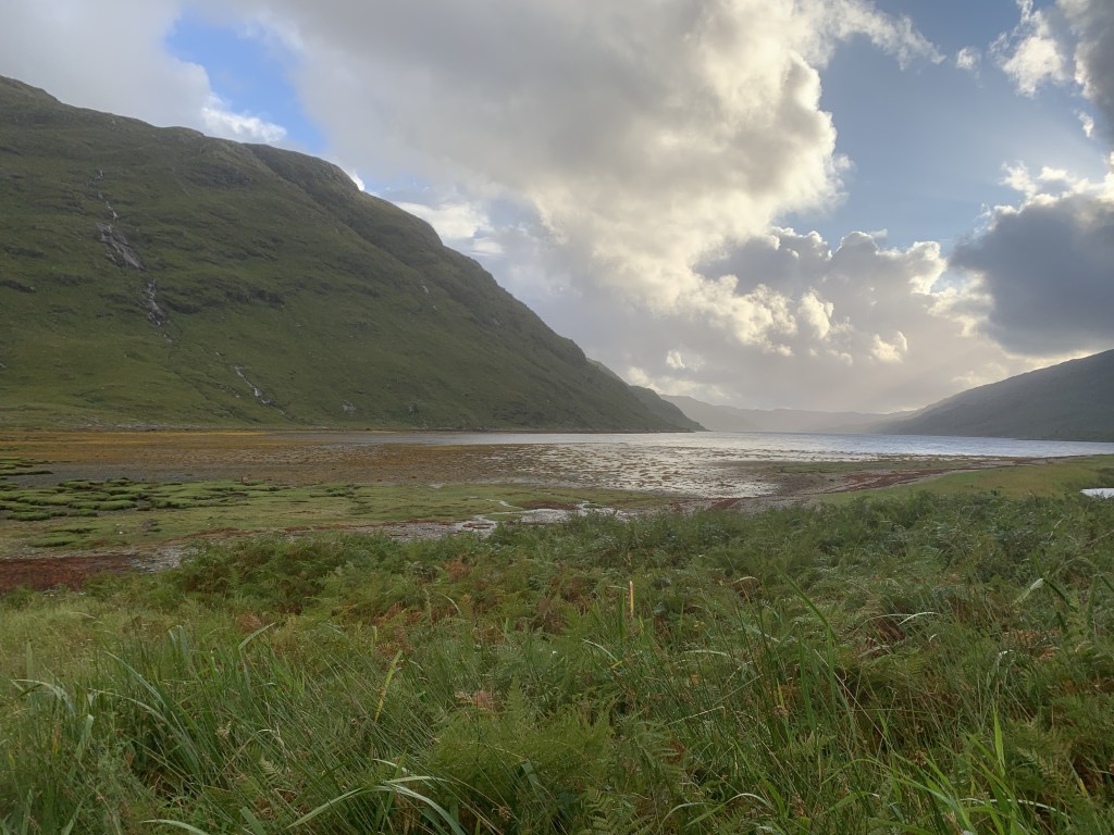
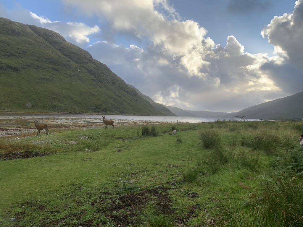
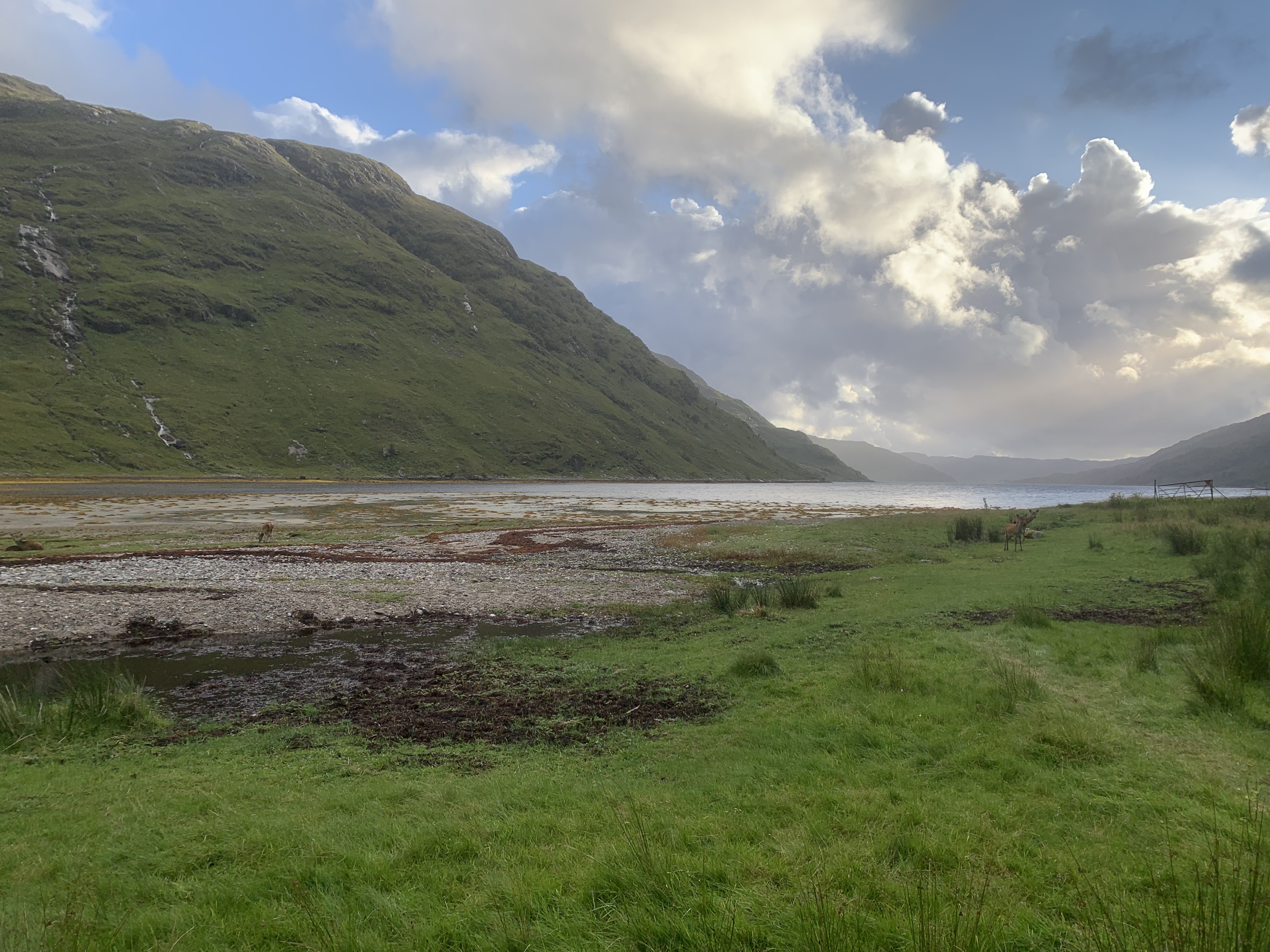
As the ground flattened out we continued on and were rewarded with another tremendous sight. Right outside the bothy and alongside the loch were red deer! We had a game on the train to Glenfinnan where we guessed how many deer we would see on the trip. I’m not even going to say what my guess was as it was embarrassingly low but, all of us were wrong as we saw so many deers across the two days. This one was the best sighting though. I don’t think you can beat this really. The pictures speak for themselves.
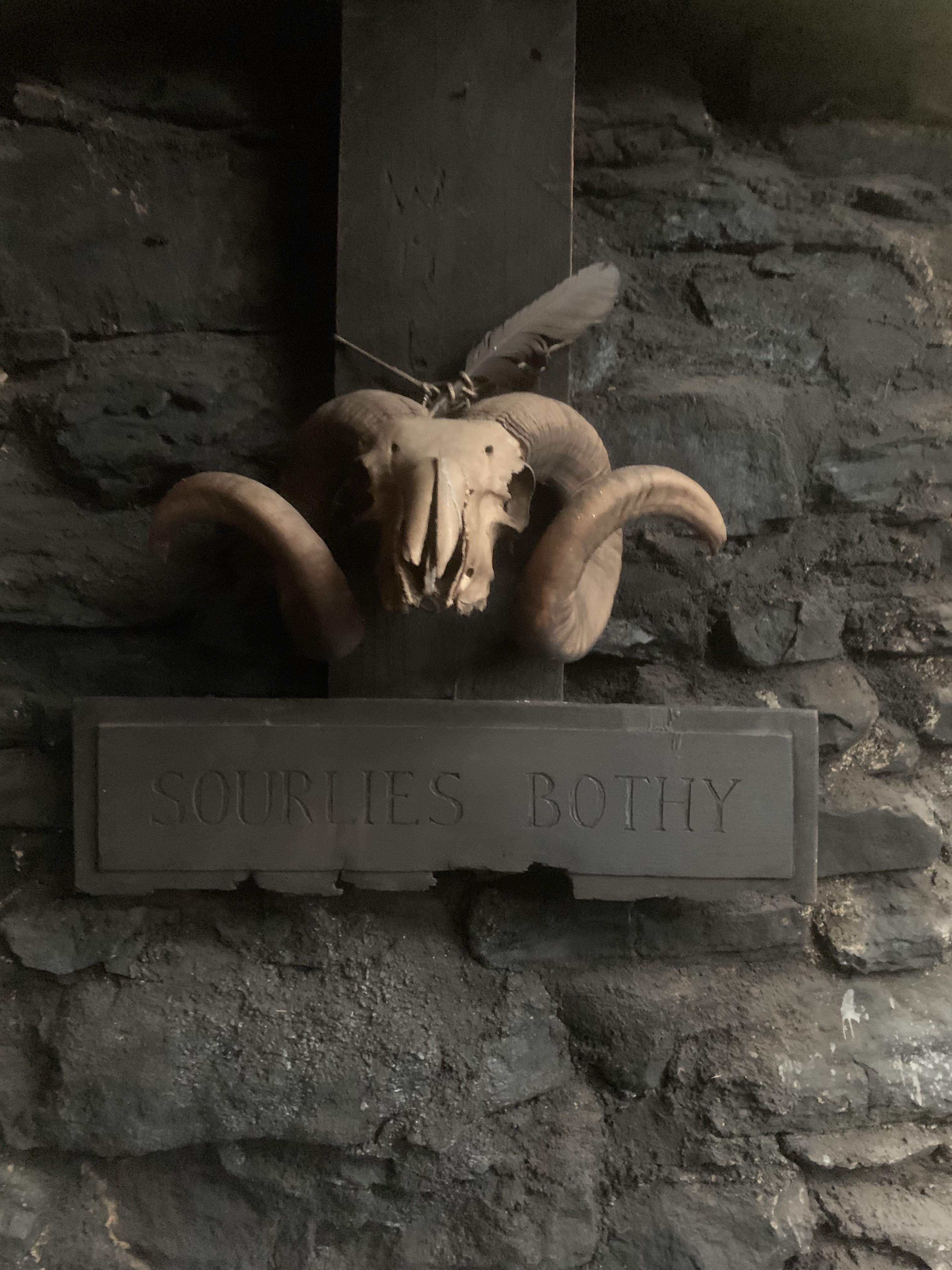
We arrived in the bothy to find that it was already pretty full. There were two ‘beds’ left, one up a ladder that I didn’t fancy rolling off in the middle of the night and another thin one. Me and Alex had to share which was a tight squeeze, let me tell you. The atmosphere in the bothy was great though and it was so nice to hear people share stories about how they tackled different parts of the route so far and where they were off to. All of the group, bar two, were heading onto Knoydart the next day. The two men who had passed us earlier had walked out to the bothy and were returning the same way. They were both Scottish and shared stories of other adventures they’d been on and it was really interesting. We caught up with the girl from day one and met two other couples. Like I said, it was a busy bothy but, made for great conversation.
That brings me to the end of day two when we spent the night at Sourlies bothy. Take a look at day 1 and two on mappedometer here and follow the step by step below.
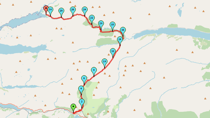
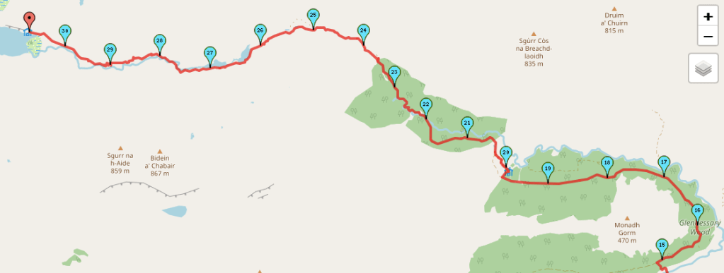
Start Point: Campspot alongside River Pean
- Head across the bridge and follow the path as it bends to the left and then the right, entering the forest area.
- Once the forest path meets a track, turn right and continue on.
- Keep following this track through the forest, avoiding any deviations.
- Eventually, after around 5km you leave the forest. There is a boundary fence on the right. If you follow that path, you will reach A’Chuil bothy. Here, we stopped for breakfast but, you can carry on along the track if you decide not to stop here.
- If you head down to the bothy, cut back across the grass to the track.
- Follow the track as it bends to the left into another forest.
- Continue to follow the path and cross the rickety bridge.
- Once you’ve crossed the bridge, keep left to stay in the forest.
- Soon, you have to ford the river. It as quite deep on this occasion but, possible to jump or to make our way further down river to find a better place to cross.
- Once you’ve exited the forest, follow the path down along the valley bottom. There are multiple path options but, at this point the river should be on your left.
- Continue to follow the path as it passes two small lochs. At this point, you’re on the left hand side of the lochs.
- Shortly, after passing the lochs, find a suitable place to cross the river.
- Continue following the path on the right hand side of the river.
- Soon, the path heads slightly away from the river and climbs a small ascent.
- Follow the path uphill to get an incredible view of the route ahead – the loch and the bothy in the distance.
- Head back down the hillside, following the path as it wiggles back down.
- Cross the bridge over the river.
- Once you reach the flat ground, the bothy should be up ahead on your right.
End Point: Sourlies bothy
Day two was mentally challenging but we were treated to some incredible views! It was such a sense of accomplishment to reach the bothy at the end.
Amie x

Leave a comment