It’s been a little bit radio (blog) silence here on Explore with Amie but, whilst I’ve been away working on my dissertation, I’ve also been doing some pretty great exploring that I can’t wait to share. First, a few weeks ago we managed to redo the walk up Crinkle Crags that we had originally planned to do on my birthday (if you follow me on instagram, you’ll know what happened there). It was well worth redoing the walk and made for a great day out on the fells. It only hits two wainwrights (we should have included Cold Pike too, really) but it is a fantastic route with some challenging elements too.
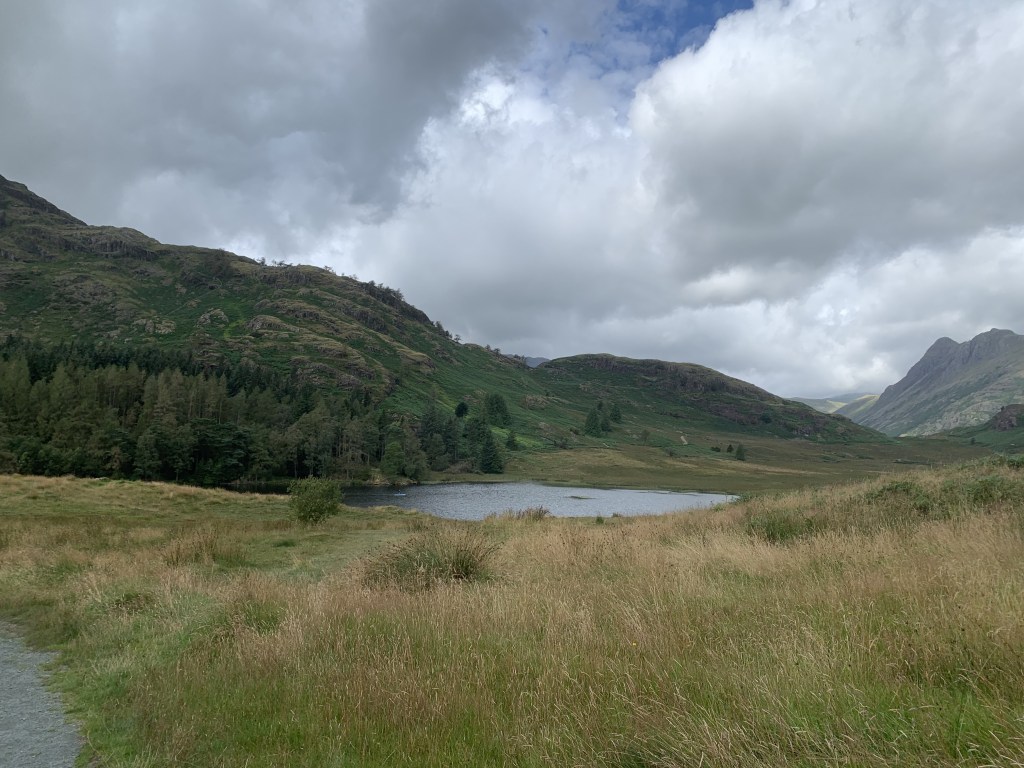
We parked in Blea Tarn car park which seems to be a popular spot for people to camp. This is a no-camping area (as is all of the lakes) but, I don’t see any issue with camping when you’re away from the roads and footpaths and can enjoy being away from people. The campers here, on the other hand, were 200m from the car park and had huge tents that certainly stuck out in the landscape. Not really the wild camping scenario that I think is acceptable. Anyway, enough of a moan. The car park is pay and display, though you can pay later using a code if you have no change or service whilst you’re there.
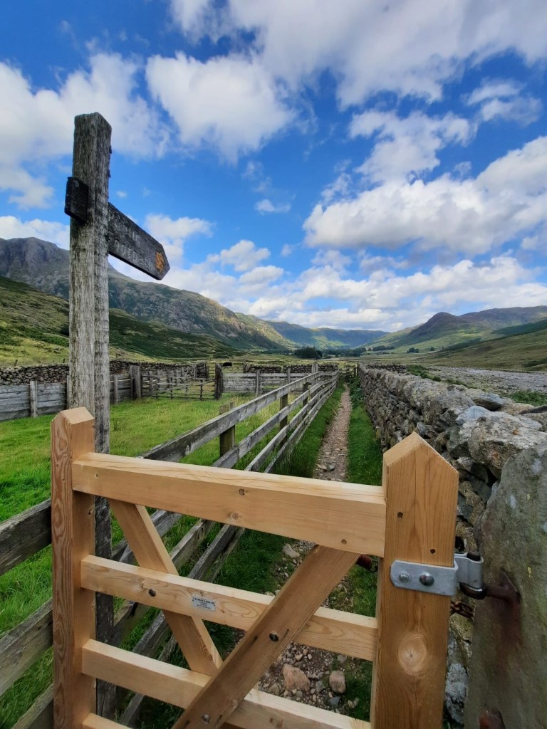
Difficulty: 2/5
Distance: 16km
Elevation +1013m
OS Map: OL6
Notable Features: Blea Tarn, The Bad Step, Pike o’Blisco, Crinkle Crags
Additional Notes: In poor conditions, the difficulty of this route (as always) would be much higher, especially in regards to The Bad Step. There is a route to avoid this short scramble if needed.
From the car park, you head straight across the road to begin the walk by circling the tarn. In the end, you do have to rejoin the road so you could skip this part out – as we did on the return journey to the car – but, it does mean a kilometre or so of road walking. Once you’ve joined the road, the path is on your left after just under half a kilometre, I would estimate. We kept consulting the map to check we hadn’t missed it but, in the end it is fairly obvious. There should be a clump of trees on the right hand side and you can hear the water of the river once you’re on the path.
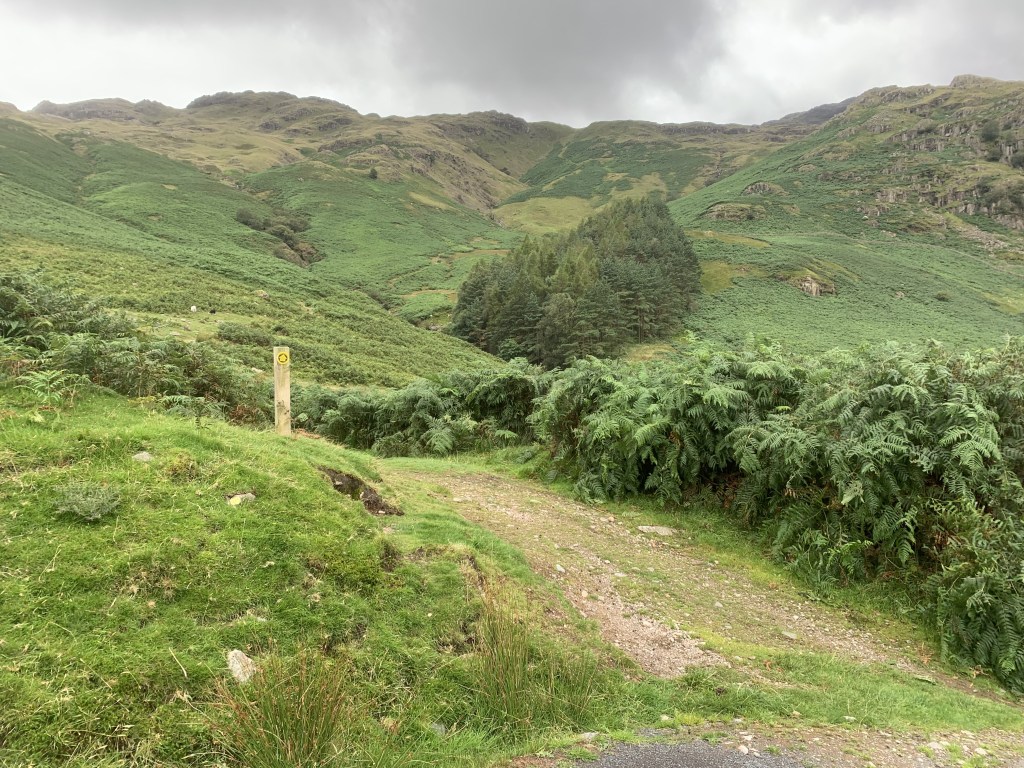
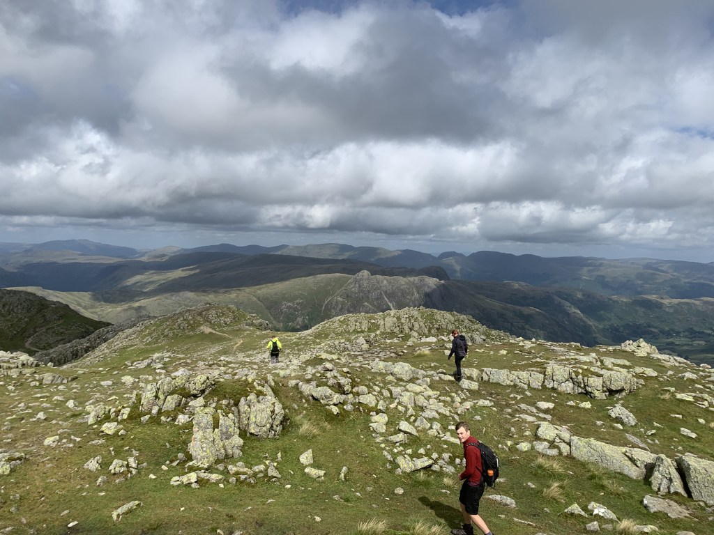
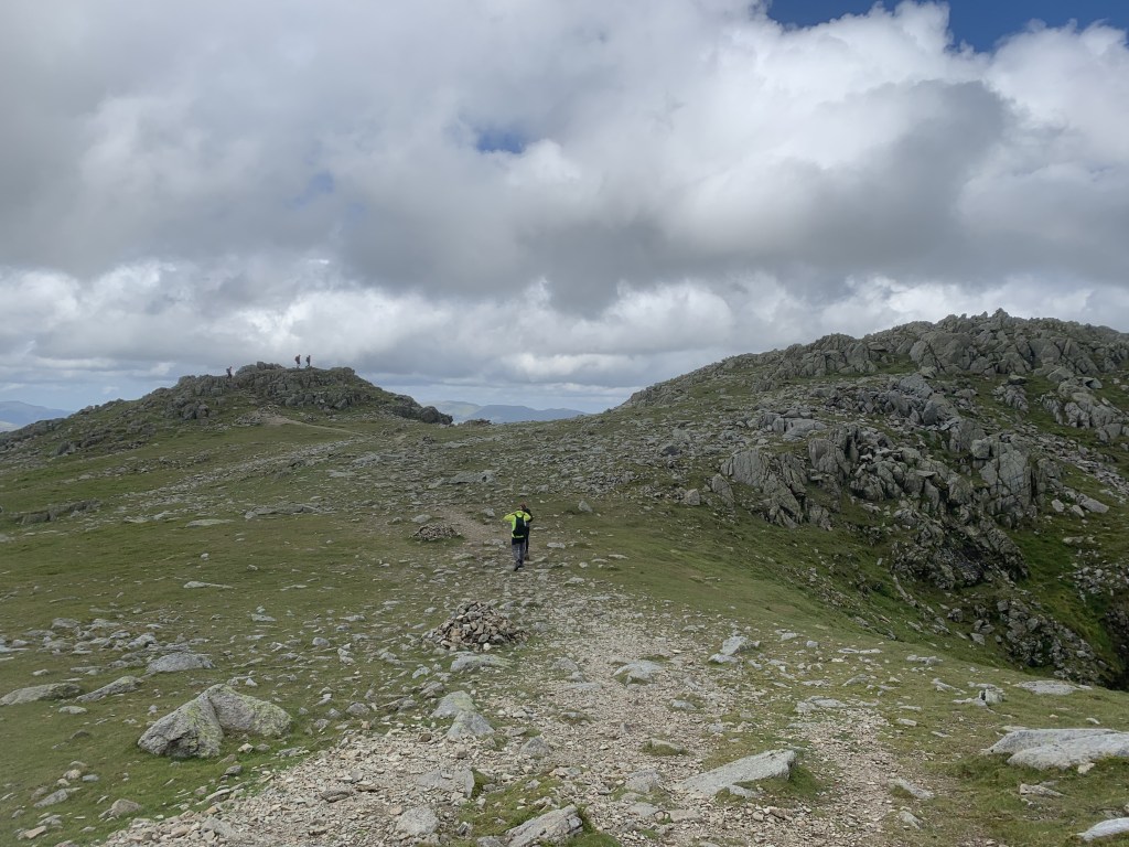
The walk is off to quite a tough start as you are instantly climbing and it is rather steep. There is no relaxing you into it with this walk. It was incredibly humid when we walked this route so that undoubtedly made a difference but it was tough going initially. There are steps that seem to go on forever but, the good thing is, once you reach the top, you’ve bagged the first wainwright essentially. Four kilometres in and you’ve reached the 705m mountain, Pike o’ Blisco. It was incredibly windy once we reached the peak so there wasn’t much waiting around and it was onto Crinkle Crags.

We made a bit of a mistake here, in my opinion, by not heading across to Cold Pike which is around the same height as Pike o’ Blisco at 701m. Now, I am basing this on looking at the map and seeing how close it is, not on the terrain or the paths out there. But, from what I can see, it would have only been a short deviation on paths to bag three Wainwrights on this walk, rather than two. I would recommend doing this as now we’re going to have to do a bit of a longer walk from Hard Knott or just go back up in the same area to hit this one Wainwright.
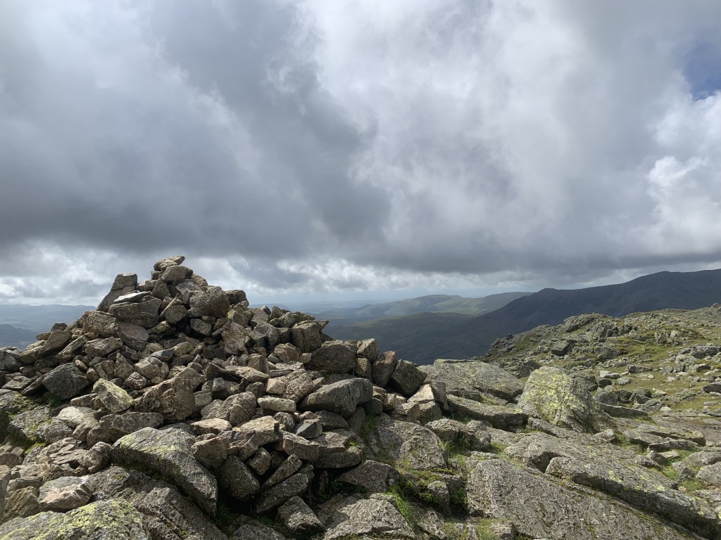
Anyway, on we went towards Crinkle Crags. It seems as if this is quite a popular route as there were quite a few people heading in the same direction as us. It is worth noting that this was during the summer holidays and on a nice day weather wise so it is always going to be that bit busier. The second peak is Great Knott – which sadly isn’t classed as a Wainwright though that may be because Arthur Wainwright saw it as part of the Crinkle Craggs range – I’m not too sure. The top is marked by a cairn.
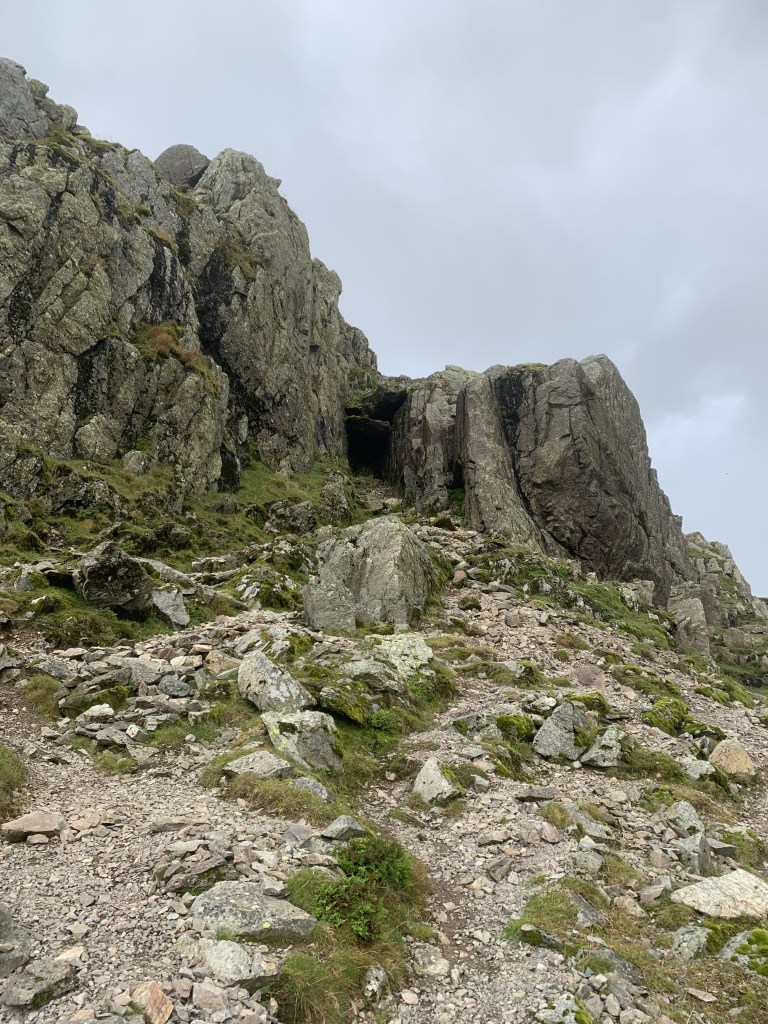
We decided to approach Crinkle Crags by heading up the Bad Step. This is as very short scramble and the only real difficult part is the one big step – can’t imagine how it got the name. I was pretty proud of myself for this though as, whilst it is only a short bit, that small area was probably the most difficult scrambling that I have ever done yet. I really had to focus on not letting my brain say ‘I’m stuck’ which, if you’ve ever done any scrambling, you know is the worst thing to think. It probably doesn’t rank in any sort of scrambling checklist but, I still think it was a very cool challenge and I was really pleased that we went that route.
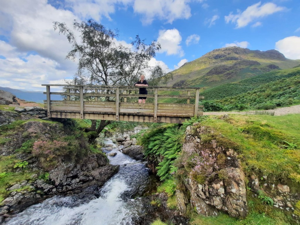
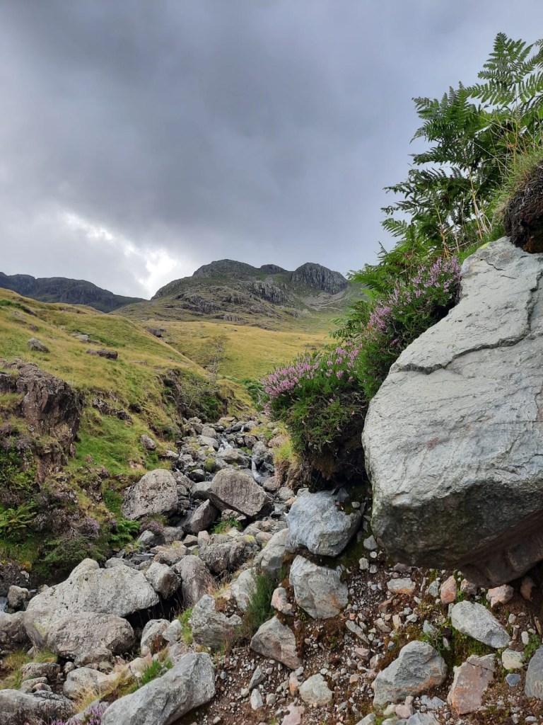
From there, it is some relatively easier clambering along Crinkle Crags which, didn’t seem to really have one clear peak but is a collection of rocky outcrops. Either way, we’ve bagged it now. The route then actually crossed over our route down from Scafell Pike (read about that route on my blog) passing the Three Tarns. However, to mix it up a little bit, we decided to take Hell’s Gill instead of The Band back down in the valley. Hell’s Gill sounds a lot worse than it is. This was a steep path alongside a river with some crossing required. It wasn’t as difficult as we were expecting.

From then, it was a walk towards Old Dungeon Ghyll Hotel and Pub and then through the campsite, back along the road to the car. You have a short uphill section to contend with after leaving the campsite but that is about it really. A lovely walk all in all!
As always, explore the map for yourself here or follow the step by step below.
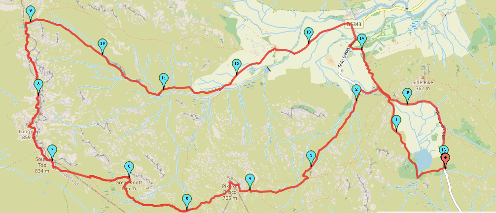
Start Point: Blea Tarn Car Park
- Head across the road and down the footpath next to the tarn.
- Follow the path around to the right, heading back towards the road.
- At the road, turn left and continue for around half a km. A path should appear on the left.
- Follow this path upwards, climbing the steps and crossing over the river when required.
- When you reach the top, continue to follow the path to the peak of Pike o’ Blisco.
- Head straight down the opposite side of Pike o’Blisco and continue onto Great Knott and then Crinkle Crags.
- After around one and a half km, keep right to head up the Bad Step. Or follow the path to the left to go around it.
- Continue straight along Crinkle Crags, eventually meeting Three Tarns.
- At the tarns, turn right and begin to follow The Band.
- After a short while, take the path on your right. This follows along the river. You will be able to see it dropping down into the valley alongside the river but, it is harder to spot the first section from the path.
- Follow the path keeping to the right hand side of the river.
- Follow the river – be sure to look out for the waterfalls – and cross the rocks over the river when the path requires it.
- Continue to follow the path. You should cross the river over a bridge as you reach the valley floor.
- Keep heading down the path. There will be a bridge on your right, ignore this as it is an alternative route in/down Pike o’Blisco.
- Pass through the gate and head through the farmland. There were huge cows in the field when we walked through but they caused no issues.
- Follow the track through the farm, following signs for the footpath.
- Once you reach Dungeon Ghyll, turn right to follow the road to the campsite.
- Soon, you’ll come to a gate on the left. Pass through the gate and the campsite. There is a short incline and you’re soon following a path alongside the road.
- Across from where you headed off the road initially to begin the climb, you will now rejoin the road here from the opposite side.
- Turn left and follow the road back to the car park.
End Point: Blea Tarn Car Park
That ends this route to Crinkle Crags! Let me know if you’ve done this route.
Amie x


Leave a comment