Fancy a cycle trail from the fabulous city of Norwich along an old heritage railway line? This is the route for you.
We recently travelled to Norfolk to attend the Old Buckenham Air Show and decided to head out on a cycle ride on a spare day and boy was it a good decision. The route I have to share with you today follows an old railway line and there are remnants left behind of the stations along the trail which is very cool to see. Plus, you have the added bonus of the end which just manages to take you into the Broads, Norfolk’s National Park.
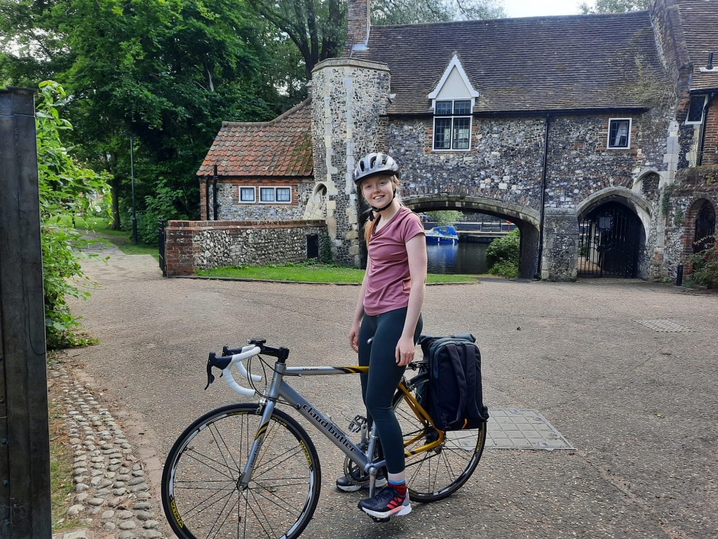
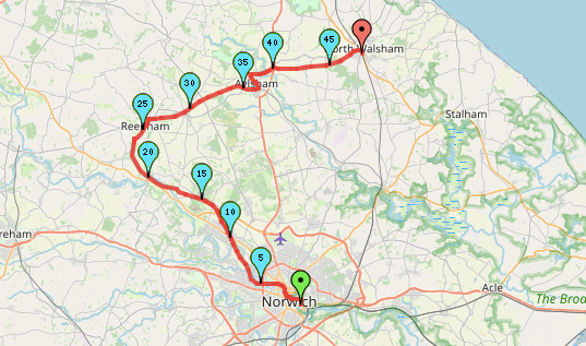
Alex and I both used road bikes for this trail and whilst I would say it is possible for 90% of the route, there is a lot of gravel and wooded areas that are not the smoothest of rides. The worst section is towards the end of the route which is more of a footpath than a cycle one so is very grassy. I did almost fall of my bike at this point, so we opted to walk. It was only a couple of hundred metres so it was not a major issue but something to bear in mind. I would suggest that a hybrid or gravel bike would be the most appropriate for this route however, it is doable in a road bike in summer.
Difficulty: Easy
Distance: 48.3km
Elevation: +237m
OS Map: 237, 238 & 252 (not required)
Notable Features: Norwich Cathedral, Dissued Railway Features, Reepham, Aylsham
Suitable For: Hybrid and Gravel bikes (Road bikes for the most part too).
In terms of transport to the start point, I have plotted a route from the city’s train station so, if you are arriving by train, you can hop straight on your bike as you exit. If your opt to drive, as we did, there is a multi-storey car park just across from the train station. However, I feel like I need to preface this that parking in the multi-storey is incredibly expensive. We returned to the car around seven hours after we left and had to pay an extortionate over £20 for the parking in July 2024. I think part of the issue was that we selected a ‘leisure’ ticket rather than rail and I’m not entirely sure how the system works but, given that we were buying a return ticket from North Walsham, I think we could have bought a rail parking ticket instead. There is also the option of the train station car park but I cannot comment on how affordable/long-stay that one is.
Just a note: Alex and I picked up treats from bakeries in Norwich for the ride. Alex opted for Bread Source which he had heard good thing about – the cinnamon bun he bought was a big hit. However, they were not very allergy friendly unfortunately so I had to go elsewhere. I highly recommend the Cornish Bakery’s farmhouse sausage roll though, so it wasn’t too much of a disappointment. The route included here travels past the Bread Source bakery near Norwich Cathedral if you would like to try it out for yourself.
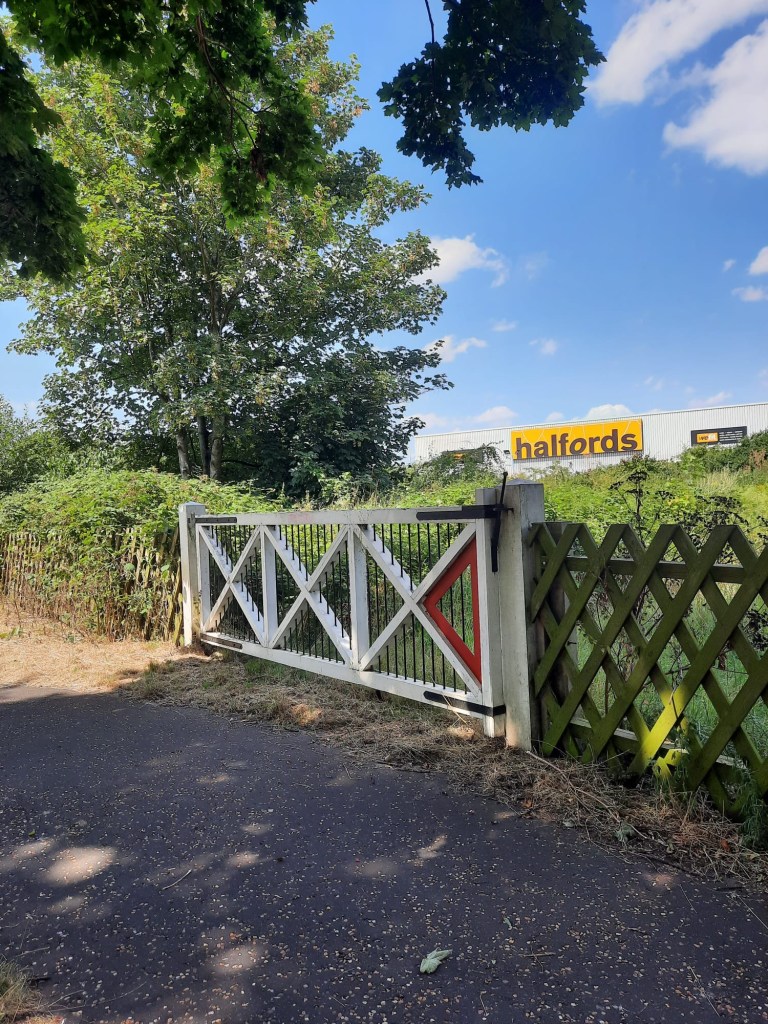
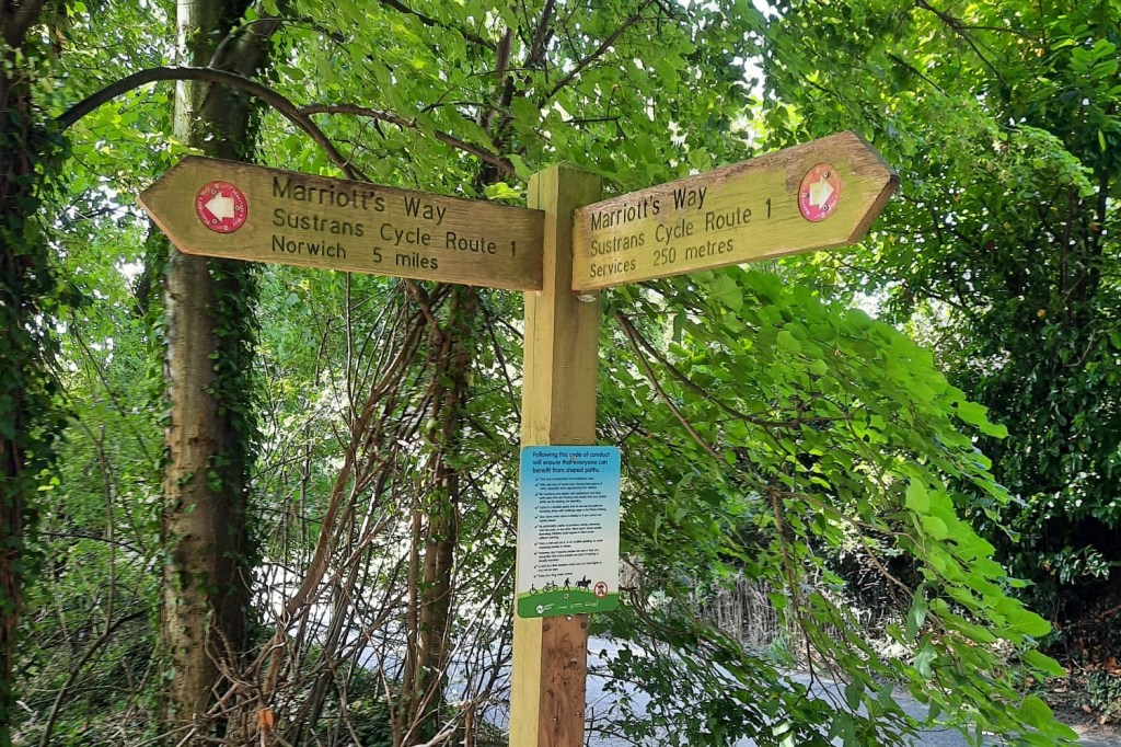
The cycle trail properly begins once you reach Halfords and this initial section is incredibly smooth and, when it is not too busy, you can really get your speed up. You can tell from the offset that you are on an old railway as there is an old railway gate that begins the route. This initial section of the route follows the Marriott’s Way.
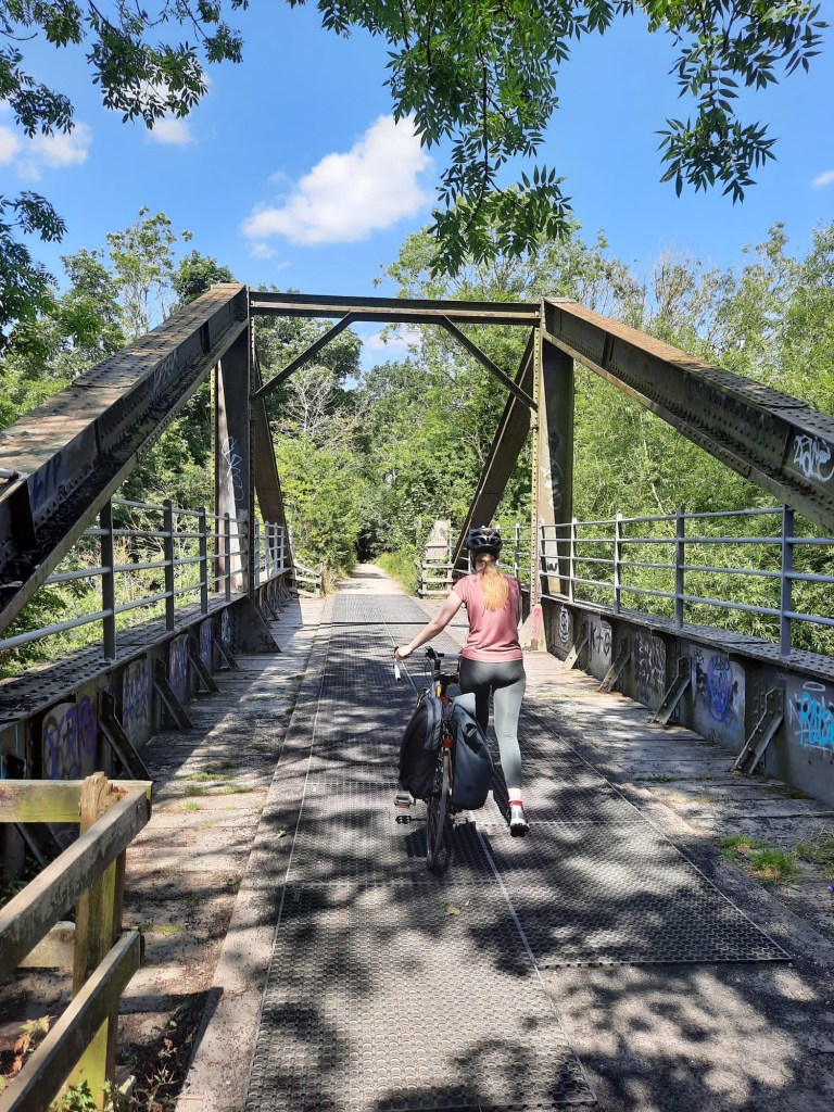
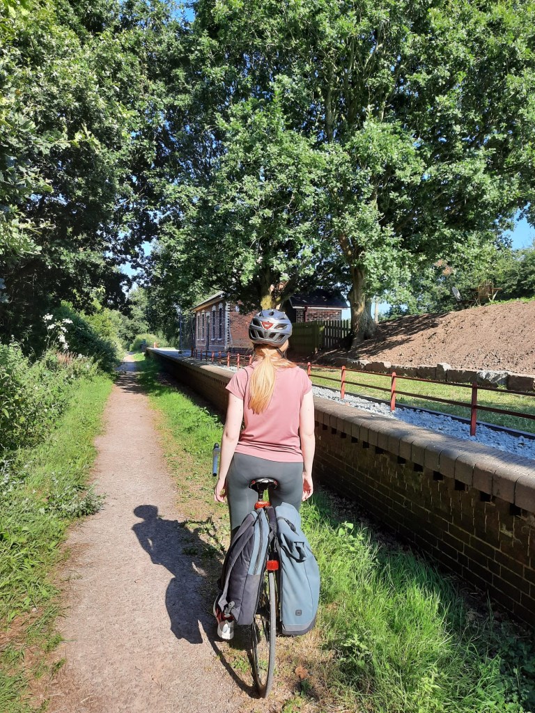
The Marriot’s Way is a 42km cycle path that runs from Norwich to Aylsham. It follows two disused railway lines and was named after the manager and engineer of the Midland and Northern Great Railway system. The coolest part about the route is the leftover signs and structures from the old railway stations. For example, Hellesdon and Attlebridge which you can see pictured here.


The official cycleway takes a little bit of a funny route towards Reepham area as it extends out to Themelthorpe to almost come back on itself (as you can see on the map on the Attlebridge sign above). We opted to cut this section out and take an alternative, and quicker, route to Reepham. At this point, we were getting quite hungry and it was incredibly hot so we were ready for a break and something to eat. Reepham turned out to be a great place to stop! This was a lovely and quaint little town. We treated ourselves to a slush that was 90% ice from the local shop and tucked into our bakery goodies. I highly recommend taking a lunch spot here.

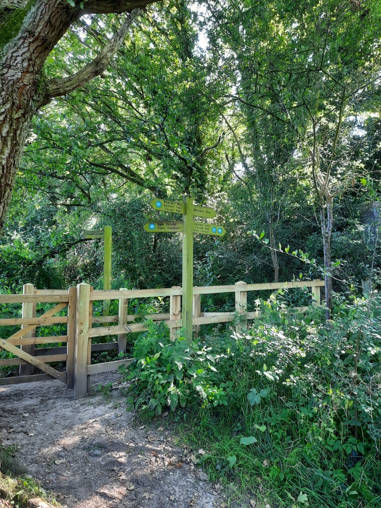
After Aylsham, we were quite concerned about the route as we were unsure if it was going to suitable for the road bikes. As I said above, it was mostly okay but it was after Aylsham that we faced the issues. Here the Marriott’s Way ends and you join Weavers Way. The full length of the Weavers Way runs from Cromer to Great Yarmouth. The route is way marked like the Marriott’s Way but pink signs are swapped for green. The Weavers Way can be either cycled or walked but it lends itself more as a walk than a cycle. It is passable though and worth it to take in that extra 10km.
You can get a return train back to Norwich direct from North Walsham. Our original plan was to get the train to Cromer and spend a couple of hours there however, we didn’t set off cycling until past noon so it was around 5pm by the time we arrived at North Walsham so it didn’t really feel worth it. You also have the option of extending the cycle to Cromer if you want to add an extra leg to the trip. There are plenty of options to choose from here!
Overall, this was a fabulous cycle and I had a great day. It was also a great opportunity to try out my new road bike and it is safe to say I am obsessed! You can really get some speed up on a road bike. I still have some way to go to get used to the drop down handle bars and the balance of the road bike but I’m really loving it so far.
If you’re interested in trying this route out for yourself, check out the step by step below or visit mappedometer.
Start Point: Norwich Train Station
- Head right outside the station and cross the bridge over the river.
- After you’ve crossed turn right to follow alongside the river following the path.
- Once the path meets Ferry Lane, turn left and follow this to the Cathedral. (if you want to stop of Bread Source, the cafe is around here).
- Head straight uphill until you meet the main road. Then head straight over and up Queen Street.
- At the junction, turn right and continue down this road, passing a church on your left. Then, turn right down Duke Street.
- Once you’ve cross the bridge, take the path alongside to the river on your left.
- Continue to follow the river until you get to the roundabout. Cross the road and take the path alongside Halfords, flanked by old railway gates.
- You are now on the Marriot’s Way. Continue to follow this path for around 22km. Notable sights include the old railways such as Attlebridge and passing over the Broadland Northway dual carriageway.
- When you reach Whitwell Railway, there is an opportunity to shortcut the trail and head into Reepham. To do so, take the path to the right after the railway to meet the road.
- Turn left down the road, past the school and into the centre of Reepham.
- At the crossroads, turn right to access the corner shops and church – a nice spot to have lunch.
- Take the road on the left before the Spar, following this road around when it bends to the right.
- Once you meet the main road, turn right and then take the next cycleway trail on the right.
- You have rejoined the Marriot’s Way. Continue for another 11km to reach Aylsham.
- At the end of the trail, at the roundabout, head straight across to follow Norwich Road.
- Follow this road up into Aylsham and continue to follow it as it bends around to the left and then the right past the pub.
- Continue straight down Penfold Street and then, at the junction, head straight again down Blickling Road.
- Pass The Old Hall on the right and then take the next path on the right. This is easy to miss but the gate should be signposted The Weavers Way. If you reach a double-breasted gate into a farmers field, you’ve gone too far.
- When you reach the road, turn right and then left up Banningham Road. It will be signposted as a dead end.
- Follow the road and then turn right down a farm track (Green Lane).
- Continue following the lane until it meets the A140 and then head straight across following the footpath (note: this path may not be suitable for bikes and you may have to get off).
- To continue to follow the Weavers Way, when this footpath meets another track, turn right and then left.
- Continue to follow the Weavers Way to North Walsham.
- Once you trail comes to the main road, North Walsham Bypass, turn right past the park and turn right to head to the train station.
End Point: North Walsham Train Station
This was a great day out and I hope you enjoy it as much as I did!
Amie x


Leave a comment