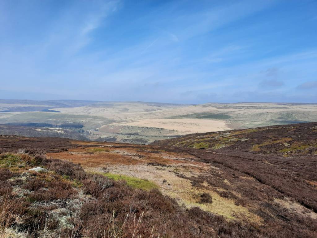
The B29 crash site and memorial is not too far from a road and is fairly easily accessible from the A57. From there, it is a 3km walk to the site however, if you want to make a day of it then this route is a great one! As well as the plane crash memorial, it also includes some waterfalls, Bleaklow Stones and Bleaklow Head and you really feel like you’re out on the moors despite hitting some popular spots.
We parked at the Woodhead Tunnels car park along on the A628, not far from Woodhead Reservoir and the old Railway Station. From what I remember, this was a free car park but there were limited spaces so that is something to bear in mind. It is also only 43 minutes from Sheffield and 56 minutes from Manchester so is a great option when travelling to those cities too. Unfortunately, there are no public transport options to the start of the route.
Difficulty: Easy
Distance: 16.16km
Elevation: 633m (+487m)
OS Map: Explorer OL01
Notable Features: Black Clough Waterfall, Bleaklow Stones, Bleaklow Head, B26 Crash Site and Memorial
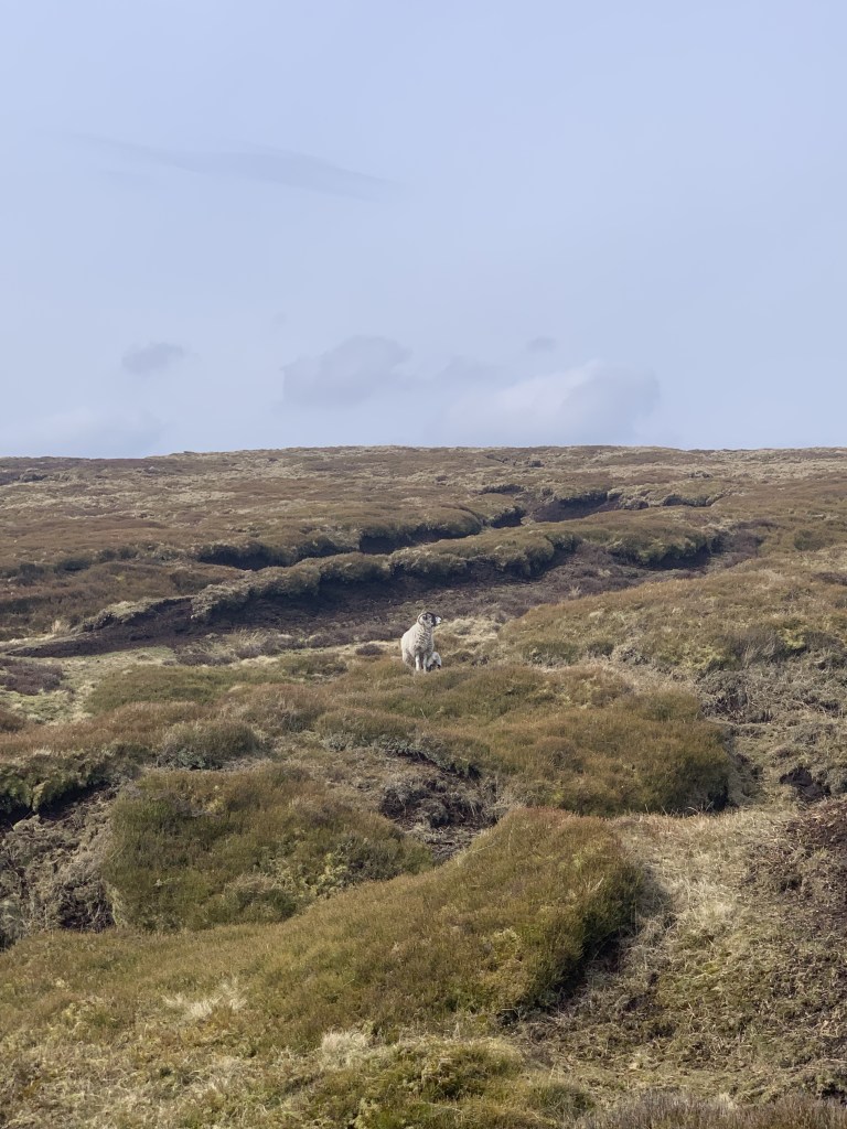
Look out for: Sheep, Mountain Hares
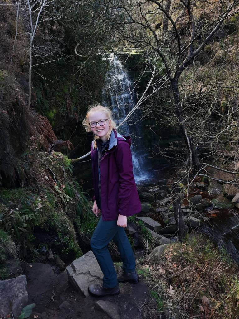
The first part of the walk follows alongside the River Etherow which makes for a scenic beginning. The first point of interest is Black Clough Waterfall which was very popular for walkers on the day we took this route. It is an easy walk from the car park which required minor clambering over rocks and some river crossings, if you wished to get to up close to the fall at least. It was still well worth the stop though. You do have to retrace your steps back to the beginning to continue the walk so, if you’re not interested, you can skip this portion out.

Retracing your steps back down the valley is the best option here. We decided we didn’t want to do that and instead tried to cut across the next path that essentially runs parallel to the walk to the waterfall. However, in between is steep valley with trees on each side and getting down one side and up the other was incredibly difficult. We made the wrong choice here and, whilst I was proud that we managed to swing from tree to tree to get handholds as we struggled up the bank, I can’t say I recommend it.
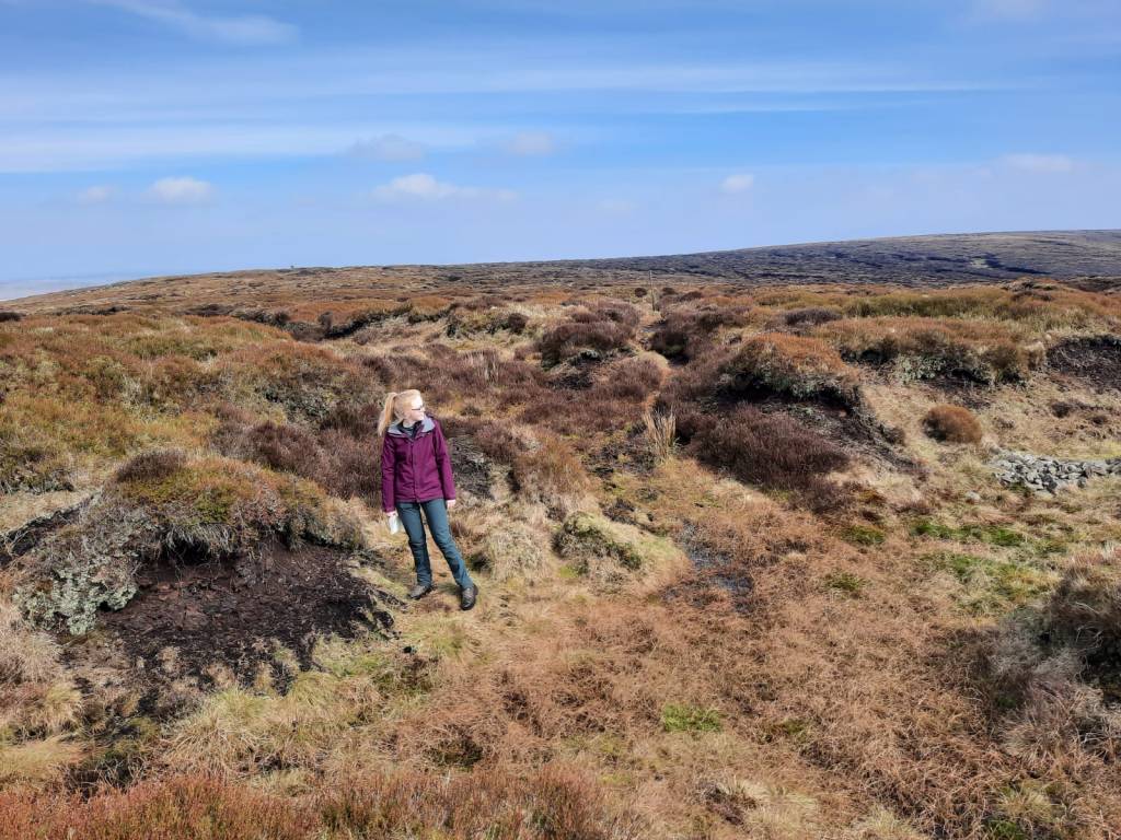
From there, it is straight gravel path to Bleaklow Stones. This was a well trodden and established path but eventually becomes grassier and boggier so keep an eye on the map to ensure you’re staying on the right track. It was interesting as between the waterfall and Bleaklow Head we didn’t see another soul about but, the minute we arrived at the crash site, there were about 15 people all here to take their time and have a look at the memorial and ruins. If you’re attempting to bag all the Peak District Ethels then Bleaklow Head is another checked off your list on this walk.
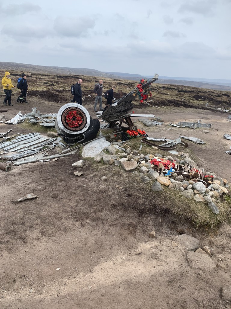
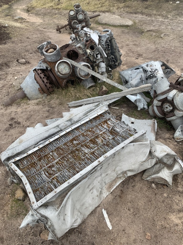
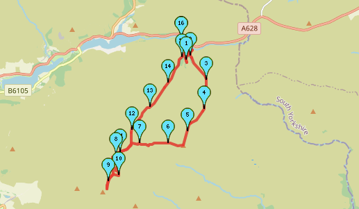
The ‘B29 Over Exposed Bomber Crash Site’ is the remains of and a memorial to a US Air Force Superfortress aircraft which crashed in November 1948. The plane was on a routing flight between air bases in the UK, from RAF Scampton to the US airbase near Warrington. Due to the level of fog, visibility was incredibly poor and the pilot assumed that, given how long they had been flying, it was time to start the descent. Sadly, all 13 passengers on board were killed. The ruins include an engine turbine as well as a portion of the body of the plane which were left as a memorial to the several people that lost their lives during the incident. In 1988, a plaque was erected in memory of those that died.

Whilst the spot is popular was walkers, it is important not to disturb any of the wreckage and it is forbidden to take anything from the site.
From the crash site, this route retraces its steps once more back to Bleaklow Head and follows the path alongside Near Black Clough. This was actually a little difficult to find as the plateau of the moorland here makes it hard to tell the terrain apart. We used a compass to help us out whenever necessary here but, once you’ve found the path, it is straight forward. You head back down through the woodland near the waterfall from the start of the walk and back to the car park.
This was such a lovely walk and I now have a desire to explore more of the Peak District. Whilst it isn’t my favourite of all the UK national parks, it is well worth exploring. Having lived not far from the Peaks my entire life, I wish I had been out there more! Well, there’s still plenty of time to do it…
Explore the route in more detail for yourself here and follow the step by step below.
Start Point: Woodhead Tunnels
- From the car park, head over the bridge and take the footpath to the left, walking alongside the river.
- Follow the path, as it bends to the right, ignoring any other routes.
- Continue uphill before crossing the river at the next opportunity.
- Keep following this path to the waterfall.
- Turn around and retrace your steps.
- When you reach the edge of the woodland, the the path on the right (the one your ignored earlier).
- Follow this gravel path. Soon it becomes less of a well defined path – ignore the path over the bridge on the right here, instead continue straight.
- Continue to follow this path, crossing a few streams (boggy patches depending on the rain level) to Bleaklow Stones.
- From the stones, take the path on the right and follow this to Bleaklow Head.
- At Bleaklow Head, follow the path more or less straight ahead which will take you to the B26 crash site and memorial.
- Retrace your steps to Bleaklow Head.
- At Bleaklow Head, follow the path you used to get to the peak but around half a km where you should take the path on the left.
- Follow this path back down the valley, into the woodland and to the car park.
End Point: Woodhead Tunnels
Like I said earlier, this route can be a little difficult to navigate at times because of the similar landscape so keep an eye on your maps. It is a great walk though and I really enjoyed it!
Let me know if you give this route a go.
Amie x


Leave a comment