Last week, I shared a more general posts detailing my time on the Isle of Arran which you can take a look at here. I mention all the top sights to see (in my opinion) as well as the accommodation we stayed at – which I highly highly recommend. I had such a great time on the Isle of Arran, despite the poor weather. One of the highlights was a day hike up the highest point on the island, Goatfell.
Goatfell is unfortunately not a munro but it is a Corbett – this is the term give to mountains in Scotland that are about 2,500ft (796 metres) but shorter than 3,500ft (914 metres). There also has to be at least 500ft (152 metres) between each listed hill and any higher hills next to it. Goatfell fits this criteria as it is 874m tall and one of four Corbetts on the island. There are many ways that you can climb Goatfell: up the main route and straight back down, along the Saddle ridge, or the way that we walked. I’m sure there are other options too but, we had to pick our route based on the weather on the day.
Difficulty: Easy
Distance: 17km
Elevation: 874m
OS Map: 361
Notable Features: Goatfell, Brodick Castle, Cnocan Wood, Arran Coast
Look Out For: Buzzards, Golden Eagle, Dwarf Juniper, Emperor Moths
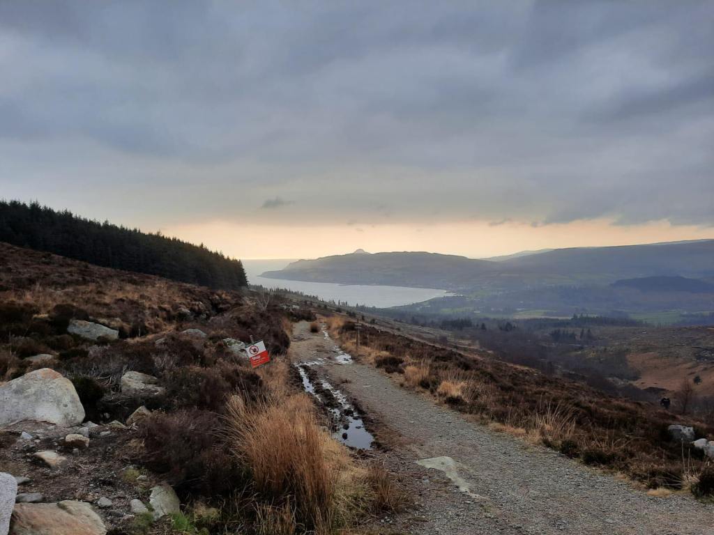
First, the best place to begin any walk up Goatfell is from Fishermans Walk Parking just outside of Brodick. Naturally, if you drive to the island, you can park you car here free of charge. From there you head across the road and through woodland that is part of Brodick Castle Garden and Country Park. We had an absolutely beautiful view of the sunrise as we headed straight from our early ferry and up to the mountain. This meant that it was probably one of the earliest times we’ve started a walk in a very long time.
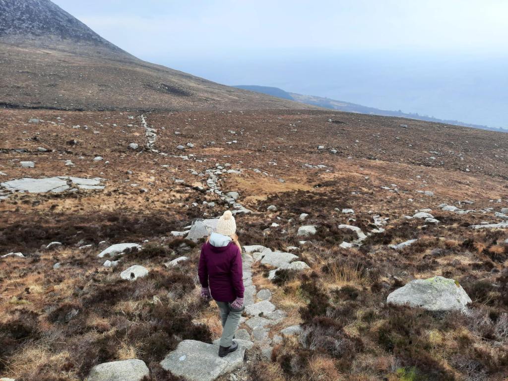
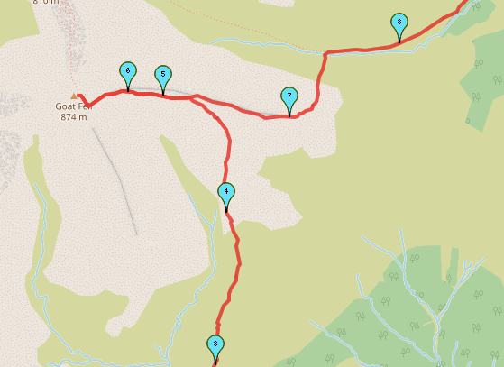
Alex read a review of the walk before we went to the island and it read ‘death by stairs’ and that about sums up this route. Although, it is a little melodramatic! You do step up lots of rock stairs for about the last 3km before you reach the summit. It isn’t actually too difficult of a walk because of that to be honest, and its not technically challenging in anyway.
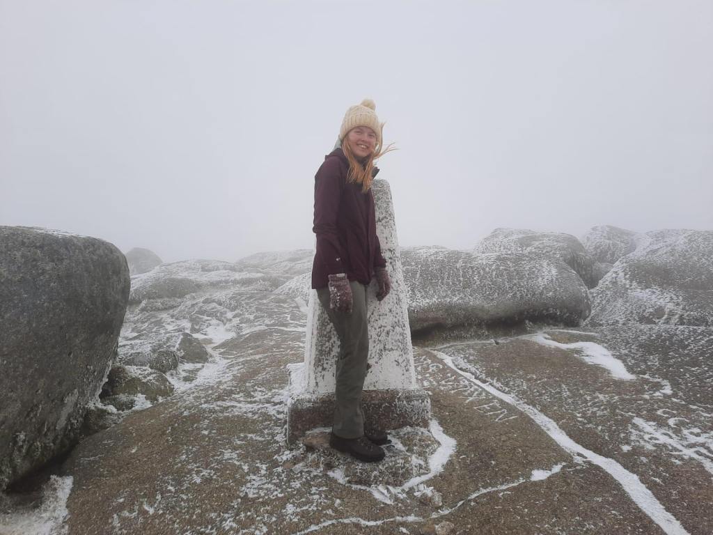
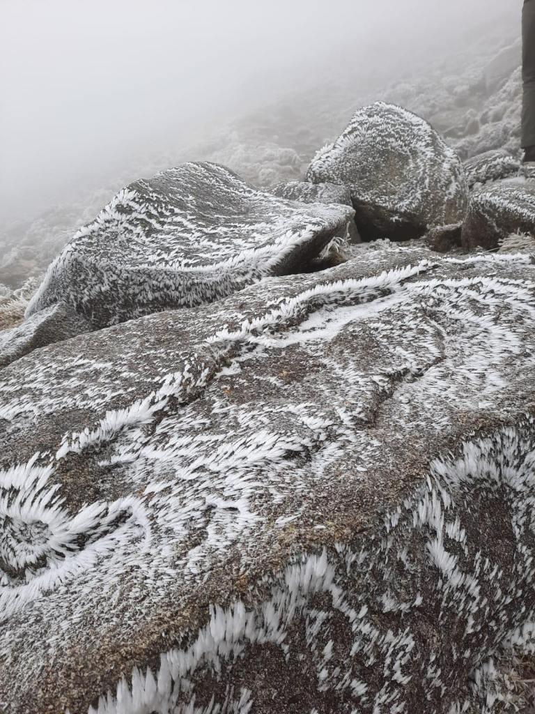
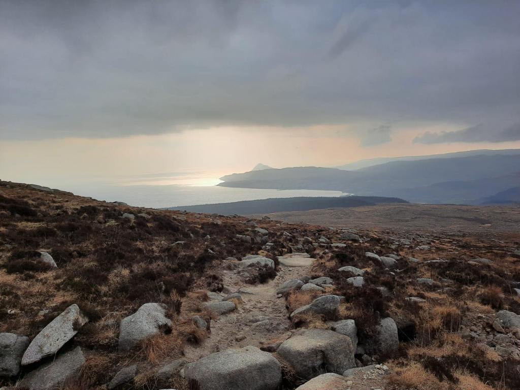
As seems to be a running theme at the moment, the top of the mountain was in cloud when we walked up and it was also incredibly windy at the peak. As you can see from the photos, there was a bit of ice and snow about too which did make the last few steps that bit more challenging. With the wind meaning the temperatures were feels like -13 degrees celcius, it was a ‘reach the top and then go straight back down’ kind of walk. However, the way the ice had formed on the rocks was spectacular, I’d never seen anything like it before. Nobody can say we are fair weather hikers!
Because of the poor visibility, we opted to change our original plan which was to head up to North Goatfell and along the Saddle ridge. This is a bit more of a scramble and would have probably been a little challenging for me as I don’t have too much experience with that yet. I was looking forward to giving it a go but the weather had other ideas. It’s definitely something I want to do a little more of in the Lakes in the coming summer months though!
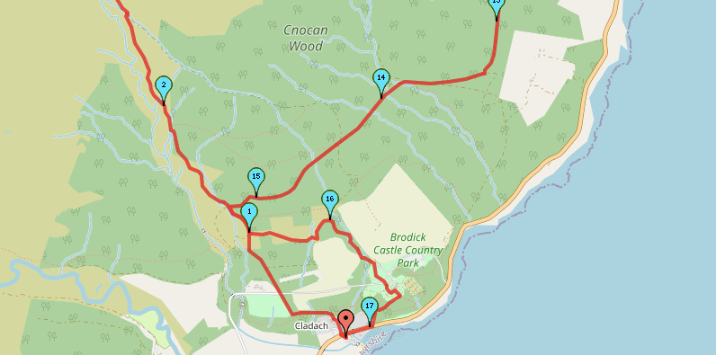
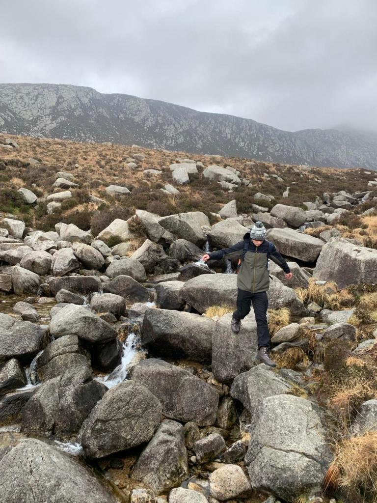
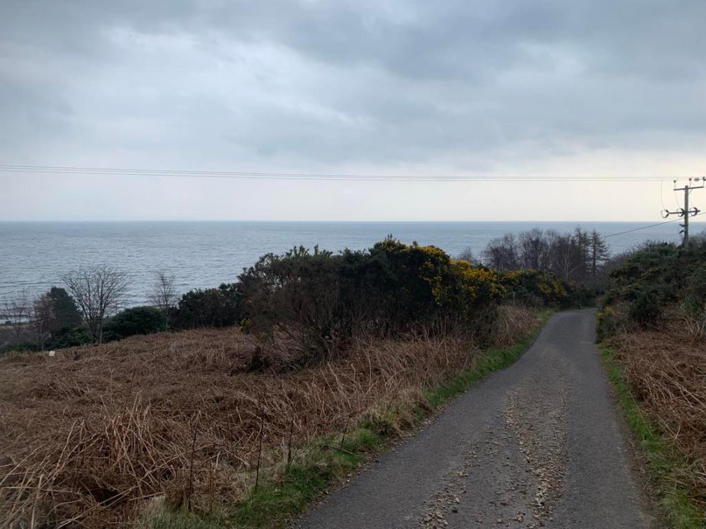
So, we headed back down the same way that we came up until about a kilometre and then headed down the path to the left. This was a bit of a spur of the moment decision but was ultimately the right one. I much prefer to do a circular route than up and down the exact same way. The path was fairly steady going too, no major ascents or descents. It crossed a small river and then dipped back down into the woodland.
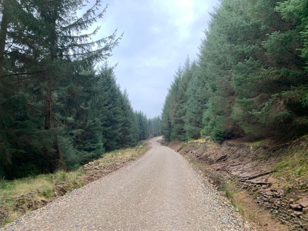
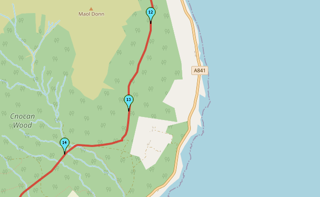
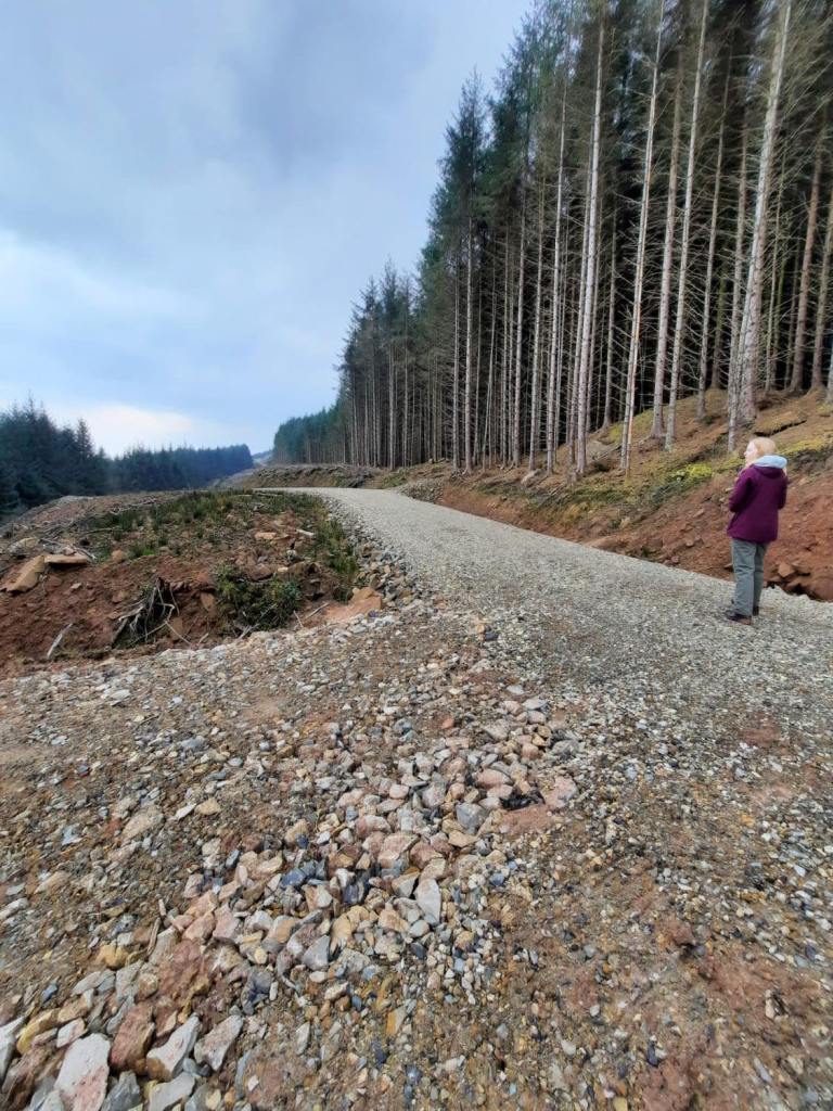
Soon enough, you reach the main road but, this isn’t for very long so don’t let that put you off this route. There isn’t any pavement but it’s not an issue because of the short length. You dip back into a forest signposted Maol Donn that is maintained by the Forestry Commission Scotland. The terrain and views here reminded me a lot of a walk that we did in Connemara as part of a camping trip in Ireland. It was very muddy in places but the route is well signposted. Admittedly, there was one arrow that was a little misleading so do be aware of that and keep an eye on your map regardless.
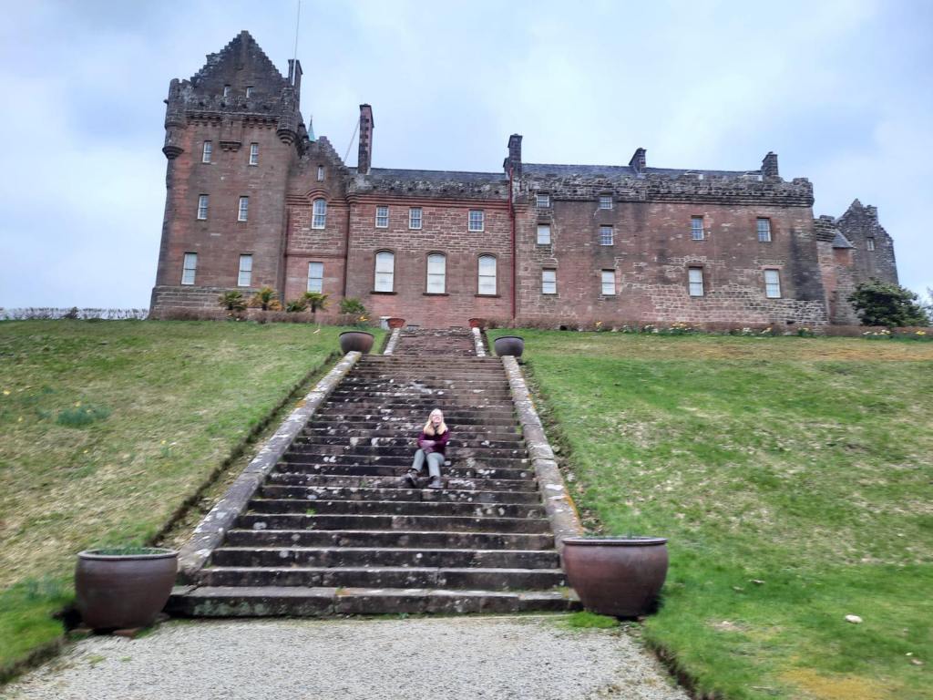
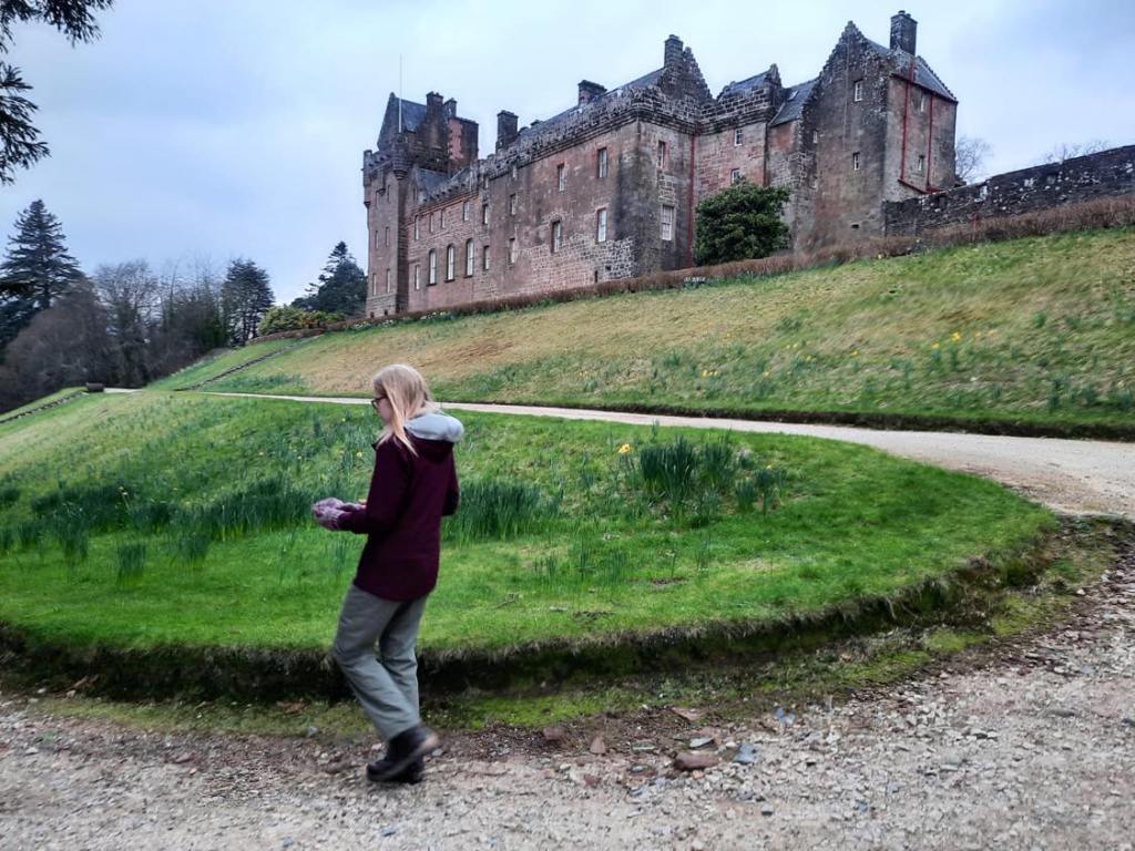
I would highly recommend walking through Brodick Castle when you’re on the home stretch back to the car park. The gardens are completely free to enter and have a handy free public toilet that was a very helpful thing to find. I imagine it is very beautiful during the spring as we saw hints of what the garden could be in February. The Castle is closed during the winter season but, is open to enter during the summer months for £15 per adult and £9 for children. Inside you can learn more about the people who have owned the castle for its lifetime with Victorian decor in the present building which was built in 1844.
This was a great walk and I’m glad we managed to fit it in during our short time on the island. It took us approximately 5 hours so is very do-able even on a weekend break to Arran. As always, you can take a look at the map for yourself through this link here or follow the step by step route below.

Start Point: Fishermans Walk Parking
- Head across the road and take the path directly across from the car park. Pass the Garden Centre, the Brewery and the Arran Gift and Souvenir Shop.
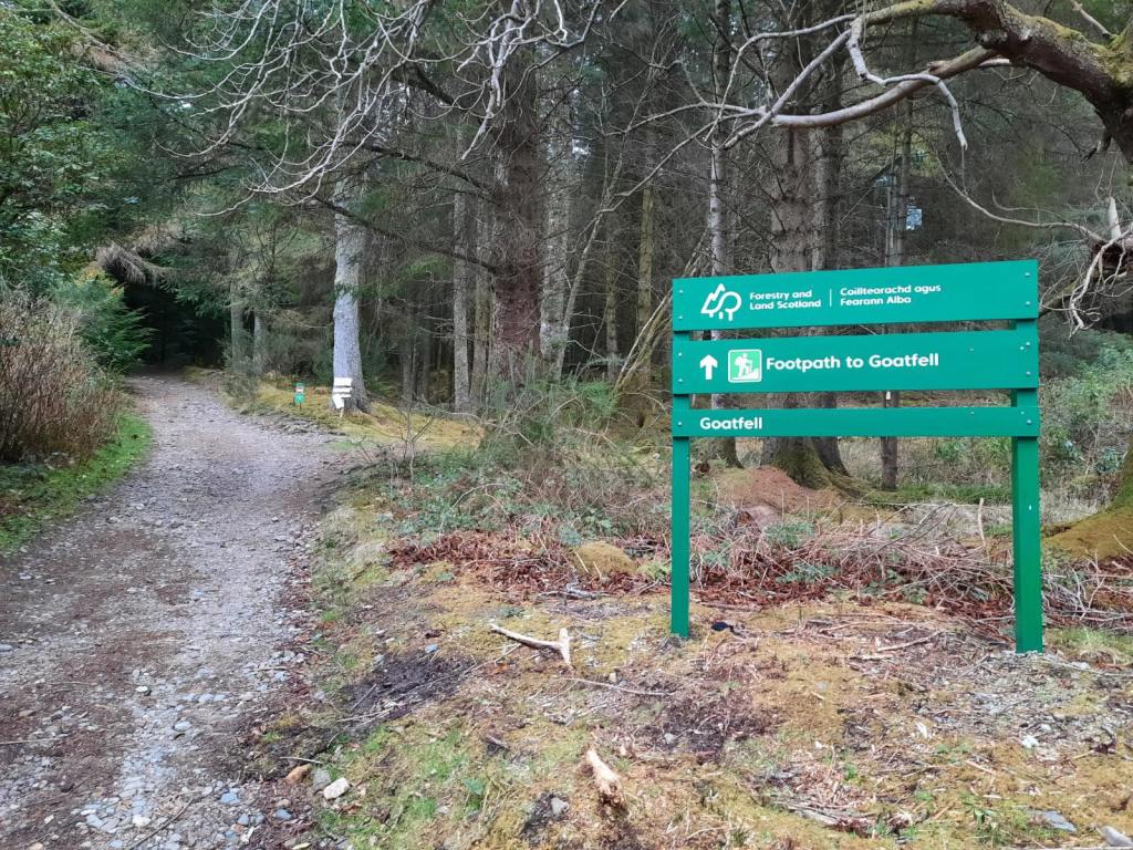
- The road will soon become a path that is well signposted to Goatfell.
- Continue to follow the path through the woodland.
- If you head straight, ignoring any intersecting paths, the woodland should soon open out and Goatfell is visible in the distance.
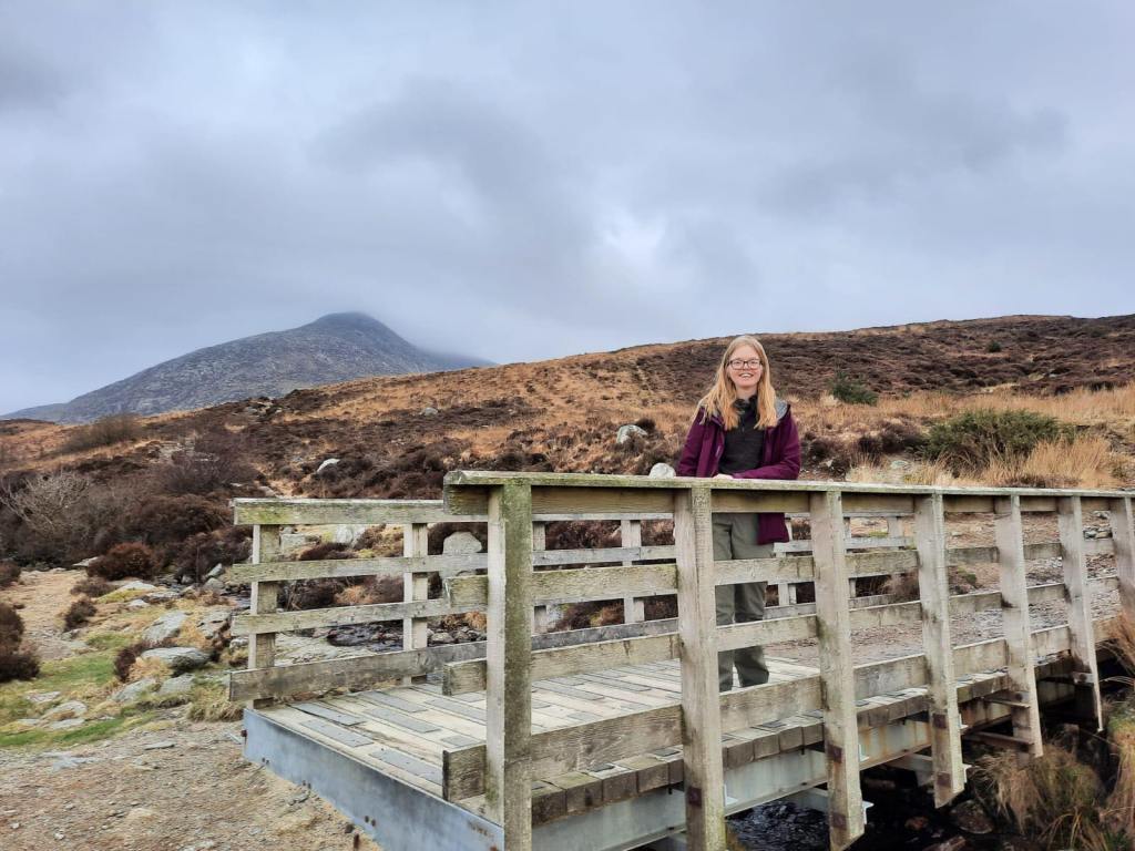
- Cross the wooden bridge and follow the path to the left – the right is a no-access forestry path.
- Continue up the steps to the peak of Goatfell.
- Return back down the path until you reach the bottom of what was the final climb to the peak.
- The path forks, take the left hand path.
- Follow this path with the valley on your left and the sea in front of you.
- Cross the river as the path descends and head right in the direction of the woodland.
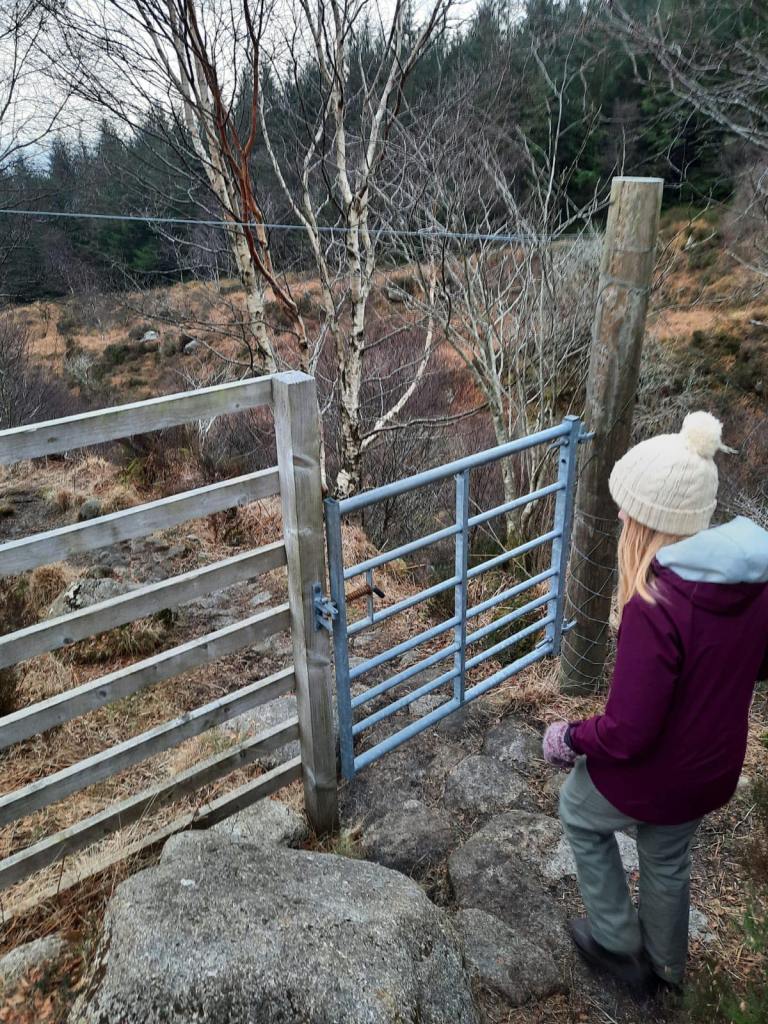
- You should pass through two gates, the second of which enters the wooded area.
- After a short while, the path reaches a lane. Follow this down towards the coast.
- Once you reach the main coastal road at Corrie, turn right and continue on for a couple of hundred metres until you reach Maol Donn.
- Enter through the gate and follow this woodland track into the forest. Continue until you reach a T-junction with a gravel forestry track. Turn left onto this.
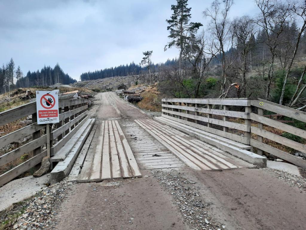
- At the next T-junction turn right and continue. The track bears left by a waterfall before crossing the bridge pictured above.
- Shortly after the bridge, a track leads off to the left. Ignore this as the signposts can be a little misleading here and continue to the right, slightly uphill.
- Take the grassy path on the left off the main track. The path should descend slightly.
- This path joins the initial one that you took through the forest at the very beginning of the walk. Take the next path to the left for a detour to Brodick Castle.
- Hamilton Cemetery will be on your right. This is the burial ground of the Hamilton family.
- Follow the path as it naturally takes you through the woodland, ignoring any stiles into nearby fields. You will cross a wooden footbridge.
- The path ends at the the public toilets in the grounds of Brodick Castle.
- Head down to the Castle and have a look around the gardens!
- From the Castle, take any route back down to the main road and back to the car park.
End Point: Fishermans Walk Parking
That brings us to the end of the Goatfell walk. Please do let me know if you’ve hiked this mountain and how you found the experience in the comments!
Amie x

Leave a comment