
Ingleborough is one of the three peaks of the Yorkshire Dales. Similar to the national Three Peaks, there is a challenge that you can complete where you walk all three in 24hours. That however, is not what this post is about. I would love to do that some day but, for now, it is one at a time. Pen y Ghent has already been ticked off so next we tackled Ingelborough. This walking route is a little different to usual though as we didn’t actually manage to complete the route we planned. But, more on that later.
We are based in the Lake District which is actually much closed to the Yorkshire Dales than I thought it was. The west of the Yorkshire Dales is under an hour away from our home which is absolutely perfect. One national park on the doorstep and another a short drive away. It was a big deal for me this walk too as I actually drove to Ingelton which was a new experience for me as I passed my driving test last summer and have recently begun to drive Alex’s car to keep the skill up. I felt pretty accomplished before we even started this week!
Difficulty: Easy
Distance: 11.4km
Elevation: 723m (+591 gain)
OS Map: OL2
Notable Features: Ingelborough, Ingelborough Viaduct
Look Out For: Red Squirrels, Cuckoo, Black Grouse, Curlews
As I said, the best way to begin this walk is to park in the small village of Ingleton. There are plenty of car parks to choose from so you should be okay there. I don’t believe there are too many public transport options to choose from here however, Dales Bus do have links with Skipton, Settle, Kirby Lonsdale and more. Be aware that certain buses only run during the summer months and bank holidays. You can find more information about that here. Regardless, the route linked at the end of this blog post will start from one of the car parks but, it will be easy enough to find the start point if you park or arrive from elsewhere.
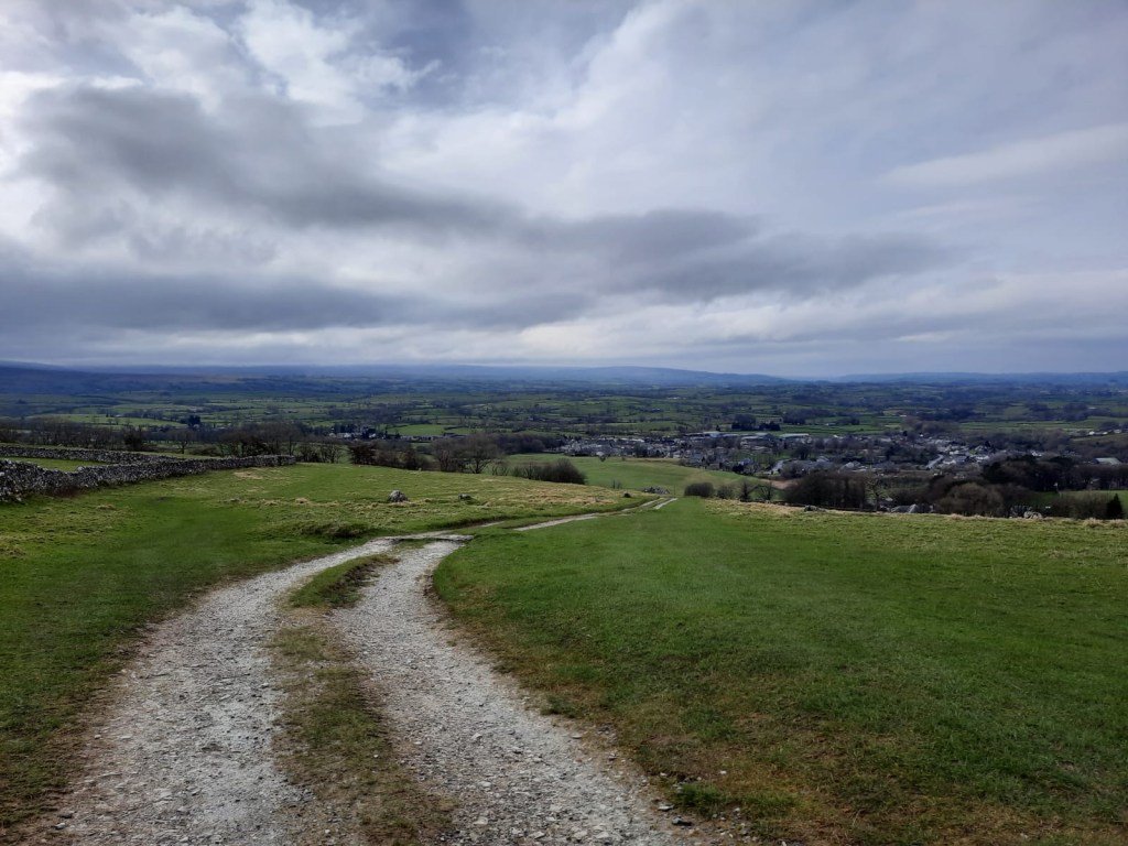
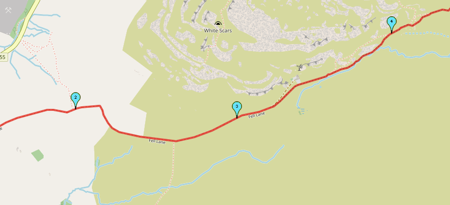
The initial part of this walk is very easy. In fact, on the whole, Ingleborough is a very accessible walk for beginners. It requires very little of anything like scrambling, more steps towards the top. Back to the start though, you head up the road and join a gravel track that is actually the very long driveway to a house. Both me and Alex said that we couldn’t imagine living that far away. I was mind blown by the mile they had to travel just to pick up their post from their postbox. You would definitely need a 4×4 although, I was very surprised that the owners 4×4 Fiat Panda made it down. They definitely had the practice though, keeping the wheels just right. We witnessed both the panda and a Land Rover make their way down the path; I can tell you which one I would have preferred…..
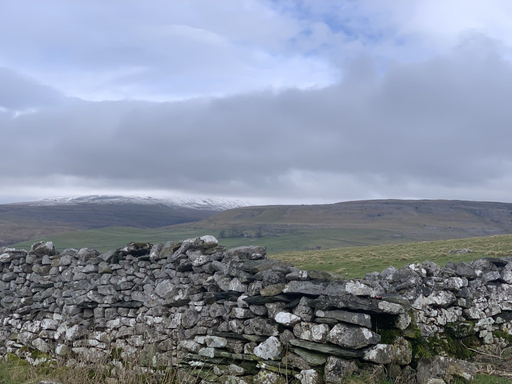
Make sure to keep turning around as you head down this gravel path as there are some lovely views back into Ingleton and its viaduct. The quarry is also visible off to the left too. At just over 3km, you leave the gravel onto a grassy path. Honestly, this is a very easy route to navigate as it is so well travelled and you’re just continuing straight for the majority of the route.
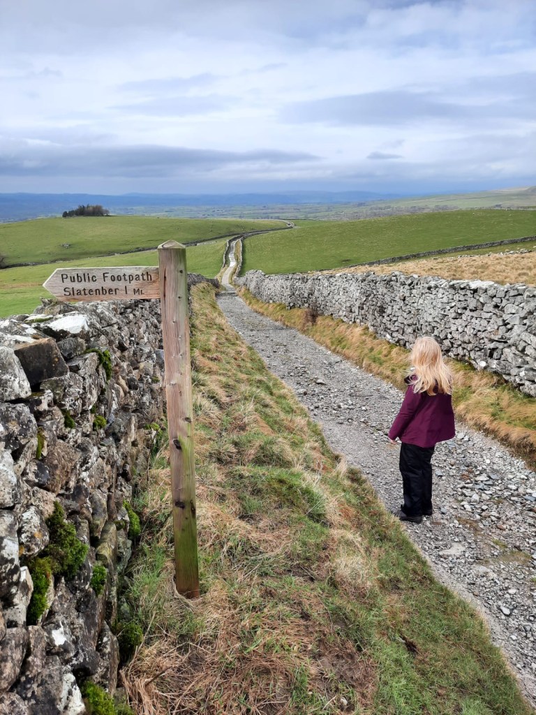

The steepest part of the route comes at the very end as it is mostly a gradual incline until that point. It does make it a little gruelling to not have too much variation on the route. To be honest, I find that the harder the terrain the more distracted I am from the pain of actually going uphill. But, that is what makes this route so great for so many different people. It is a high mountain at 723m but, it doesn’t feel it. The last couple of hundred metres are using rocks as steps and I don’t think that would be too difficult in summer conditions.
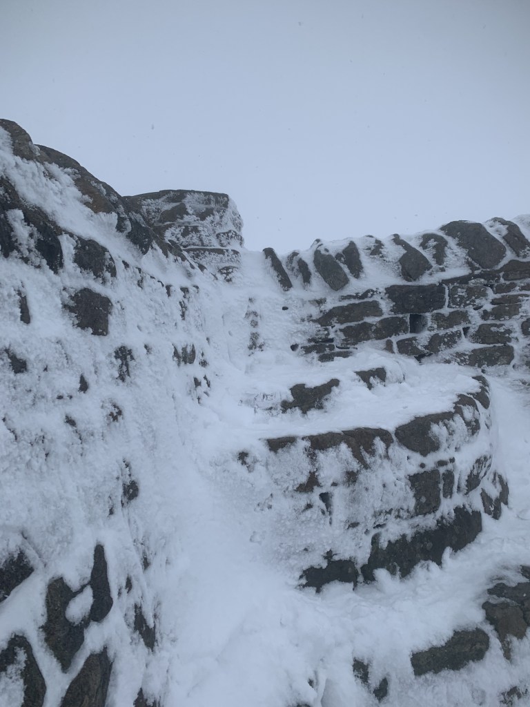
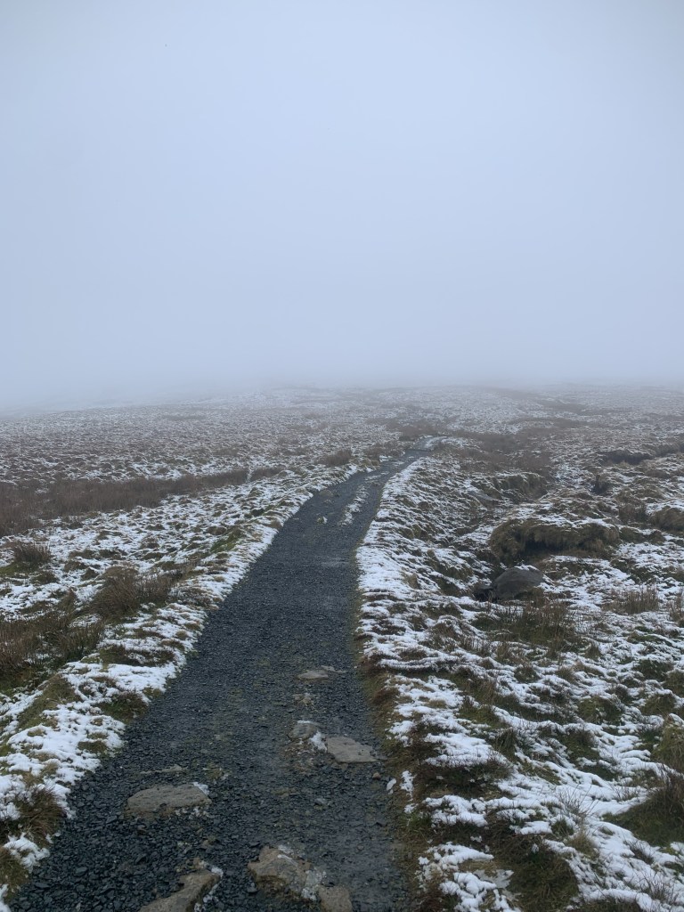
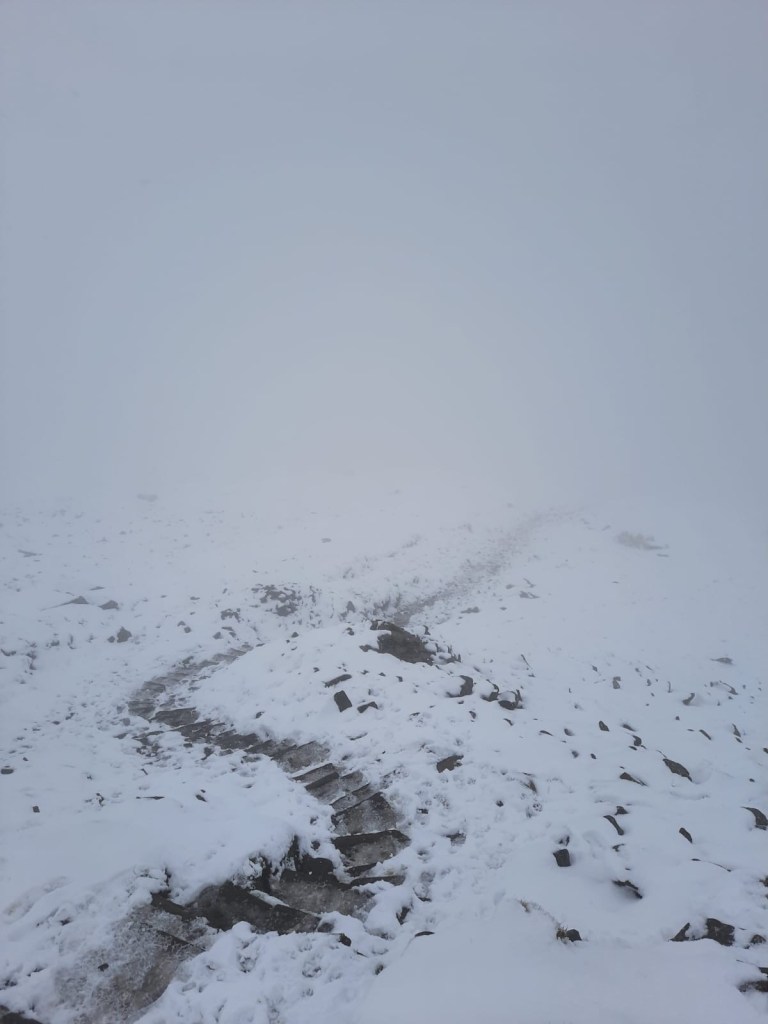
HOWEVER….and here is where the fun stuff happened. We had looked at the mountain forecast and it said that there would be a (and I quote) “light dusting of snow” at the peak and as you can see from these pictures, it was a little bit more than that. That made the steps a little slipper but, the main difficulty was navigating at the top.
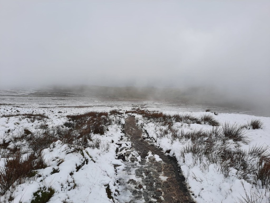

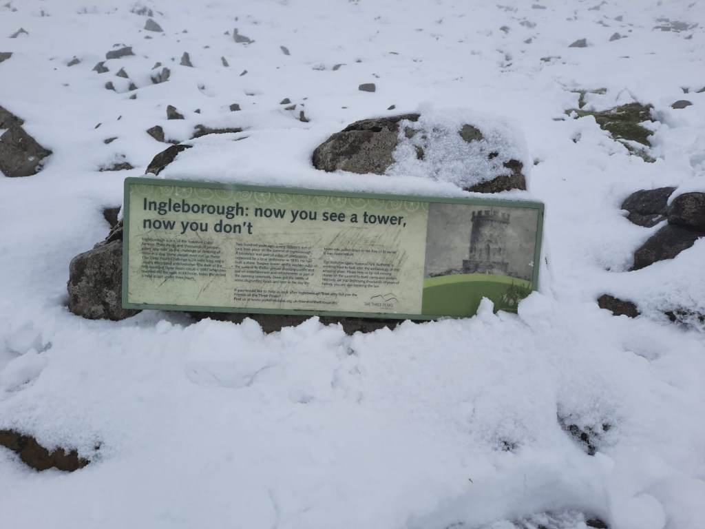
Ingleborough is a plateau so there is lots of flat space when you reach the trig point that marks the top of the mountain. Because of the whiteout, we couldn’t’ see thirty metres ahead of us which made the plateau difficult to navigate. We had planned on heading down the mountain via Little Ingleborough as we prefer a circular route to heading back down the same way. The conditions just didn’t permit it. We couldn’t see well enough to find the path down to Little Ingleborough and we didn’t want to venture too far and then not be able to find our way back to the peak. We had no choice really. We couldn’t see well enough to recognise any of the key features on the map so using the compass wouldn’t have been as reliable either. Yes, we probably could have used our phones but, at the time, we didn’t think of that and I don’t like relying on technology when you’re out and about hiking either.
Despite the change of plans, we had a really lovely day! We headed back down to Ingleton on the same route and then visited a bakery which, if you’re in the area, you have to go to. Seasons Bakery is a great last stop on your walk. We bought a sausage roll each to add to our lunch (we had only had half a sandwich each at the peak!) and pies for dinner. As well as that, we treated ourselves to a sweet treat. I bought a flapjack which lasted me a couple of days for dessert with yoghurt whilst Alex chose a rocky road (which he finished instantly). It is not the cheapest of bakeries but, it was really delicious. It is just want to you want after you’ve worked hard on a hike.
That just about wraps up my thoughts on our hike up Ingleborough. As always, here is the link to the route or you can follow the step by step below. After Ingelborough peak, you have other options but, for the sake of safety, it feels only right that I share the route that I actually completed. I can’t tell you any distinguishing features about the walk we originally planned so my directions would be based on the map alone which doesn’t feel worth it. I hope that is okay! Hopefully, I get to return to Ingelborough and complete the walk I originally planned at some point in time. We’ve ticked this peak off for now though so, onto the next one I say!
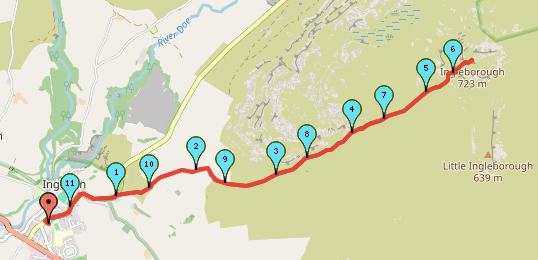


Start Point: Ingleton Car Park
- Exit the car park by heading back to the main road.
- Turn left and continue back up the main road (B6255).
- At the junction, follow the road to the right and then stick left as you continue uphill.
- On the corner, there will be a gravel path on the right. It will be signposted Ingleborough. Go up the gravel path.
- Continue straight up the gravel path until you reach a house. Here, the path moves away from the track and onto the grass.
- Follow this path, it does become rocky in places but is easy to walk.
- Continue to follow the path up the steps until you reach the plateau.
- Continue straight to meet the Ingleborough peak.
- Turn back and follow the path back the way you came!
End Point: Ingleton Car Park
That is potentially the most simplistic and boring step by step I have ever done. But, as I said, it was the best decision for us to make in the conditions. And, it did not feel right to share a route that I hadn’t actually walked myself. I hope that’s okay!
Like I said, I can see why so many people hike Ingleborough every year as it is a very accessible peak for people who aren’t as used to hiking – especially in the summer. Although not my favourite walk ever, it is a worthy one nonetheless!
Amie x

Leave a comment