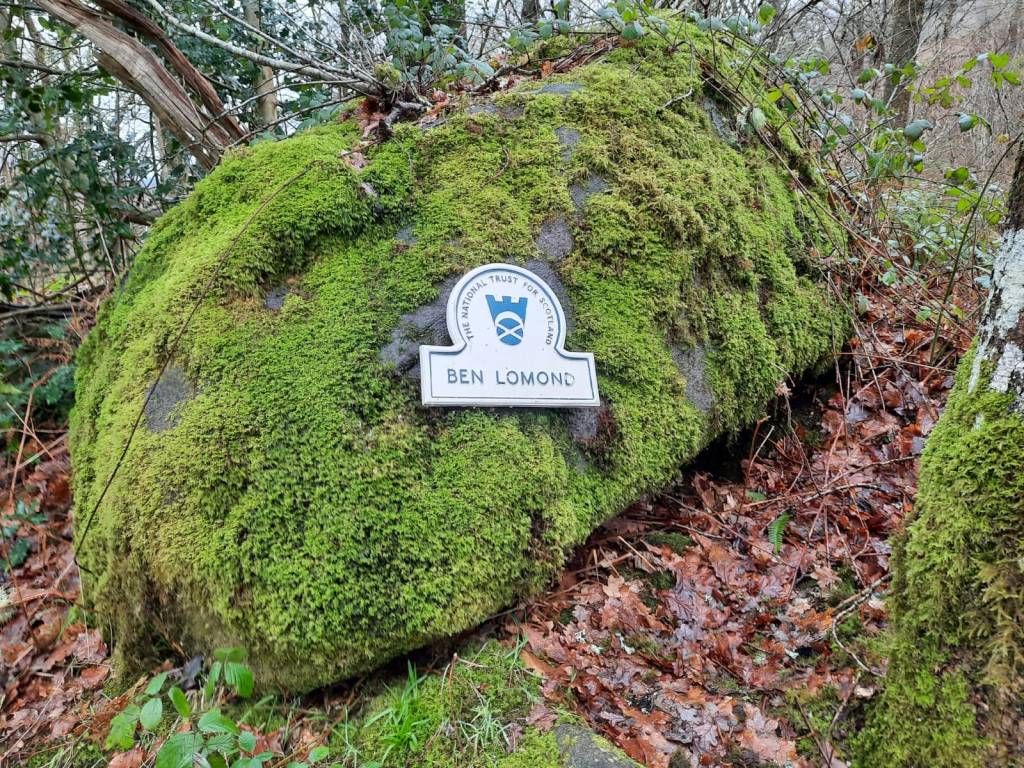
I bagged my first every munro! I mean, I feel like it is about time given that I have been living in Scotland for over 5 months now but, the weather has certainly made that a little more difficult. Ben Lomond is 973m which is a similar height to Scafell Pike, the highest peak in England. However, it is only the 184th highest munro which certainly puts into perspective th landscape of Scotland. Despite the height, I do think that this was a very good munro to start with and would be as a beginner to walking even.
The route begins at Ben Lomond Car Park which is located in Rowardennan. The road to the car park is lovely as it runs right alongside the loch. The journey takes 1hrs 51minutes from Edinburgh, 1hr 8 minutes from Glasgow and 54 minutes from Stirling so it is fairly accessible from all of the major cities in the central area of Scotland. I do remember seeing a bus stop here but, from what I can see online, it is not possible to get public transport from any of these cities. Car seems to be the best option here, certainly out of season anyway. Visiting out of season also had the added perk of the car park being free! That was a nice surprise when we got there.
Difficulty: Easy
Distance: 12.3km
Elevation: 992m
OS Map: 364
Notable Features: Honesty Box, Ptarmigan Ridge, Ben Lomond, Loch Lomond
Look Out For: Ravens, Capercaillie (lived on a Loch Lomond island until recently), Cuckoo, Ptarmigan
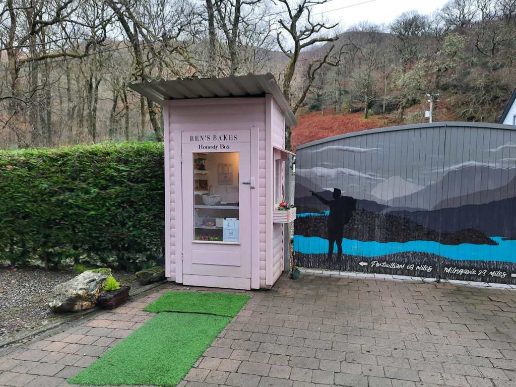
The walk begins from the car park towards the youth hostel, following signposts for the lodgings. You soon come across a honesty box selling sweet treats, drinks and other baked goods for walkers which I thought was just so lovely. It was a pink shed with prices up on the wall and it was such a nice idea from the people who live in the house there. I don’t imagine they make lots of money out of it but, I imagine there is a lot of footfall past it in the summer months. Unfortunately, with my allergy, we opted not to get anything but I do wish that we had.
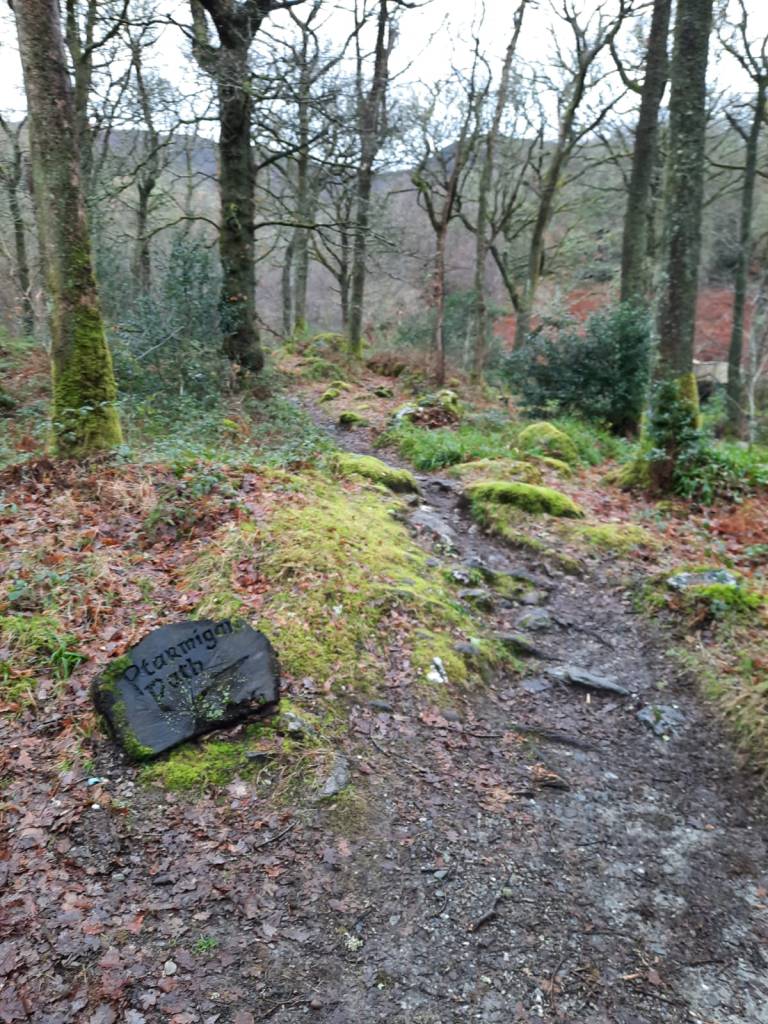
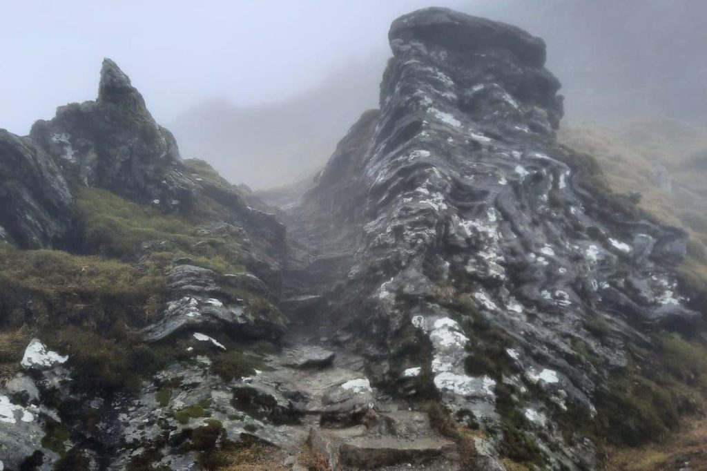
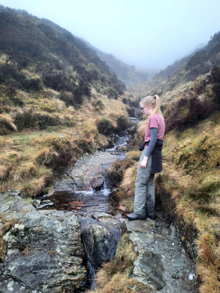
We decided to take the Ptarmigan ridge route as this is supposed to be the more challenging way of reaching the summit. In all honesty, this wasn’t actually too bad at all. It involved minor scrambling but nothing too difficult, especially when its dry. I would definitely suggest doing the walk clockwise though, going up this ridge and back down the easier slope. We tend to do all of our walks clockwise anyway, though there is no real reason for it. It is nice to get the most difficult part out of the way first.
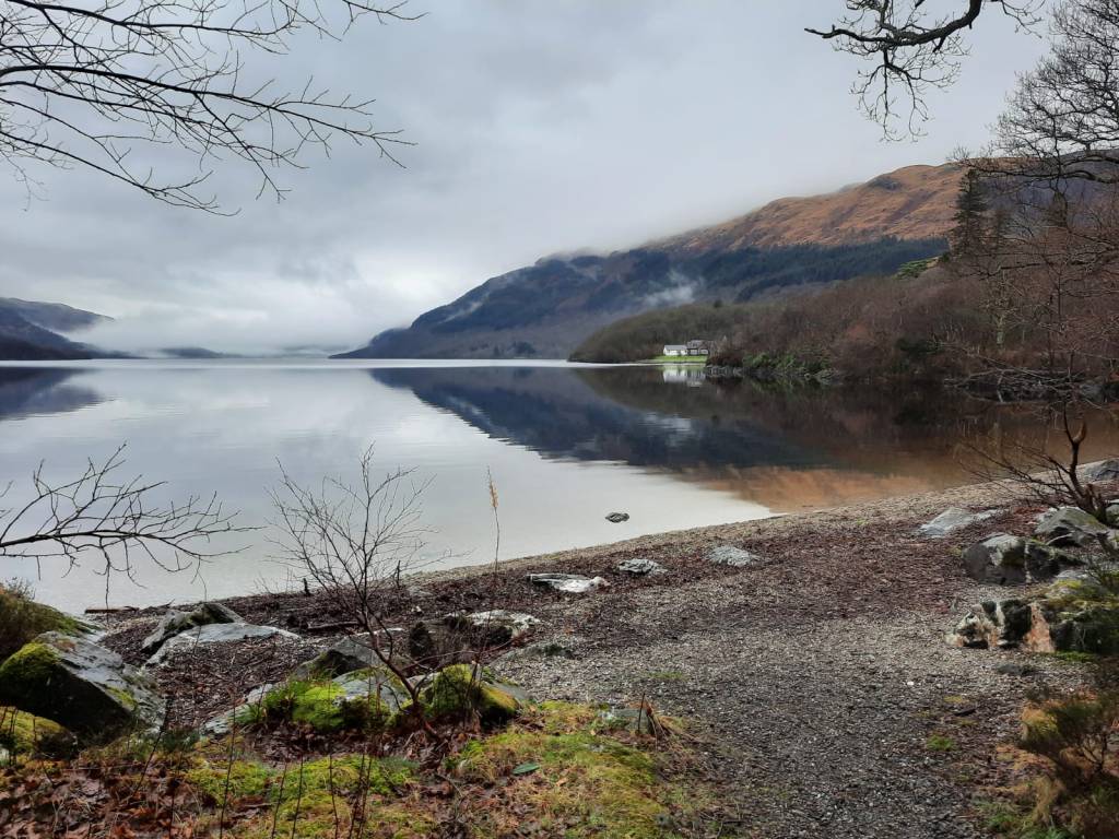
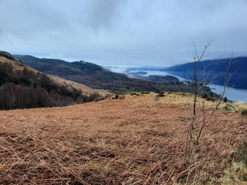
It was Sod’s law that, even though the Friday and Sunday were lovely weather wise, the Saturday was cloudy and raining. The first part of the walk was great as it wasn’t too cold and we had a lovely view of the loch alongside us. That is definitely one of the perks of this route; take a look behind you at the loch as you climb. However, soon enough the clouds were rolling in and we couldn’t see much at all. The path was easy to navigate though so it wasn’t a major issue. In fact, when we were nearing the peak, there was actually a bit of snow on the ground. This wasn’t deep or anything and the path was mostly clear of it – just wet – but it was cool to see. It was a shame that we didn’t get to see anything from the summit though as I have heard that the view are great.
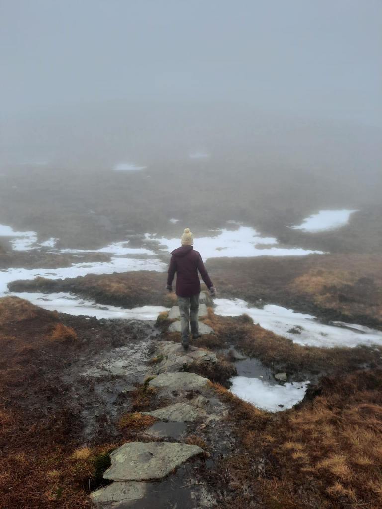
We managed to plough all the way to the top and were looking forward to rewarding ourselves with lunch at the peak. Yet, the minute I touched the trig point, the heavens opened and the rain came. It wasn’t just spitting either, we were getting lashed with it so decided to just head straight back down. The idea was that the rain would abate and we could break for lunch then. Unfortunately, that was not the case and we walked all the way down in the rain with no lunch. We also made the error of not putting on our waterproof over-trousers which was perhaps the biggest mistake of all. We were soaked to the bone by the time we reached the car. I don’t advocate for doing either of these things – make sure to eat and try and stay as dry as possible on walks.

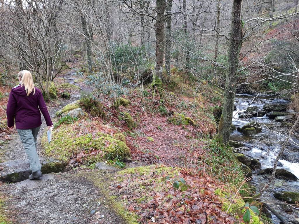
The walk down was relatively uneventful, weather aside. We eventually came below the cloud and were greeted with a wet but lovely view of the loch. The path dips down into a woodland area before meeting the car park and all of this was very easy to follow. We didn’t have to consult the map at all though, I would recommend always taking one with you!
We were so wet when we reached the car that I actually changed from my walking trousers into my waterproof overtrousers. Luckily, we both had a different pair of shoes that we could wear too. The downside of our car is that the aircon and heating doesn’t work so we had to drive with the windows down slightly to stop the windows steaming up which isn’t the best when you’re already wet. That meal deal in the car park never tasted so good. I think we both just wanted to get back and have a warm shower and that is exactly what we did.
Despite getting so wet and Alex unfortunately getting cold/flu the day after, I still think that this was a really great day out. I was super pleased to have bagged my first munro and I think we picked very well. This wasn’t too difficult – we were up and down in just over four hours – and it was still very rewarding. I would have liked to have seen the view from the top but that is what you get going out in the winter. As always, do check the mountain forecast before you head out regardless of the season.
If you want to follow the route yourself, click the link here or follow the step by step below:
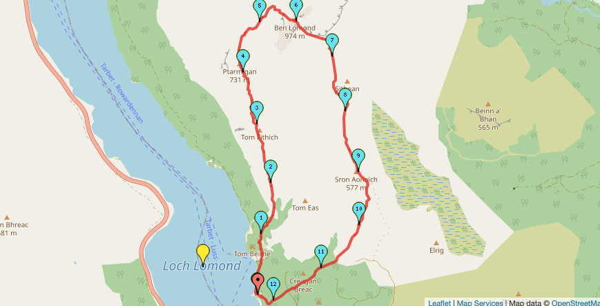
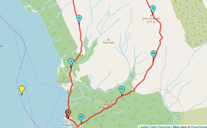
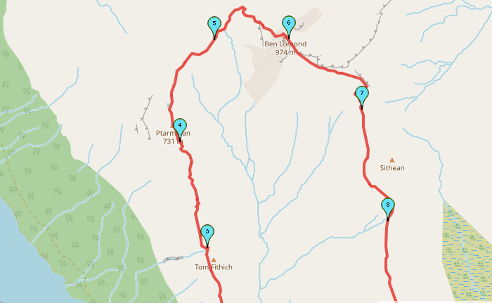
Start Point: Ben Lomond Car Park
- Head out of the car park, following the path that runs alongside the edge of the loch.
- When the path splits, keep right toward Ben Lomond Bunkhouse and then continue straight past the buildings.
- You should soon reach an honesty/self-service hut with snacks and drinks available to purchase. Shortly after the box, take the path on the right, signposted on a rock ‘Ptarmigan’.
- Continue to follow this path up the ridge.
- After 5kms, follow this path as it bends to the right and up to the peak of Ben Lomond.
- Head straight past the trig point, and follow the path straight ahead to start the descent.
- Continue to follow this path down the mountainside.
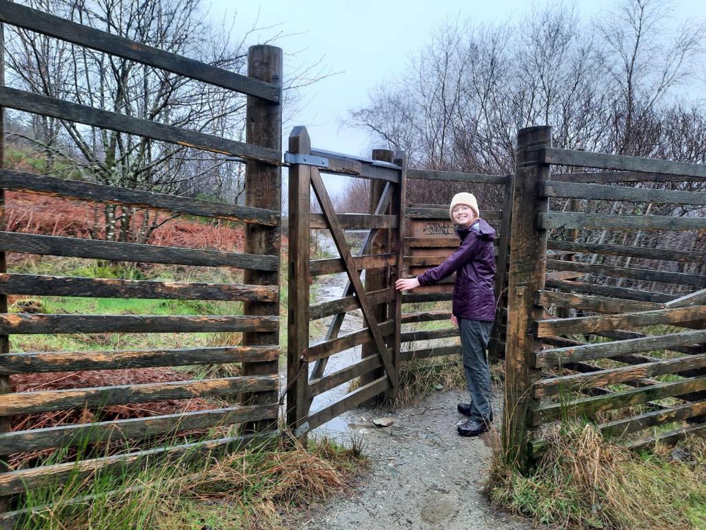
- After just under 5km the path enters a woodland. Continue on through the gate.
- Eventually, the path meets a crossroads. Take the path straight ahead back to the car park.
End Point: Ben Lomond Car Park
There isn’t much to this walk directions wise as it is fairly simple to follow. However, it is still well worth it as a walk to tick off your list!
Amie x


Leave a comment