Dartmoor National Park will always have a special place in my heart; it is where I fell in love with walking. This route is the second walk I ever did on Dartmoor and, although the first one didn’t go exactly to plan (more on that in an upcoming post), I really love this national park. if you aren’t aware, I studied my undergraduate degree in Exeter so Dartmoor was right on the doorstep. I would love to go and explore more of it at some point in the future. But, other than the sometimes incredibly poor and highly changeable weather conditions, I think it is a great place for beginner walkers as the terrain isn’t too difficult and you don’t get as much as height as the Lake District, for example.
This route starts at one of the most notable towns on the outskirts of the park: Okehampton. Back when I did this walk, you had to get the bus here which took quite a long time however, now the train station has reopened increasing the accessibility of the National Park from Exeter. For ease, I adapted the route ever so slightly to start from the train station. It is quite a nice scenic train ride and doesn’t take too long either. Okehampton is at the northern edge of the National Park and is a very good place to start for walks as there is a lovely little walk through a woodland to get to the moors via this route.
Difficulty: Easy
Distance: 22.8km
Elevation: +645 metres
OS Map: OL28
Notable Features: High Willhays, Nine Maidens Stone Circle, Yes Tor, Rowtor Target Railway
Look Out For: Raven, Mistle Thrush,
However, a very important thing to note with this walk as well as others on Dartmoor is that the area is used for military training as a firing range. There are three different ranges in the National Park that take up the western side. When they are practicing, you are not allowed to enter these areas for obvious reasons. They have flags and signals bordering the ranges when they are practicing. When the warning signals are active, you should not enter. The best way to avoid this even being a possibility is to check the firing times on the government or national park website. It is really easy to do, just press the link HERE.
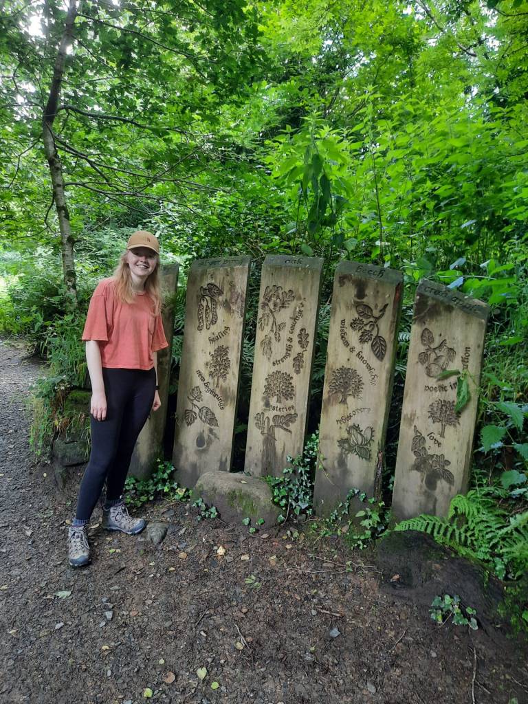
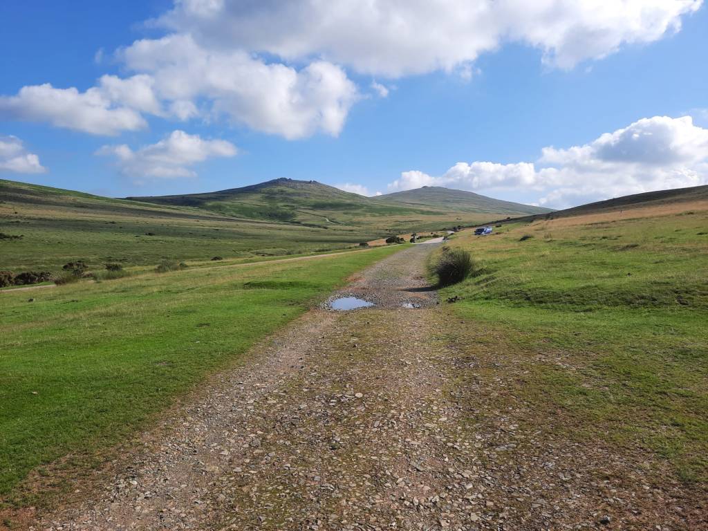
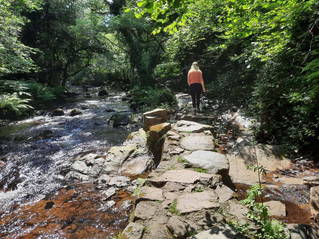
As I said above, this walk begins with a lovely woodland area which has lots of carved benches and other features along the way. The path goes along the river and into a Conservation Area. It is nice to have a variety of different terrains on a route and this one is perfect for that. The incline on Dartmoor is also fairly gradual and you don’t gain all that much height despite the highest point in Dartmoor featuring on this walk.
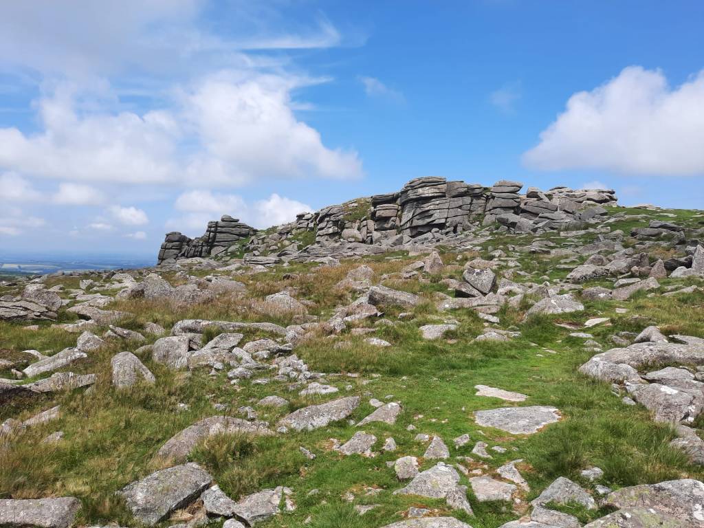
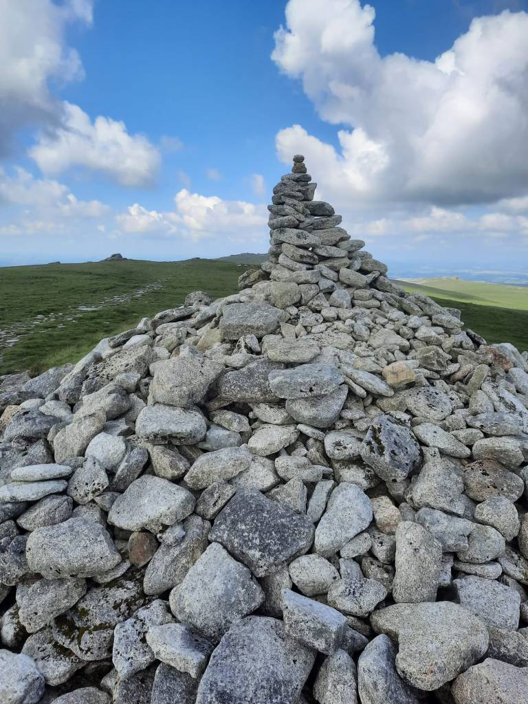
The peaks on Dartmoor are referred to as ‘Tors’ which is celtic for the word ‘tower’ as they almost always have a pile of rocks on the top. A lot of the tors are actually easily accessible by road whilst others require more of a walk. Some people aim to climb all of them, similar to the Wainwrights, although they are less grand in magnitude. It would still be very cool to say that you had nonetheless. This walk takes you to 6 tors but skirts a couple more that you could easily add in. The highest of point in the South of England, and therefore on Dartmoor, is the High Willhays. This tor is 621 metres which is a similar height to Birks which is the ranked 124th of the Wainwrights. That puts the gradient into perspective for you. Despite that though, Dartmoor is home to many other interesting and unique sites.
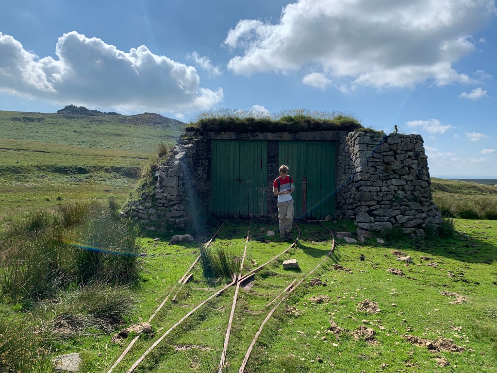
On this walk, for example, you have an old abandoned portion of railway. Rowtor Target Railway was built in 1959 and was used for target practice by the military. It is a really interesting feature that you are unlikely to see in many other places when out walking. There were many old civilisations on Dartmoor and therefore, stone circles and crosses are a common feature. The Nine Maidens Stone Circle can be found 5km into this walk. The area is rich with history to explore.
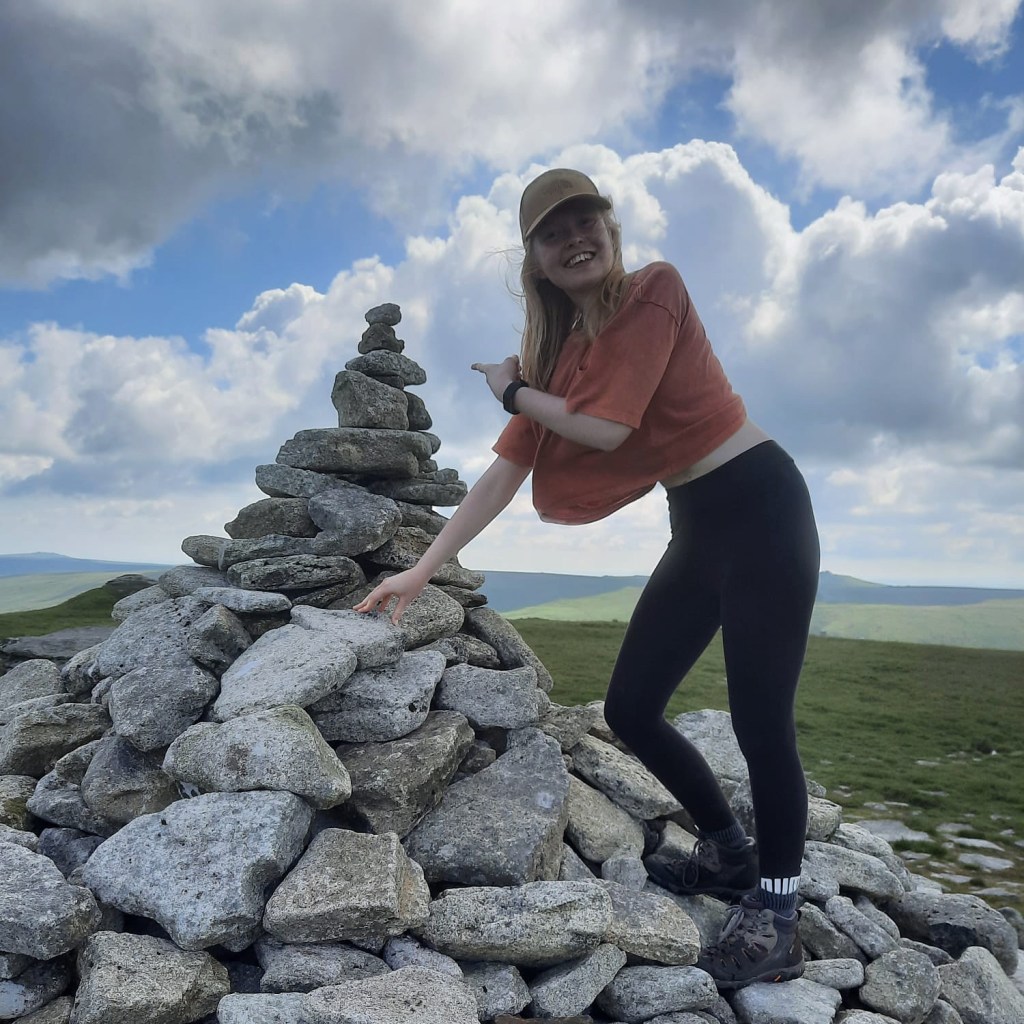
Because this route is the first from Dartmoor to feature on my blog, this post has acted more as an introduction to the national park as a whole. But, I also think this walk would be a good introduction to the area, as it was for me back in 2021. You can tell from what I am wearing in the photographs that this is an old walk as I don’t have any of the walking clothes I wear now. However, it also shows that you don’t need to have all the best kit, or any specific walking kit (other than some cheap walking shoes), to begin your hiking journey.
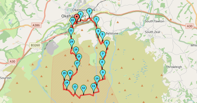
Check out the link HERE to see the route for yourself or follow the step by step guide below.


Start Point: Okehampton Train Station
- From the station, head down Station Road, towards the town centre. Take the first footpath on the left, only a couple of hundred metres down the road.
- Follow this footpath, turning right across the bridge and then following the path to the right.
- Continue along this side of the river, following it through the woodland and skirting the playing field.
- Take the next path on the right, back into the woodland and across another bridge. Once again, after crossing the bridge, follow the path to the right at the crossroads.
- You should then pass through a gate/stile into a conservation area. Continue to follow this path until it meets a track with a car park.
- Follow this to the right, joining the footpath at the end and cross the tracks and under the carriageway bridge.
- Continue along the footpath which heads uphill through the woodland. The river East Okement, which should stay on the left, becomes increasingly rocky and some waterfalls can be seen.
- When the path meets a junction, take the left route, before heading to the right and towards the Nine Maidens Stone Circle.
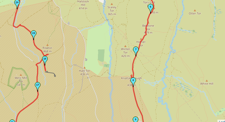
- Continue past the Stone Circle and then turn right uphill towards Tors End Tor. Follow the path to Belstone Tor.
- Follow straight up to High Tor, and Knattaborough Tor. Don’t be afraid to stray from the paths a little as they can be difficult to follow; on a clear day the tors should be visible. However, if visibility is poor, make sure you’re following your map and using a compass.
- Knattaborough Tor is on the edge of the firing range. You should see the posts that mark the boundary here. Follow the path down from the Tor and into the range.
- Continue to follow the path straight to OP Oke Tor. From the peak, follow the path to the right down Steeperton Tor Road (this is more of a gravel track).
- When you reach the road, turn left.
- Cross the ford and then take the the next road to the right. There should be a path exactly opposite going to the left.
- Pass over two rivers/streams, cross over the road and head straight ahead.
- Continue following this path up to the High Willhays – the highest peak on Dartmoor.
- From the peak, head right towards Yes Tor. Retrace your steps back down Yes Tor, before taking the path on the left which skirts the Tor before bending away to right.
- On the left is West Mill Tor but follow the path that skirts the tor, rather than heading up (though, this would be an easy addition).
- Rowtor Target Railway should be on your left, have a look here before following the track to the right that runs parallel to West Mill Tor Road.
- Join the road for under half a kilometre, take the path on the left and over the stile.
- Continue straight through Okehampton Training Camp.
- When you leave the camp, follow the footpath on the left, moving off the road.
- Follow the path through the woodland, past the YHA.
- Join the road, follow it round to the right and then left at the junction.
- Follow the Granite Way to the right back towards the train station.
End Point: Okehampton Train Station
This walk has some really interesting features and it only scratches the surface on what Dartmoor National Park has to offer. I’m looking forward to sharing more routes with you in the coming months.
Amie x


Leave a comment