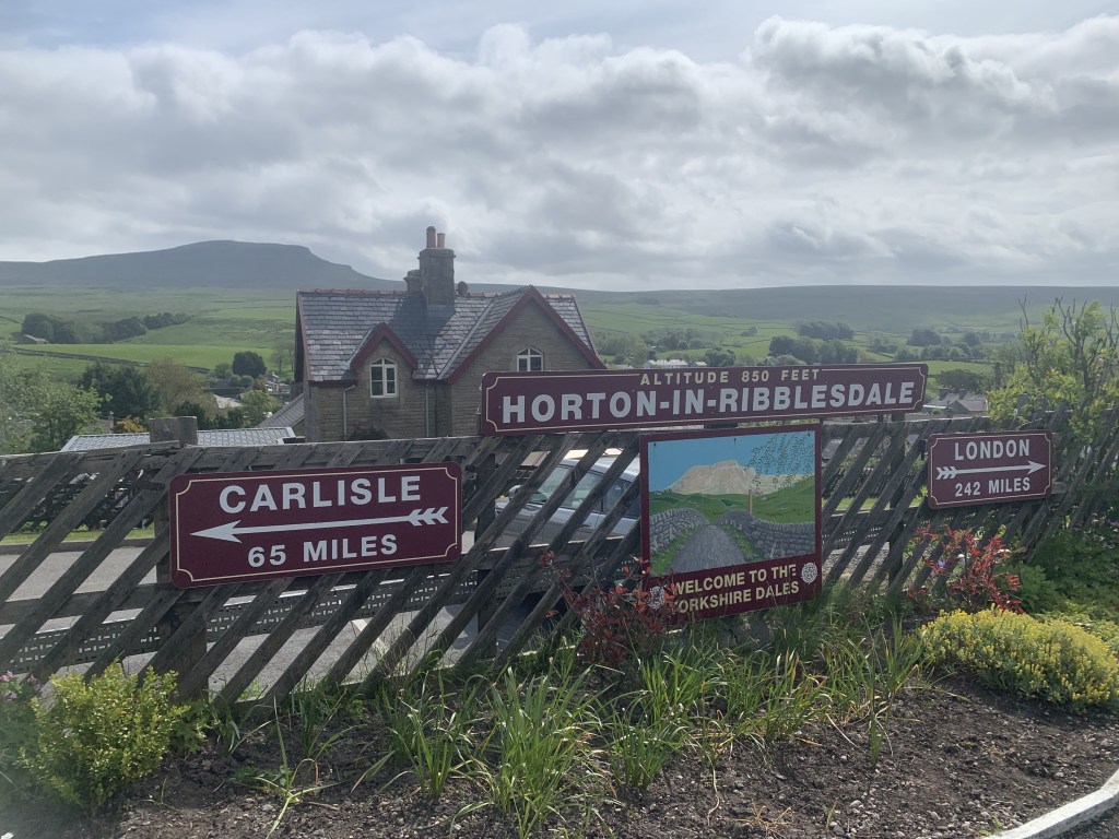
I’ve already shared the first walk from my weekend trip to the Yorkshire Dales last month which you can check out the route for HERE. That first walk took place just outside the Dales in the Nidderdale AONB however, today’s walk is in the Yorkshire Dales itself. It also includes Pen y Ghent, one of the Yorkshire Three Peaks. This is a great route that includes an iconic tourist hotspot but also takes you outside the well trodden paths. Most walkers will head straight up and down Pen y Ghent, beginning in Horton in Ribblesdale, climbing and then heading back down to Horton in Ribblesdale. I think this walk is a much better option for those wanting to go that little bit further and avoid the crowds. Scroll to the end for a step by step route.
We began our day in Horton in Ribblesdale as we camped here the night before. We opted to get the train to Settle rather than driving. This was pretty cheap however, they only run around every two hours. That is one of the reasons why I think it is best to begin the walk in Settle rather than walk to Settle and get the train back to Horton in Ribblesdale. It gives you the extra level of security that you’re going to get back to the car/campsite if you’re based there like we were. Of course, if you’re based in Settle you might prefer to do the opposite.
Difficulty: Easy-Moderate
Distance: 17.4km
Elevation: 694m
OS Explorer: OL2
Notable Features: Hoffmann Kiln & Craven Lime Works, Pen Y Ghent, Hull Pot
Look out for: Donkeys, Lambs, European Honey Buzzard (recent sightings)
Settle is a lovely little town and very much reminded me of Buxton in the Peak District National Park. You can expect lots of little independent shops and cafes, as well as a Co-Op which was where we bought our lunch for the day. Coincidentally, the walk takes you past the supermarket and up the road alongside it before joining a footpath. You’re thrown straight into it as you head up the incline towards the hills. There was a field of donkeys on the left as we walked up which was unusual to see and, of course, lots of sheep hanging around with their lambs.
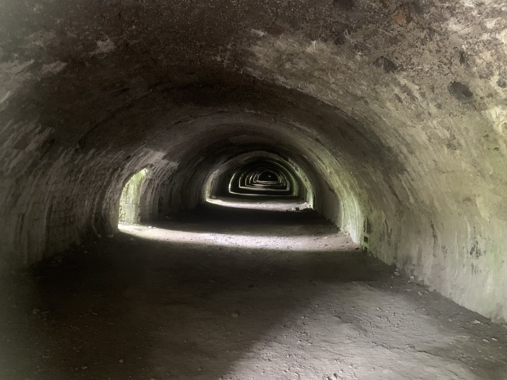
One of the major selling points of this walk appears a few kms in. The Hoffman Kiln and Craven Lime Works is a really fascinating site that has lots of information boards telling you about its history. You can walk around the interior of the old abandoned lime kiln which is the best preserved Hoffman Kiln in England. It was built in 1873 and had 22 individual firing chambers in a circuit which you are able to walk around. There is a circular trail around the area called the Craven Lime Works Trail which this route skirts; it doesn’t include all of it but, you could add that in if you wished.
Another village on route is Stainforth; there isn’t a lot to see in these places. They’re more just passing points to make sure you’re on track. However, it is worth noting that the path goes through a field which, when we walked past in the spring, contained cows with calves. As a walker, you know it is best to avoid these where possible as calves can be especially inquisitive. I like cows but hate coming across them on walks. We took a very odd route around this field to keep away from them. I would suggest that you assess the situation and act as you see fit if you do this walk in the spring time. They might not be in that field all year round though.
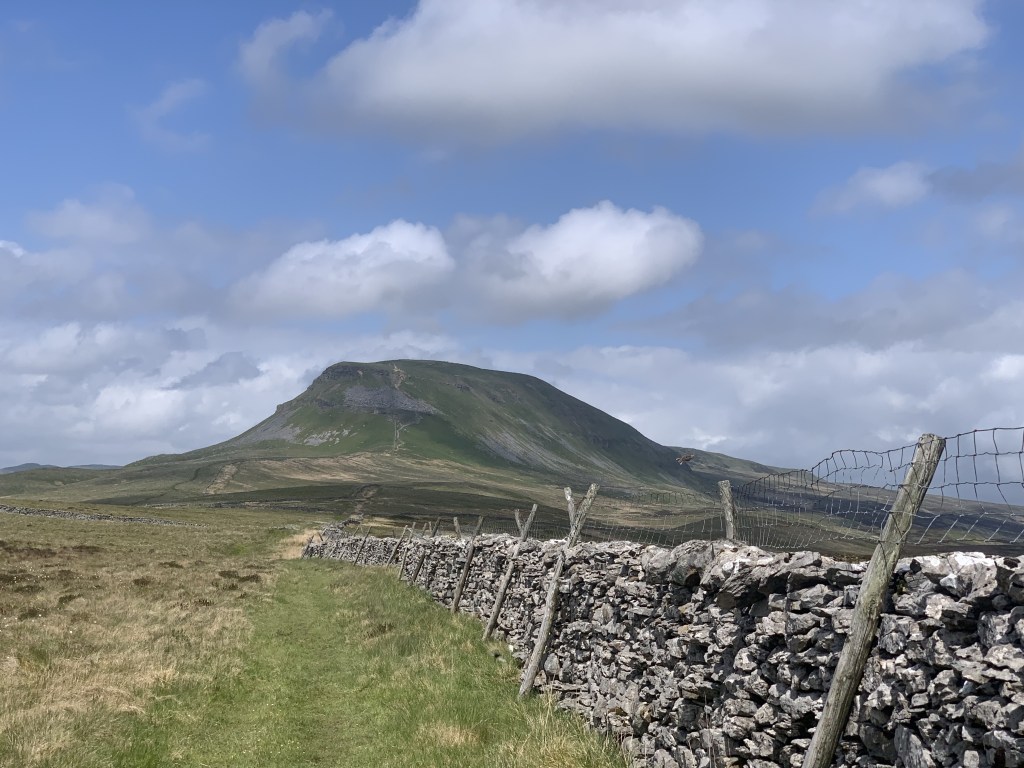

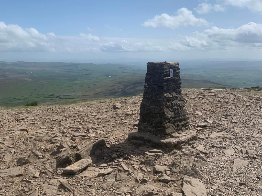
After Stainforth, it’s time to head back uphill and, at this point, you’re essentially on a long ascent towards Pen y Ghent. Pen y Ghent is supposed to be the easiest of the Yorkshire Three Peaks and reaches a height of 694m at its summit. I have climbed quite a few mountains before and I would say that Pen y Ghent is one of the easiest as the incline is gradual until the last couple of hundred metres. It does involve a little bit of climbing but, to be honest, it’s more like steps but they’re just not as well defined as a straight up and down staircase. I thought it was going to be a case of taking breaks as we went up but it wasn’t necessary; we just ploughed on up and it didn’t take long at all. Of course, by starting in Settle this was one of the last things we did on the walk but, at just under 18km, we weren’t too tired at this point anyway. The path back down the other side is also beautiful and well worth the climb.
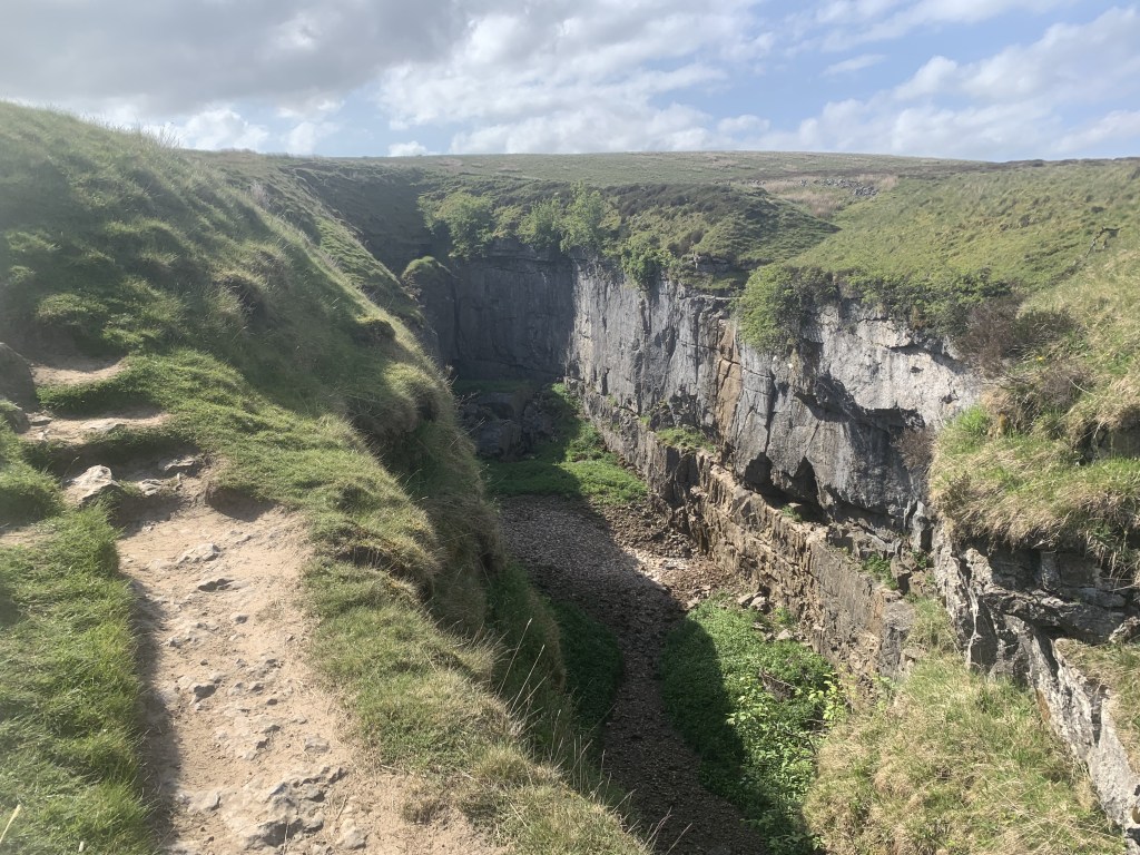
The final point of interest on the walk is on the journey from Pen y Ghent to the end point of the walk, Horton in Ribblesdale. Hull Pot is a collapsed cavern on the western side of Pen y Ghent and, after heavy rainfall, there is also a waterfall within it. Unfortunately, this was not the case when we were there but, I can’t complain because it was beautiful weather. I believe that the cavern is used for rock climbing and potholing/caving. However, it is still a very cool site to see as a walker.
Despite Pen y Ghent, I would say that this is still an easy walk to be honest with a total distance of 17.4km. The inclines, other than the final stretch up Pen y Ghent, is all very gradual, though it does feature steps and stiles. This walk didn’t take us as long as we expected but I would still advise that you set out a full day to do it. You don’t have to arrive in Settle too early though; I believe we started the walk towards 11am. It is always good to leave yourself ample time so that you can take your time and really enjoy the scenery.
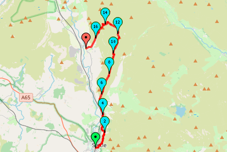
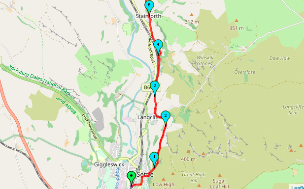
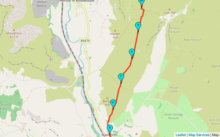
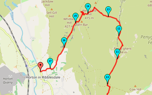
As usual, here is a map of the walking route using the website mappedometer.com. Because of the length and unidirectional nature of this walk, the map pictures are hard to follow so I would suggest checking out the link HERE or following the directions below for a more indepth look at the route.
Although we started our walk from the train station, I’ve opted to begin these instructions from the Market Square as this is a good place to start for those based in Settle or who have driven to the town. If you are heading from the station, head into the centre of the town and you’ll find Market Square.
Start Point: Market Square, Settle
- Begin the walk at Market Square.
- Head past the Co-Op supermarket and follow Constitution Hill out of Settle.
- Shortly after a left hand 90 degree bend in the road, take the gravel footpath that is signposted on the right. You should be still heading uphill.
- At the second gate, the land should level off. Continue along the flatter route hugging the dry stone walls to your left.
- Continue straight. At the next fork, take the left path downwards through the field towards Langcliffe. The small church in the village is the useful marker for your approach.
- When you reach the road, turn left. There should be a car park on your right. Follow the footpath sign through the car park and down Pike Lane.
- Take the first right up the track which shortly becomes a footpath.
- At the junction where three paths converge, take the middle path. This will take you diagonally across a series of fields.
- Follow this footpath as it runs alongside the railway line and go straight across the road up the steps.
- You should arrive at newly built industrial/retail units. Continue straight alongside the car park. You should soon reach Hoffman Kiln and Craven Lime Works.
- Explore Hoffman Kiln. Be sure to take some time here to read the information boards and walk inside the old kiln.
- At the far end of the kiln structure, head up the steps, over the foot bridge and take the path on the left.
- In front of the next structure, turn right up the hill. Continue along this footpath until it meets Stainforth Road. In one of the fields here, there was a small bridge over a brook.
- Turn right at the road and head towards Stainforth.
- Take the next road on your right and continue along Main Road, passed the pub and over the bridge.
- At the next junction, head straight across and up the small lane. This road is a dead end.
- Climb the stile to follow the footpath up the hill. Note: this field contained cows and calves during our visit so be careful not to startle any livestock.
- At the next field, head to the top left corner where there is a stile.
- Continue along this path, working your way uphill until you meet a gravel track called Moor Head Lane. Cross the lane and continue straight.
- Follow the footpath through the fields alongside the boundary walls. You should be able to see Pen y Ghent in the distance so you can see where you’re heading.
- You will reach another gravel lane in around 3km. Follow the gravel path to the right down the hill. Take the next footpath on the left (Pennine Way) towards Pen y Ghent.
- Continue along this well trodden path and climb Pen y Ghent to the summit.
- Once you reach the summit, take your obligatory photograph and then head down the path that takes you over the stone stile behind the summit stone.
- Follow the steps down the hill.
- Where the path meets a sharp left, head straight ahead. It will seem as if you’re leaving the major footpath here.
- Continue to head downhill. Turn left at the crossroads.
- Hull Pot is located at the bottom of the hill, easily spotted.
- After you’ve finished exploring Hull Pot, return back through the gate to continue on along the path.
- Head straight ahead at the crossroads rejoining the Pennine Way, signposted to Horton in Ribblesdale.
- Follow this gravel track all the way to the village. If you are looking for the train station, take the main road to the right.
End Point: Horton in Ribblesdale
You have arrived at Horton in Ribblesdale! There is a lot of steps to this route so if you need any clarification let me know in the comments and I’ll do my best to make it clearer. I really do think this is a great way to tick off one of the Yorkshire Three Peaks.
If you do this route, let me know how you found it!
Amie x

Leave a comment